Toggle navigation
LMEC Home
Exhibitions
Georeferencing
Tools for Teachers
Collections
My Favorites
Sign Up / Log In
Search
Search the map portal
Map Collection
Map Collection
Map Sets
Search
Search
Search for
Search In
All Fields
Creator
Title
Subject
Place
Search All Digital Collections
Advanced Search
13385 Results
Filter your Search
Place
North and Central America
9,353
United States
7,078
Suffolk (county)
1,664
Boston
1,621
Europe
1,035
Canada
949
Massachusetts
794
New York
532
more
Place
»
Topic
Boston (Mass.)--Maps
741
City planning--Massachusetts--Boston--Maps
418
United States--History--Revolution, 1775-1783--Maps
329
United States--Maps
315
Urban renewal--Massachusetts--Boston--Maps
254
Real property--Massachusetts--Boston--Maps
252
Massachusetts--Maps
219
Insurance surveys
197
more
Topic
»
Date
Date range begin
–
Date range end
Current results range from
1482
to
2023
View distribution
Creator
United States. Hydrographic Office
595
Boston Redevelopment Authority
403
Des Barres, Joseph F. W. (Joseph Frederick Wallet), 1722-1824
247
Royal United Services Institute for Defence and Security Studies
160
Jefferys, Thomas, -1771
154
George, III, King of Great Britain, 1738-1820
152
George, IV, King of Great Britain, 1762-1830
151
O.H. Bailey & Co
148
more
Creator
»
Format
Maps/Atlases
13,205
Manuscripts
985
Prints
102
Books
49
Drawings/Illustrations
44
Photographs
15
Objects/Artifacts
13
Documents
7
more
Format
»
Georeferenced
Yes
979
No
12,406
Collection
Norman B. Leventhal Map Center Collection
8,891
American Revolutionary War-Era Maps
3,305
Boston and New England Maps
2,804
Urban Maps
2,397
Maritime Charts and Atlases
1,150
William L. Clements Library Collection
910
Library of Congress Collection
618
Boston Redevelopment Authority Collection
475
more
Collection
»
Available to use
No known restrictions
9,952
Creative Commons license
1,677
Search Constraints
Sort by date (asc)
relevance
title
date (asc)
date (desc)
Number of results to display per page
50 per page
10
per page
20
per page
50
per page
100
per page
View results as:
grid view
map view
Search Results
9351.
Windsor, Vermont : 1886
9352.
Alas, poor Yorick!--from the painting by Horace Fisher
9353.
Alaska and adjoining territory
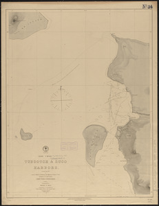
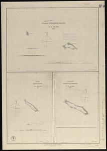
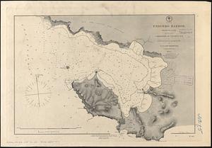
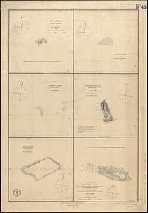
9354.
Aleutian Archipelago
9355.
Antrim, N.H. and Clinton Village : 1887
9356.
Arctic America : eastern sheet
9357.
Athol, Mass : 1887
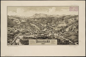
9358.
Bennington, N.H : 1887
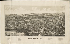
9359.
Bennington, Vt : [1887]
9360.
Bridgewater, Massachusetts : 1887
9361.
Carta universal en que se contiene todo lo que del mundo se ha descubierto fasta agora
9362.
Central America, north coast of Panama, Port Chagres : from a British survey in 1829 & 1840, and a survey in 1875 by the...
9363.
Central America, west coast of Costa Rica, Ballena Bay (Gulf of Nicoya) : from a survey in 1885 by the officers of the U.S.S....
9364.
Central America, west coast of Costa Rica, El Rincon Harbor (Gulf of Dulce) : from a survey in 1885 by the officers of the...
9365.
Central America, west coast of Costa Rica, Piedra Blanca Bay : from a survey in 1885 by the officers of the U.S.S. Ranger,...
9366.
Central America, west coast of Costa Rica, Port Culebra
9367.
Central America, west coast of Costa Rica, Port Elena (Elena Bay) : from a survey in 1885 by the officers of the U.S.S. Ranger,...
9368.
Channel on the north side of Vanua Levu from Aramula Passage to Muthuata Island, Feejee Islands
9369.
Chapinville, Mass : 1887
9370.
Charlton City & Charlton Depot, Mass
9371.
Chart of Georges Shoal & Bank
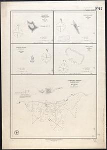
9372.
Chart of Phœnix Group
9373.
China Sea, Hongkong, Man of War Anchorage : from a British survey in 1877
9374.
Cochituate, Mass. and North Natick, 1887
9375.
Colebrook, N.H., Coos Co., 1887
9376.
Contour plan, Melbourne and suburbs
9377.
Cottage City, Martha's Vineyard, Mass
9378.
Deans, Krusensterns, and Lazareff Islands
9379.
Derry Depot, N.H : Rockingham County : 1887
9380.
Disappointment Group ; Reao or Serle Island ; Pukaruha or Clermont-Tonnere
9381.
Dominion of Canada, New Brunswick, L'Etang Harbor (Bay of Fundy) : from a British survey in 1847
9382.
Dominion of Canada, New Brunswick, Port Saint Andrews (Passamaquoddy Bay) : from a British survey in 1844
9383.
East Bridgewater, Massachusetts : 1887
9384.
East-India Archipelago, Singapore Strait : from British and Dutch surveys, 1865 to 1869 : republication of the British Admty....
9385.
Endermo Harbor, Island of Jesso
9386.
France, Mediterranean coast : from the Pilote Français 1842 ; republication of Brit. Admty. chart no. 2607, with additions &...
9387.
Gardner's or Kemins Island, Phœnix Group ; Flint's Island ; McKeans Island, Phœnix Group ; Maro Reef ; Lahaina Roads, Island of...
9388.
Genealogical, chronological and geographical chart embracing Biblical and profane history of ancient times from Adam to Christ
9389.
Gente Hermosa or Swains Island ; Jarvis' Island ; Birnies Island, Phœnix Group ; Enderbury' Island, Phœnix Group ; Hull's...
9390.
Geological map of south-west Pennsylvania, with special reference to the Pittsburgh coal bed
9391.
Goffstown, N.H. 1887
9392.
Gulf of St. Lawrence, Cape Breton Island, Louisburg Harbor : from British surveys
9393.
Harbour of Uafato, island of Upolu ; Saluafata Harbor
9394.
Highlandville, Massachusetts : 1887
9395.
Hinsdale, Mass
9396.
Islands of Manua, Ofoo & Oloosinga, Samoan Group ; Island of Tutuila, Samoan Group
9397.
Kawahe or Vincennes Island, Paumoto Group ; Raraka Island, Paumotu Group
9398.
(Loo Choo) Tubootch & Suco Harbors
9399.
Magnolia, Gloucester, Mass
9400.
Map of Boston, for 1887
‹ Prev
Next ›
1
2
…
184
185
186
187
188
189
190
191
192
…
267
268