Toggle navigation
LMEC Home
Exhibitions
Georeferencing
Tools for Teachers
Collections
My Favorites
Sign Up / Log In
Search
Search the map portal
Map Collection
Map Collection
Map Sets
Search
Search
Search for
Search In
All Fields
Creator
Title
Subject
Place
Search All Digital Collections
Advanced Search
13385 Results
Filter your Search
Place
North and Central America
9,353
United States
7,078
Suffolk (county)
1,664
Boston
1,621
Europe
1,035
Canada
949
Massachusetts
794
New York
532
more
Place
»
Topic
Boston (Mass.)--Maps
741
City planning--Massachusetts--Boston--Maps
418
United States--History--Revolution, 1775-1783--Maps
329
United States--Maps
315
Urban renewal--Massachusetts--Boston--Maps
254
Real property--Massachusetts--Boston--Maps
252
Massachusetts--Maps
219
Insurance surveys
197
more
Topic
»
Date
Date range begin
–
Date range end
Current results range from
1482
to
2023
View distribution
Creator
United States. Hydrographic Office
595
Boston Redevelopment Authority
403
Des Barres, Joseph F. W. (Joseph Frederick Wallet), 1722-1824
247
Royal United Services Institute for Defence and Security Studies
160
Jefferys, Thomas, -1771
154
George, III, King of Great Britain, 1738-1820
152
George, IV, King of Great Britain, 1762-1830
151
O.H. Bailey & Co
148
more
Creator
»
Format
Maps/Atlases
13,205
Manuscripts
985
Prints
102
Books
49
Drawings/Illustrations
44
Photographs
15
Objects/Artifacts
13
Documents
7
more
Format
»
Georeferenced
Yes
979
No
12,406
Collection
Norman B. Leventhal Map Center Collection
8,891
American Revolutionary War-Era Maps
3,305
Boston and New England Maps
2,804
Urban Maps
2,397
Maritime Charts and Atlases
1,150
William L. Clements Library Collection
910
Library of Congress Collection
618
Boston Redevelopment Authority Collection
475
more
Collection
»
Available to use
No known restrictions
9,952
Creative Commons license
1,677
Search Constraints
Sort by relevance
relevance
title
date (asc)
date (desc)
Number of results to display per page
50 per page
10
per page
20
per page
50
per page
100
per page
View results as:
grid view
map view
Search Results
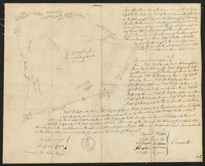
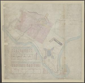
9251.
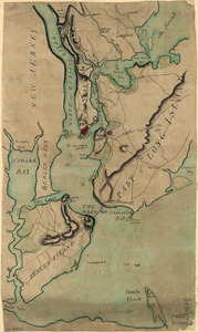
Plan of New York and Staten Islands with part of Long Island
9252.
Plan of New York and Staten Islands with part of Long Island, survey'd in the years 1781, & 82
9253.
A plan of New York Island, and part of Long Island, with the circumjacent country, as far as Dobbs's Ferry to the north, and...
9254.
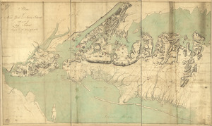
A plan of New York Island, part of Long Island &c : shewing the position of the American & British armies, before, at, and...
9255.
A plan of New York Island, part of Long Island &c. shewing the position of the American and British Armies, before, at, and...
9256.
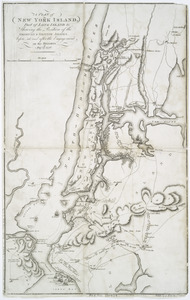
A plan of New York Island, with part of Long Island, Staten Island & east New Jersey, with a particular description of the...
9257.
A plan of New York Island, with part of Long Island, Staten Island & east New Jersey, with a particular description of the...
9258.
A plan of New York Island, with part of Long Island, Staten Island & east New Jersey, with a particular description of the...
9259.
A plan of New York Island, with part of Long Island, Staten Island, & East New York : with a particular description of the...
9260.
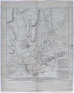
A plan of New York Island with the circumjacent country as far as Dobb's Ferry to the north, and White-Plains the the east;...
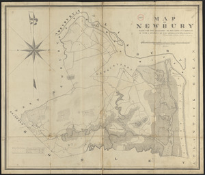
9261.
Plan of Newbury made by Philander Anderson, dated June, 1830
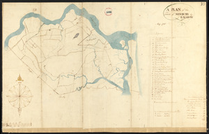
9262.
Plan of Newbury surveyed by E. March, dated May 1795.
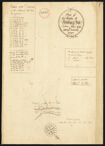
9263.
Plan of Newburyport, made by Joseph Somerby, dated May 1795.
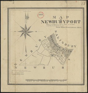
9264.
Plan of Newburyport made by Philander Anderson, dated May 1830
9265.
Plan of Newburyport Mass. from an actual survey
9266.
Plan of Newcastle surveyed by Thomas Boyd, dated December 24, 1794.
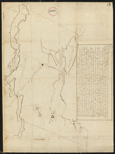
9267.
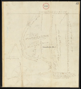
Plan of Newfield, surveyor's name not given, dated 1794-5.
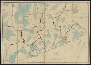
9268.
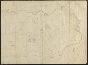
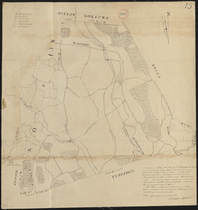
Plan of Newton & Needham
9269.
Plan of Newton made by E. F. Woodward and W. F. Ward, dated 1831
9270.
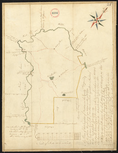
Plan of Newton surveyed by Jonathan Kingsbury, dated 1794.
9271.
Plan of Newton Terraces, Newton, Mass
9272.
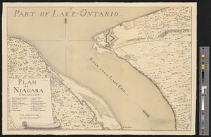
Plan of Niagara
9273.
Plan of Niagara River between the Lakes Ontario and Erie
9274.
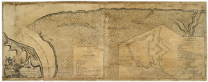
Plan of Niagara with the adjacent country surrendered to the English army under the command of Sr. Willm: Johnson Bart: on the...
9275.
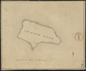
Plan of No Man's Land (Chilmark), surveyor's name not given, dated 1830
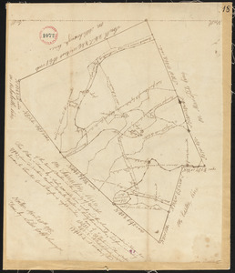
9276.
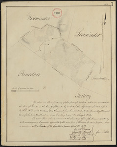
Plan of No Town (Princeton), surveyor's name not given, dated 1838
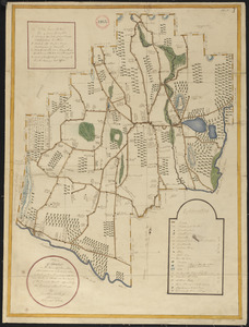
9277.
Plan of Nobleborough, made by Ephraim Robings, dated March 24, 1795.
9278.
Plan of Norridgewock, made by Daniel Steward, dated March 2, 1795.
9279.
Plan of North Brookfield made by Bonum Nye, dated 1830
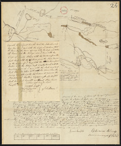
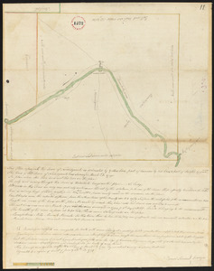
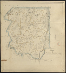
9280.
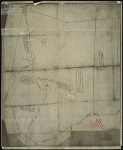
Plan of north precinct, Reading, 1732 : showing precinct boundaries, rivers, and location of meeting house
9281.
Plan of North Yarmouth surveyed by Asa Lewis, dated 1794-5.
9282.
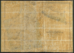
Plan of Northampton made by John G. Hales, dated 1831
9283.
Plan of Northampton surveyed by J Denison, dated November, 1794.
9284.
Plan of Northborough made by Gill Valentine, dated 1830
9285.
Plan of Northborough surveyed by Silas Keyes, dated February 23, 1795.
9286.
Plan of Northbridge made by Frederic Taft, dated November 1830
9287.
Plan of Northbridge surveyed by Jonathan Adams and Amariah Preston, dated Mar. 2, 1795.
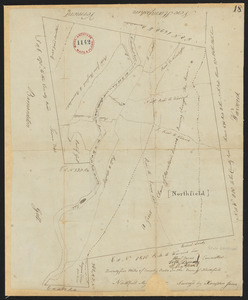
9288.
Plan of Northfield made by Arthur W. Hoyt, dated 1830
9289.
Plan of Northfield surveyed by Xenophon Janes,dated May 1795.
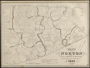
9290.
Plan of Norton made by C. Leonard and E. Lincoln, dated October 1830
9291.
Plan of Norton made by E. Lincoln and C. Leonard, dated October 1830
9292.
Plan of Norton surveyed by Silas Cobb, dated November, 1794.
9293.
Plan of Norway (Rustfield), surveyor's name not given, dated December 1795.
9294.
Plan of Norwich (Huntington) made by Joseph Kirkland, dated 1831
9295.
Plan of Oak Bluffs, Marthas Vineyard
9296.
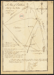
Plan of Oakham, made by Daniel Walker, dated 1794-5.
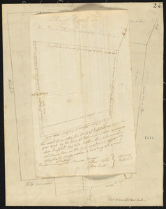
9297.
Plan of Oakham made by James Allen, dated November 1830
9298.
Plan of Ocean View, Pigeon Cove, Mass
9299.
Plan of old fort Frontenac and town plot of Kingston
9300.
Plan of Orange made by Jonathan Blake, Jr., dated February 15, 1831
‹ Prev
Next ›
1
2
…
182
183
184
185
186
187
188
189
190
…
267
268