Search Constraints
Search Results

3361. Fort at Carlisle
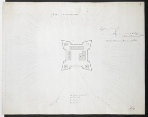
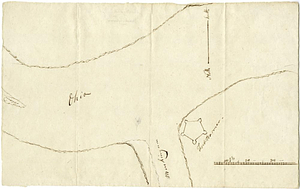
3362. FORT AT IUNIATA
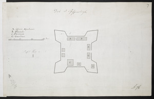
3363. Fort at Shippensburgh
3364. Fort Augusta
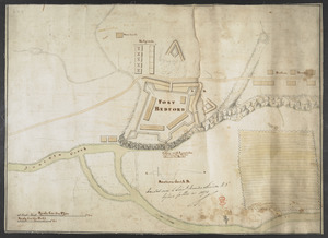
3365. FORT BEDFORD
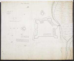
3366. FORT BEDFORD

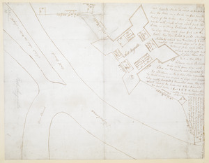
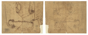
3367. Fort Bedford
![[Fort Bedford, on the Juniata Creek]](https://bpldcassets.blob.core.windows.net/derivatives/images/commonwealth:hx11z402t/image_thumbnail_300.jpg)

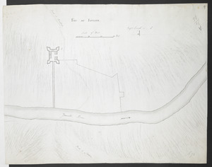
3369. Fort Edward


3379. Fort Lee