Toggle navigation
LMEC Home
Exhibitions
Georeferencing
Tools for Teachers
Collections
My Favorites
Sign Up / Log In
Search
Search the map portal
Map Collection
Map Collection
Map Sets
Search
Search
Search for
Search In
All Fields
Creator
Title
Subject
Place
Search All Digital Collections
Advanced Search
13385 Results
Filter your Search
Place
North and Central America
9,353
United States
7,078
Suffolk (county)
1,664
Boston
1,621
Europe
1,035
Canada
949
Massachusetts
794
New York
532
more
Place
»
Topic
Boston (Mass.)--Maps
741
City planning--Massachusetts--Boston--Maps
418
United States--History--Revolution, 1775-1783--Maps
329
United States--Maps
315
Urban renewal--Massachusetts--Boston--Maps
254
Real property--Massachusetts--Boston--Maps
252
Massachusetts--Maps
219
Insurance surveys
197
more
Topic
»
Date
Date range begin
–
Date range end
Current results range from
1482
to
2023
View distribution
Creator
United States. Hydrographic Office
595
Boston Redevelopment Authority
403
Des Barres, Joseph F. W. (Joseph Frederick Wallet), 1722-1824
247
Royal United Services Institute for Defence and Security Studies
160
Jefferys, Thomas, -1771
154
George, III, King of Great Britain, 1738-1820
152
George, IV, King of Great Britain, 1762-1830
151
O.H. Bailey & Co
148
more
Creator
»
Format
Maps/Atlases
13,205
Manuscripts
985
Prints
102
Books
49
Drawings/Illustrations
44
Photographs
15
Objects/Artifacts
13
Documents
7
more
Format
»
Georeferenced
Yes
979
No
12,406
Collection
Norman B. Leventhal Map Center Collection
8,891
American Revolutionary War-Era Maps
3,305
Boston and New England Maps
2,804
Urban Maps
2,397
Maritime Charts and Atlases
1,150
William L. Clements Library Collection
910
Library of Congress Collection
618
Boston Redevelopment Authority Collection
475
more
Collection
»
Available to use
No known restrictions
9,952
Creative Commons license
1,677
Search Constraints
Sort by relevance
relevance
title
date (asc)
date (desc)
Number of results to display per page
100 per page
10
per page
20
per page
50
per page
100
per page
View results as:
grid view
map view
Search Results
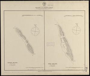
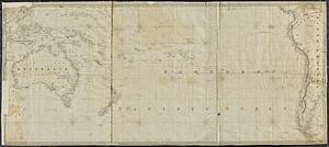
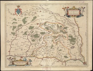
11801.
South Pacific Ocean
11802.
South Pacific Ocean, Caroline Island
11803.
South Pacific Ocean, Easter Island (Te Pito te Henua Island)
11804.
South Pacific Ocean, Islands in the Gilbert Group : from an examination by the U.S.S. "Narragansett", Comdr. R.W. Meade, in 1872
11805.
South Pacific Ocean, Paumotu Group - Rairoa (Rangiroa) Island, Avatoru Pass and anchorage
11806.
South Pacific Ocean, Samoan Group, Fangaloa Bay (Island of Upolu)
11807.
South Pacific Ocean, Solomon Islands, Guadalcanal and Florida Is. with a portion of Malaita I. : from British surveys to 1912
11808.
South Pacific--Society Islands, n.w. coast of Tahiti, Papiete Harbor : from a French survey in 1869 ; corrected 1889
11809.
The south part of Africa, and the island of Madagascar : here the Portugueze have many settlements and all the trade
11810.
The south part of Great Britain, called England and Wales
11811.
The south part of New England as it planted this yeare, 1634
11812.
The south part of New England, as it planted this yeare, 1639
11813.
The south part of New-England, as it is planted this yeare, 1635
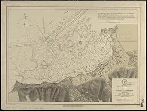
11814.
South Perry, [Ohio]
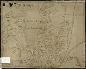
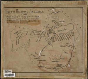
11815.
South Reading
11816.
South Reading as it was : being a copy of an old map of the First Parish of Reading, supposed to have been drawn about the year...
11817.
[South Reading Common area] : copied from an old plan formerly in the possession of Burrage Yale
11818.
The South Shore and Norfolk County, Mass
11819.
South Station development study : access plan
11820.
South Station development study : site location and functional areas
11821.
South Station development study : parcel plan
11822.
South Station development study : estimated track retirement
11823.
A south view of Oswego, on Lake Ontario, in North America
11824.
The south west coast of the peninsula of Nova Scotia
11825.
The south west coast of the peninsula of Nova Scotia
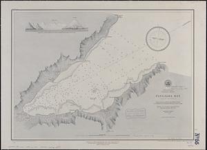
11826.
South west end of Lake Erie
11827.
South west Pacific, anchorages in the Solomon Islands : from various authorities with corrections to 1874 ; republication of...
11828.
A south west view of the city of New York, in North America = Vue de sud ouest de la ville de New York, dans l'Amerique...
11829.
South western districts
11830.
South western shore of the Caribbean Sea, anchorages on the coast of Honduras : from British surveys
11831.
South Weymouth, Norfolk County, Mass. 1885 : from the fair grounds
11832.
South-Carolina and parts adjacent : shewing the movements of the American and British armies
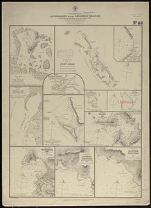
11833.
South-east New Guinea
11834.
Southeast States road map
11835.
Southern Alberta : map showing disposition of lands
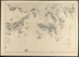
11836.
Southern Asia
11837.
Southern British Columbia : map showing disposition of lands
11838.
Southern coast of China, harbor of Hongkong and approaches : compiled from the latest information, 1886
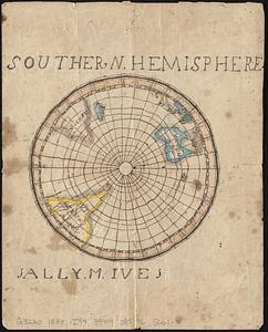
11839.
Southern hemisphere
11840.
Southern Luzon : showing portion of theatre of operations ; 8th Army Corps, Major General Elwell S. Otis commanding
11841.
Southern Luzon, showing portion of theatre of operations : 8th Army Corps, Major General Elwell S. Otis commanding
11842.
Southern Mississippi and Alabama showing the approaches to Mobile
11843.
Southern New York and northern New Jersey
11844.
The southern or lower part of the Pacific Ocean
11845.
The southern part of the Province of New York : with part of the adjoining colonies
11846.
Southern portion of Lake Megantic and the Dead River : Québec July 25th, 1761
11847.
Southern provinces of the United States
11848.
Southern Railway system
11849.
Southern shore of the Caribbean Sea, Costa Rica, Port of Limon
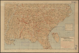
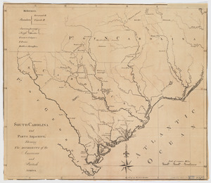
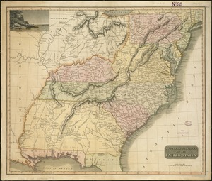
11850.
Southern States
11851.
Southern Vancouver Island, British Columbia
11852.
Southington, Conn : 1878
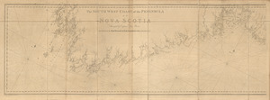
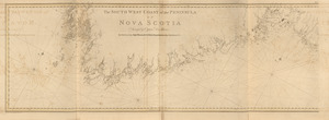
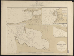
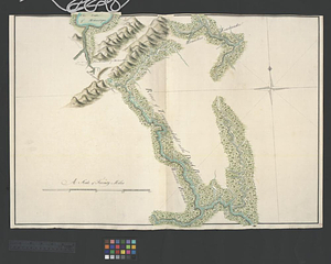
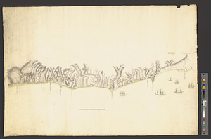
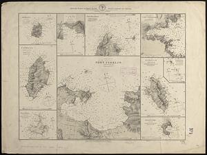
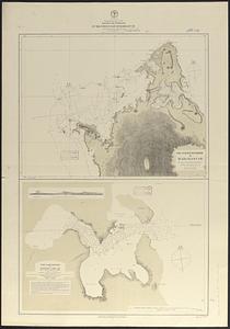
11853.
Southville and Cordaville, Massachusetts, 1887
11854.
[Southwest coast of Nova Scotia from Cape Sable to Cape St. Mary]
11855.
[Southwest coast of Nova Scotia from Cape Sable to Cape St. Mary]
11856.
[Southwest coast of Nova Scotia from Cape Sable to Cape St. Mary]
11857.
Southwest coast of St. Vincent
11858.
Southwest corridor development plan
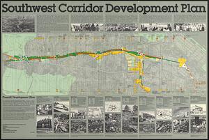
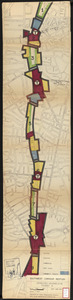
11859.
Southwest corridor restudy
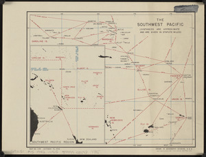
11860.
The southwest Pacific
11861.
The southwestern railroad system United States and Mexico
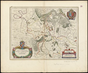
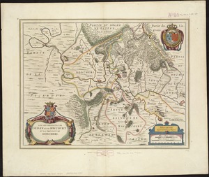
11862.
La souverainete de Dombes
11863.
Les Souverainetez de Sedan et Raucourt et la Prevosté de Doncheri
11864.
Les Souverainetez de Sedan et Raucourt et la Prevosté de Doncheri
11865.
La Spagnuola
11866.
Spagnvola
11867.
Spagnvola
11868.
Spain & Portugal
11869.
Spain and Portugal
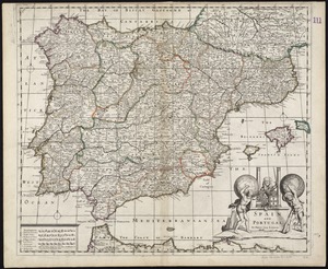
11870.
Spain and Portugal
11871.
Spain and Portugal
11872.
Spain and Portugal, from the best authorities
11873.
Spain and Portugal from the best authorities
11874.
The Spainish Netherlands, vulgarly called Flanders, devided into its X provinces, wherein are delineated the fortified towns...
11875.
Spain--south coast, Port Málaga : from the Spanish government survey of 1872
11876.
Spain--west coast, Arosa and Pontevedra Bays : from the latest Spanish surveys : republication of Brit. Admty. chart no. 1756
11877.
Spanish North America
11878.
Spanish North America, southern part
11879.
Spartanburg, South Carolina : the city of success ; city map and street directory
11880.
Special chart of Cape Florida belonging to the 13th section
11881.
Special chart of Muskito Inlet
11882.
Special map of Rossland, British Columbia
11883.
Special plan to chart no. 565 : harbors and anchorages on the N.E. coast of Madagascar : from British and French surveys,...
11884.
Special plans to chart no. 318
11885.
Special plans to chart no. 320, west-coast of Italy
11886.
Special plans to chart no. 394, western shore of the Caribbean Sea : from British surveys, corrected to 1872
11887.
Special plans to chart no. 565 : harbors and anchorages on the N.W. coast of Madagascar : from British surveys in 1824,...
11888.
Special plans to chart no. 565, harbors and anchorages on the north coast of Madagascar : from British and French surveys,...
11889.
Specialkarte der Asiatischen Türkey : oestliches blatt
11890.
Special-karte der eisenbahn-, post- u. dampfschiff-verbindungen Mittel-Europa's mit angabe aller eisenbahn-, post- u....
11891.
Special-karte der Europäischen Türkey
11892.
Special-karte der Fränkischen Schweiz und der umgegend von Nürnberg : (aus Reymann's Special-karte von Central-Europa)
11893.
Specialkarte des Grossen Salzsee's von Utah und Seiner Umgebungen : nach den aufnahmen von Frémont und Stansbury
11894.
Specialkarte vom kriegsschauplatz am Rhein 1870 (Erfurt bis Paris) : Belgien, nordöstliches Frankreich, Luxembourg,...
11895.
Specimen trigesimae sextae partis ex globo terrestri trium pedum Parisin cujus nec non globi Coelestis constructio addito...
11896.
Spencer
11897.
Spencer, Mass : 1877
11898.
Spencer, Massachusetts, 1892
11899.
Spezialkarte der Samoa-Inseln
11900.
Spezielle reise- und gebirgs-karte vom Lande Tyrol mit den angrenzenden theilen von Süd Bayern, Salzburg, der Schweiz,...
‹ Prev
Next ›
1
2
…
115
116
117
118
119
120
121
122
123
…
133
134