Search Constraints
Search Results
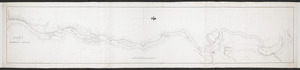
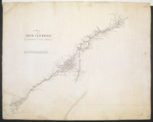
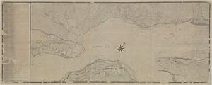
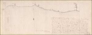
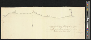
![[Chart of the Saint Lawrence River]](https://bpldcassets.blob.core.windows.net/derivatives/images/commonwealth:hx11z0594/image_thumbnail_300.jpg)


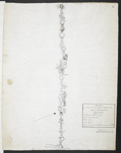


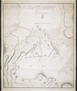
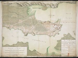
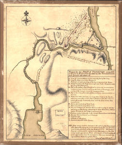
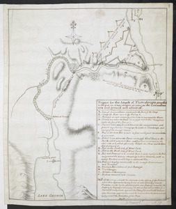
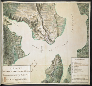
11509. Fort Edward to Ticonderoga

![[Map of Fort Carillon]](https://bpldcassets.blob.core.windows.net/derivatives/images/commonwealth:hx11z179t/image_thumbnail_300.jpg)
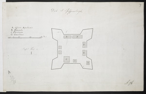
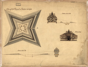
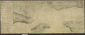
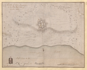
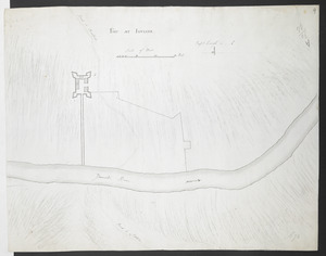
11513. [Map of Fort Carillon]
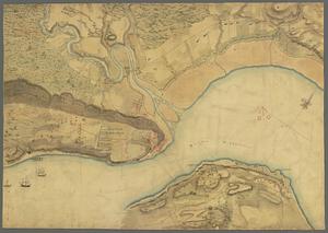
![[Map of Quebec and environs showing the position of the English and French troops]](https://bpldcassets.blob.core.windows.net/derivatives/images/commonwealth:hx11xz61s/image_thumbnail_300.jpg)

![[Map of the environs of Quebec showing the position of the English and French troops]](https://bpldcassets.blob.core.windows.net/derivatives/images/commonwealth:hx11xz690/image_thumbnail_300.jpg)
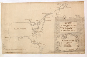
![[Map showing the disposition of General Amhert's boats and rafts]](https://bpldcassets.blob.core.windows.net/derivatives/images/commonwealth:hx11xz67f/image_thumbnail_300.jpg)

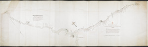
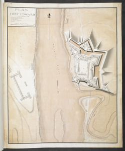
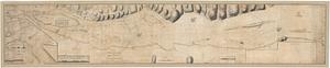
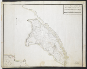
11525. PART OF HUDSON'S RIVER

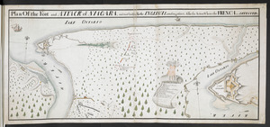
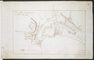
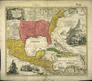
11526. PARTIE DU PLAN DE QUEBEC

![[PLAN de Carillon]](https://bpldcassets.blob.core.windows.net/derivatives/images/commonwealth:hx11z1778/image_thumbnail_300.jpg)
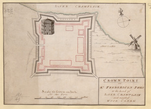
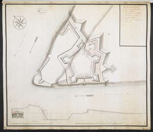
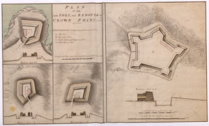
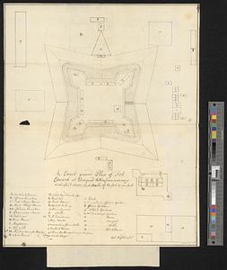
11528. [PLAN de Carillon]
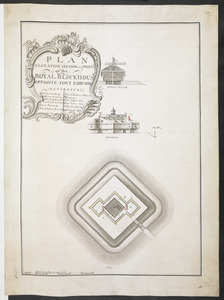
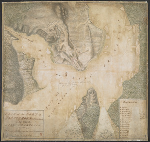
11532. PLAN FORT EDWARD
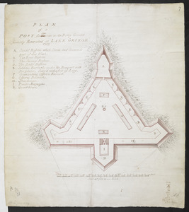

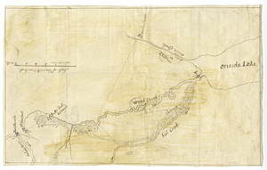
![Plan of Fort [Brewerton] at the west end of Onnide Lake](https://bpldcassets.blob.core.windows.net/derivatives/metadata/commonwealth-oai:639615613/image_thumbnail_300.jpg)
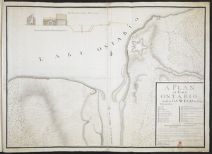


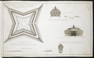
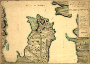
![[Plan of proposed Fort Ontario at Oswego]](https://bpldcassets.blob.core.windows.net/derivatives/images/commonwealth:hx11z1204/image_thumbnail_300.jpg)

11545. A plan of Quebec
![Plan of Quebec, the capital of Canada in North America, with the bason and part of the adjacent contry [sic] shewing the principal encampments and works of the British Army commanded by Maior General Wolfe and those of the French Army commanded by Lieut. General, the Marquis of Mont Calm during the siege of that place in 1759 [overlay down]](https://bpldcassets.blob.core.windows.net/derivatives/images/commonwealth:q524nd83b/image_thumbnail_300.jpg)
![Plan of Quebec, the capital of Canada in North America, with the bason and part of the adjacent contry [sic] shewing the principal encampments and works of the British Army commanded by Maior General Wolfe and those of the French Army commanded by Lieut. General, the Marquis of Mont Calm during the siege of that place in 1759 [overlay up]](https://bpldcassets.blob.core.windows.net/derivatives/images/commonwealth:q524nd81s/image_thumbnail_300.jpg)


![[A map of the River Schohary with a plan and elevation of the new fort]](https://bpldcassets.blob.core.windows.net/derivatives/images/commonwealth:hx11z356x/image_thumbnail_300.jpg)


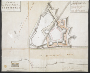
![[Ein grund-riss von der Festung Duquessne wie sie ausgesehen hat, ehe sie die Frankosen zerstoren aben, und zum theil noch aussiehet]](https://bpldcassets.blob.core.windows.net/derivatives/images/commonwealth:z603vv49q/image_thumbnail_300.jpg)

11598. Fort at Carlisle
11599. FORT AT IUNIATA