Toggle navigation
LMEC Home
Exhibitions
Georeferencing
Tools for Teachers
Collections
My Favorites
Sign Up / Log In
Search
Search the map portal
Map Collection
Map Collection
Map Sets
Search
Search
Search for
Search In
All Fields
Creator
Title
Subject
Place
Search All Digital Collections
Advanced Search
13385 Results
Filter your Search
Place
North and Central America
9,353
United States
7,078
Suffolk (county)
1,664
Boston
1,621
Europe
1,035
Canada
949
Massachusetts
794
New York
532
more
Place
»
Topic
Boston (Mass.)--Maps
741
City planning--Massachusetts--Boston--Maps
418
United States--History--Revolution, 1775-1783--Maps
329
United States--Maps
315
Urban renewal--Massachusetts--Boston--Maps
254
Real property--Massachusetts--Boston--Maps
252
Massachusetts--Maps
219
Insurance surveys
197
more
Topic
»
Date
Date range begin
–
Date range end
Current results range from
1482
to
2023
View distribution
Creator
United States. Hydrographic Office
595
Boston Redevelopment Authority
403
Des Barres, Joseph F. W. (Joseph Frederick Wallet), 1722-1824
247
Royal United Services Institute for Defence and Security Studies
160
Jefferys, Thomas, -1771
154
George, III, King of Great Britain, 1738-1820
152
George, IV, King of Great Britain, 1762-1830
151
O.H. Bailey & Co
148
more
Creator
»
Format
Maps/Atlases
13,205
Manuscripts
985
Prints
102
Books
49
Drawings/Illustrations
44
Photographs
15
Objects/Artifacts
13
Documents
7
more
Format
»
Georeferenced
Yes
979
No
12,406
Collection
Norman B. Leventhal Map Center Collection
8,891
American Revolutionary War-Era Maps
3,305
Boston and New England Maps
2,804
Urban Maps
2,397
Maritime Charts and Atlases
1,150
William L. Clements Library Collection
910
Library of Congress Collection
618
Boston Redevelopment Authority Collection
475
more
Collection
»
Available to use
No known restrictions
9,952
Creative Commons license
1,677
Search Constraints
Sort by relevance
relevance
title
date (asc)
date (desc)
Number of results to display per page
100 per page
10
per page
20
per page
50
per page
100
per page
View results as:
grid view
map view
Search Results
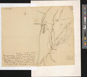
11101.
[River St. John]
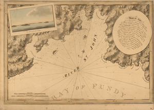
11102.
The river St. John
11103.
The River St. John
11104.
THE RIVER S.T LAURENCE
11105.
The River St. Lawrence from Mal Bay to the Basin of Quebec
11106.
The River St. Lawrence from the Basin of Quebec to the Falls of Richeu
11107.
River valley with several foothills and swamp
11108.
Riverside & Dan River Cotton Mills, Inc. "Dan River Division," Schoolfield, Va. [insurance map]
11109.
Riverside & Dan River Cotton Mills, Inc. "Riverside Division, Mill No. 8" (Cotton Mill), Danville, Va. [insurance map]
11110.
The Riverway master plan
11111.
La Riviere de la Garomne et la Dordogne et le pays aux environs de Bordeaux
11112.
La rivière du Détroit depuis le Lac Sainte Claire jusqu'au Lac Erié
11113.
R.L. Polk & Co.'s map of Bay City, and Essexville Mich
11114.
R.L. Polk & Co's map of greater Battle Creek and suburbs
11115.
R.L. Polk & Co's map of Memphis, Tenn : from official records and original plats
11116.
The road from London to Buckingham
11117.
The road from New Bridge and Hackinsack to Burlington
11118.
Road from the White Plains to Bloomer's Mill at Rye Neck, and Cross Roads : no 20
11119.
Road map, drawn & engraved expressly for Road book of Boston & vicinity
11120.
Road map of the Albany-Troy district
11121.
Road map of the Boston district showing the metropolitan park system.
11122.
Road map of the Boston District, showing the metropolitan park system
11123.
Road map of the Boston district showing the metropolitan park system
11124.
Road map of the island of Rhode Island, or Aquidneck
11125.
Road map of Worcester County, Mass
11126.
ROAD OF COUDRE
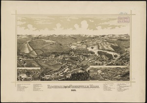
11127.
Roads about White Plains : no 59
11128.
Roads and communications of Sinkiang
11129.
Roads and country that Col. Campbell marched thro'--Ebenezer to Augusta in Georgia
11130.
The roads from Chelmsford to St. Edmunds Bury
11131.
Roads from Windsor to Easton through the highlands
11132.
The Roads of Toulon, with the adjacent country
11133.
The roads of ye south part of Great Britain, called England and Wales : Containing all ye cities, market towns, post towns,...
11134.
Robinson's atlas of Norfolk County, Massachusetts : compiled from official records, private plans & actual surveys
11135.
Rochdale and Greenville, Mass : 1887
11136.
Rochester, N.H : Gonic and East-Rochester, 1884
11137.
Rock Island-Frisco lines and Chicago & Eastern Illinois R.R : traverse the richest and most prosperous commonwealths in the Union
11138.
Rockland
11139.
Rock's illustrated map of London
11140.
Rohmer Medford Wool Scouring Company, Medford, Mass. [insurance map]
11141.
Rollstone Foundry, Inc., Foster Machine Company, Ten., Fitchburg, Mass. [insurance map]
11142.
Roma, la capitale degli Stati Pontifici, fondata da Romolo e Remo verso vanno 754 prima di Cristo, e situato sul 41°53'54" di...
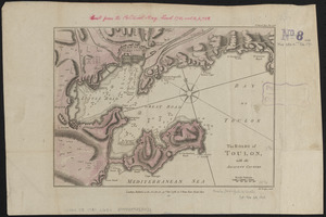
11143.
Roma, suburbio e dintorni
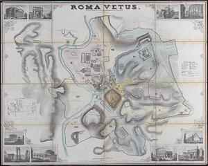
11144.
Roma vetus
11145.
Romagna olim Flaminia
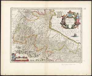
11146.
Romania
11147.
Ropewalk bldg. Charlestown Navy Yard
11148.
Rose F. Kennedy Garden
11149.
Rose garden in Fens-Back Bay
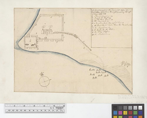
11150.
Rose Kennedy Garden : contract documents August 1986 : prepared for City of Boston ; Parks & Recreations Department ; Boston...
11151.
A rough and inaccurate sketch of the streets of Boston as they are supposed to have been first laid out & the owners of the...
11152.
[Rough draft of Charlestown, in water colour]
11153.
[Rough draught of Boston and harbour]
11154.
A rough draught of New Haven fort
11155.
Rough PLAN of FORT DUQUESNE such as it was before it was demolish'd 1758
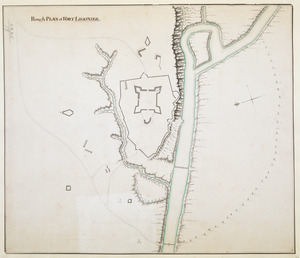
11156.
Rough PLAN of FORT LIGONIER
11157.
Rough Scetch of the King's Domain at Detroit
11158.
A rough sketch of the field of battle, near Turtle Creek, of the 9th July, with the disposition of the British troops, and...
11159.
Roumania
11160.
Route and pictorial map of Maine
11161.
Route chart showing routes to and from northwestern Europe
11162.
Route map, Juneau to Porcupine River, Alaska
11163.
Route map of Massachusetts
11164.
Route of the Albany & West Stockbridge Rail Road
11165.
Route of the late expedition commanded by Act'g Rear Admiral D.D. Porter U.S.N. attempting to get into the Yazoo River by the...
11166.
Route of the Massachusetts nautical training ship Ranger, 1909
11167.
Route of the proposed Providence & Worcester rail-road
11168.
Route of the Providence and Worcester rail road
11169.
Routes of Grand Trunk Pacific Steamships : Pacific coast service
11170.
Roxbury
11171.
Roxbury - N. Dorchester G.N.R.P. : preliminary land use plan
11172.
Roxbury - N. Dorchester G.N.R.P. : preliminary circulation plan
11173.
Roxbury to Concord : Roads & distances, &c
11174.
Roxbury-N. Dorchester G.N.R.P. r-50 : existing & proposed community facilities
11175.
Roxbury-N. Dorchester G.N.R.P. r-50 : existing circulation
11176.
Roxbury-N. Dorchester G.N.R.P. r-50 : proposed treatment and title I projects
11177.
Roxbury-N. Dorchester G.N.R.P. r-50 : proposed circulation
11178.
Roxbury-N. Dorchester G.N.R.P. r-50 : proposed land use
11179.
Roxbury-N. Dorchester G.N.R.P. r-50 : existing building conditions
11180.
Roxbury-N. Dorchester G.N.R.P. r-50 : existing population density
11181.
Le Royaume d'Angleterre : divisé selon les sept Royaumes, ou Heptarchie des Saxons, avec la Principauté de Galles, et...
11182.
Royaume de Danemarck : qui comprend le Nort-Jutland divisé en ses quatre dioceses, le Sud-Jutland divisé en ses deux duchés...
11183.
Le Royaume de Hongrie, divisé en Haute et Basse Hongrie, Transilvanie, Esclavonie et Croatie
11184.
Royaume d'Irlande : divisé en ses quatre provinces et subdivisé en comtés
11185.
Ruatan or Rattan
11186.
A rude sketch of a part of the road between the township of Horton and Granville on the river of Annapolis, relative to a...
11187.
Rugby : belonging to Wood, Harmon & Co
11188.
Ruggles Center : existing condition plan
11189.
Ruggles Center : site area diagram
11190.
Rumänien und Bulgarien
11191.
Rural cultural regions in the United States
11192.
Russell
11193.
Russell's map of Boston from the latest surveys : colored to show the burned district of the Great Fire Nov 9th & 10th 1872
11194.
Russell's map of Boston from the latest surveys
11195.
Russell's map of Massachusetts
11196.
Russell's map of Paris and fortifications
11197.
Russia
11198.
Russia in Europe
11199.
The Russian Empire, in Europe and Asia
11200.
Russisch-Türkischer Kriegsschauplatz, 1877
‹ Prev
Next ›
1
2
…
108
109
110
111
112
113
114
115
116
…
133
134