Toggle navigation
LMEC Home
Exhibitions
Georeferencing
Tools for Teachers
Collections
My Favorites
Sign Up / Log In
Search
Search the map portal
Map Collection
Map Collection
Map Sets
Search
Search
Search for
Search In
All Fields
Creator
Title
Subject
Place
Search All Digital Collections
Advanced Search
13385 Results
Filter your Search
Place
North and Central America
9,353
United States
7,078
Suffolk (county)
1,664
Boston
1,621
Europe
1,035
Canada
949
Massachusetts
794
New York
532
more
Place
»
Topic
Boston (Mass.)--Maps
741
City planning--Massachusetts--Boston--Maps
418
United States--History--Revolution, 1775-1783--Maps
329
United States--Maps
315
Urban renewal--Massachusetts--Boston--Maps
254
Real property--Massachusetts--Boston--Maps
252
Massachusetts--Maps
219
Insurance surveys
197
more
Topic
»
Date
Date range begin
–
Date range end
Current results range from
1482
to
2023
View distribution
Creator
United States. Hydrographic Office
595
Boston Redevelopment Authority
403
Des Barres, Joseph F. W. (Joseph Frederick Wallet), 1722-1824
247
Royal United Services Institute for Defence and Security Studies
160
Jefferys, Thomas, -1771
154
George, III, King of Great Britain, 1738-1820
152
George, IV, King of Great Britain, 1762-1830
151
O.H. Bailey & Co
148
more
Creator
»
Format
Maps/Atlases
13,205
Manuscripts
985
Prints
102
Books
49
Drawings/Illustrations
44
Photographs
15
Objects/Artifacts
13
Documents
7
more
Format
»
Georeferenced
Yes
979
No
12,406
Collection
Norman B. Leventhal Map Center Collection
8,891
American Revolutionary War-Era Maps
3,305
Boston and New England Maps
2,804
Urban Maps
2,397
Maritime Charts and Atlases
1,150
William L. Clements Library Collection
910
Library of Congress Collection
618
Boston Redevelopment Authority Collection
475
more
Collection
»
Available to use
No known restrictions
9,952
Creative Commons license
1,677
Search Constraints
Sort by date (desc)
relevance
title
date (asc)
date (desc)
Number of results to display per page
10 per page
10
per page
20
per page
50
per page
100
per page
View results as:
grid view
map view
Search Results
10211.
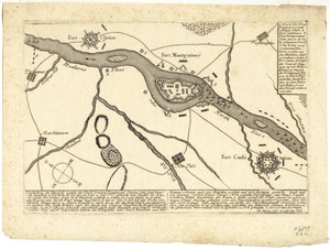
Vorstellung der diversio welche der Enll. Generel Lieutenant Clinton samt dene Generals Vaughan u. Tryon in de Ierseys im Sept....
10212.
West Indies
10213.
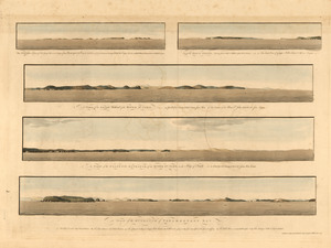
The Wolves, a cluster of isles lying s.e. near 3 leagues from Pasamaquady Bay ... ; Grand Manan Island ... ; A view of the...
10214.
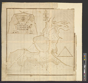
Plan de l'entrée de la rivière de Charleston le 30 Dexbre 1776
10215.
The attack and defeat of the American fleet under Benedict Arnold, by the kings fleet commanded by Captn. Thos. Pringle, upon...
10216.
The seat of action, between the British and American forces or an authentic plan of the western part of Long Island, with the...
10217.
A general map of the southern British colonies in America comprehending North and South Carolina, Georgia, East and West...
10218.
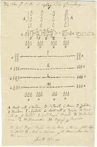
The order of battle in crossing Lake Champlane
10219.
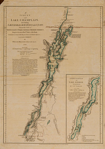
A survey of Lake Champlain, including Lake George, Crown Point and St. John : surveyed by order of his excellency Major-General...
10220.
A chart of Tibee Inlet in Georgia
‹ Prev
Next ›
1
2
…
1,018
1,019
1,020
1,021
1,022
1,023
1,024
1,025
1,026
…
1,338
1,339