Toggle navigation
LMEC Home
Exhibitions
Georeferencing
Tools for Teachers
Collections
My Favorites
Sign Up / Log In
Search
Search the map portal
Map Collection
Map Collection
Map Sets
Search
Search
Search for
Search In
All Fields
Creator
Title
Subject
Place
Search All Digital Collections
Advanced Search
298 Results
My Search
Start Over
1780
Remove constraint 1780
Filter your Search
Place
North and Central America
260
United States
180
Canada
40
New York
34
Charleston (county)
31
Charleston
27
South Carolina
25
New Jersey
19
more
Place
»
Topic
United States--History--Revolution, 1775-1783--Maps
54
Manuscript maps--Early works to 1800
22
Charleston (S.C.)--Maps
11
Charleston (S.C.)--Siege, 1780--Maps
9
Fortification--Newfoundland and Labrador--St. John's--Maps, Manuscript--Early works to 1800
9
Harbors--Newfoundland and Labrador--St. John's--Maps, Manuscript--Early works to 1800
9
Military art and science--Newfoundland and Labrador--St. John's--Maps, Manuscript--Early works to 1800
9
St. John's (N.L.)--Maps, Manuscript--Early works to 1800
9
more
Topic
»
Date
Date range begin
–
Date range end
Current results range from
1711
to
1909
View distribution
Creator
Skinner, Monier
28
Skinner, William, 1700-1780
28
Des Barres, Joseph F. W. (Joseph Frederick Wallet), 1722-1824
25
Faden, William, 1749-1836
16
André, John, 1751-1780
11
Bonne, Rigobert, 1727-1794
8
Carver, Jonathan, 1710-1780
6
Ferguson, Patrick, 1744-1780
6
more
Creator
»
Format
Maps/Atlases
292
Manuscripts
71
Prints
5
Drawings/Illustrations
1
Georeferenced
Yes
7
No
291
Collection
American Revolutionary War-Era Maps
266
Norman B. Leventhal Map & Education Center Collection
67
William L. Clements Library Collection
65
Library of Congress Collection
63
British Library Collection
33
Maritime Charts and Atlases
27
Richard H. Brown Revolutionary War Map Collection at Mount Vernon
26
Boston and New England Maps
13
more
Collection
»
Available to use
Creative Commons license
142
No known restrictions
67
Search Constraints
Sort by relevance
relevance
title
date (asc)
date (desc)
Number of results to display per page
20 per page
10
per page
20
per page
50
per page
100
per page
View results as:
grid view
map view
Search Results
181.
New York Island and East Jersey : Unfinished
182.
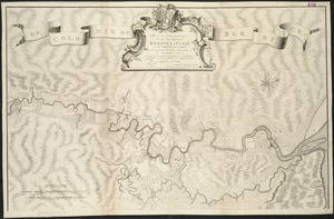
[Charles Town Harbour & adjacent Islands, Country, Rivers &c]
183.
F.T. Neely's new commercial map of the United States, Canada, British Columbia, and Northern Mexico, showing all the railroads,...
184.
Plan de Savannah
185.
An accurate map of Rhode Island, part of Connecticut and Massachusets, shewing Admiral Arbuthnot's station in blocking up...
186.
A map of the island of St. Domingo
187.
Nouvelle carte geographique des postes des Païs Bas, de la Westphalie, & des provinces limitrophes
188.
Boston
189.
[Carte de la rivière et de la colonie Demerari jusqu'à Mahayka Creek]
190.
A new and accurate map of the province of New York and part of the Jerseys, New England and Canada, shewing the scenes of our...
191.
Nieuwe en zeer accuraate generaale caart van de twee rievieren Berbice en Canje met alle desselfs plantagien en gronden op...
192.
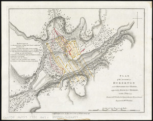
Plan of the action at Huberton under Brigadier Genl. Frazer, supported by Major Genl. Reidesel, on the 7th July 1777
193.
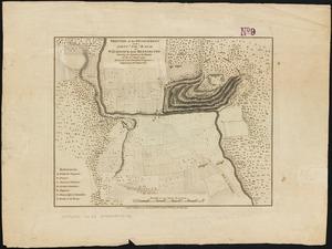
Position of the detachment under Lieut. Col. Baum, at Walmscock near Bennington shewing the attacks of the enemy on the 16th...
194.
A sketch of the environs of Charlestown in South Carolina
195.
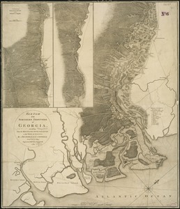
Sketch of the northern frontiers of Georgia, extending from the mouth of the River Savannah to the town of Augusta
196.
An accurate map of Rhode Island, part of Connecticut and Massachusets, shewing Admiral Arbuthnot's station in blocking up...
197.
Boston
198.
Boston et ses environs
199.
Carte particuliere du havre de Boston : avec les sondes les bancs de Sable, les rochers les Amaies et les autres directions...
200.
Carte particuliere du havre de Boston : avec les sondes les bancs de Sable, les rochers les Amaies et les autres directions...
‹ Prev
Next ›
1
2
…
6
7
8
9
10
11
12
13
14
15
![[Charles Town Harbour & adjacent Islands, Country, Rivers &c]](https://bpldcassets.blob.core.windows.net/derivatives/images/commonwealth:hx11z271t/image_thumbnail_300.jpg)


![[Carte de la rivière et de la colonie Demerari jusqu'à Mahayka Creek]](https://bpldcassets.blob.core.windows.net/derivatives/images/commonwealth:w9505s514/image_thumbnail_300.jpg)