Toggle navigation
LMEC Home
Exhibitions
Georeferencing
Tools for Teachers
Collections
My Favorites
Sign Up / Log In
Search
Search the map portal
Map Collection
Map Collection
Map Sets
Search
Search
Search for
Search In
All Fields
Creator
Title
Subject
Place
Search All Digital Collections
Advanced Search
1716 Results
My Search
Start Over
More Like
commonwealth-oai:bg25cd491
Remove constraint More Like: commonwealth-oai:bg25cd491
Filter your Search
Place
North and Central America
1,687
United States
1,425
Suffolk (county)
764
Boston
756
Massachusetts
717
Canada
205
New York
195
Quebec
111
more
Place
»
Topic
Boston (Mass.)--Maps
752
United States--History--Revolution, 1775-1783--Maps
330
United States--History--French and Indian War, 1754-1763--Maps
149
City planning--Massachusetts--Boston--Maps
105
Real property--Massachusetts--Boston--Maps
99
Landowners--Massachusetts--Boston--Maps
74
Boston Harbor (Mass.)--Maps
67
Urban renewal--Massachusetts--Boston--Maps
63
more
Topic
»
Date
Date range begin
–
Date range end
Current results range from
1700
to
2023
View distribution
Creator
Boston Redevelopment Authority
114
Rocque, Mary Ann
29
Geo. H. Walker & Co
28
Holland, Samuel, 1728-1801
25
Jefferys, Thomas, -1771
25
Montrésor, John, 1736-1799
25
Bellin, Jacques Nicolas, 1703-1772
24
Boynton, George W., d. 1884
21
more
Creator
»
Format
Maps/Atlases
1,700
Manuscripts
13
Drawings/Illustrations
11
Documents
5
Posters
1
Prints
1
Georeferenced
Yes
101
No
1,615
Collection
American Revolutionary War-Era Maps
942
William L. Clements Library Collection
909
Norman B. Leventhal Map & Education Center Collection
662
Boston and New England Maps
622
Urban Maps
493
Boston Redevelopment Authority Collection
121
Mapping Boston Collection
27
Maps from AAS
14
more
Collection
»
Available to use
No known restrictions
729
Creative Commons license
45
Search Constraints
Sort by relevance
relevance
title
date (asc)
date (desc)
Number of results to display per page
20 per page
10
per page
20
per page
50
per page
100
per page
View results as:
grid view
map view
Search Results
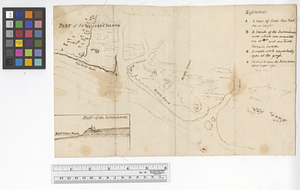
301.
Southern New York and northern New Jersey
302.
St. Eustatia topographically drawn & humbly dedicated to his excellency John Vaughan commander in chief of his majestys forces...
303.
Stony Point
304.
Sullivans Island
305.
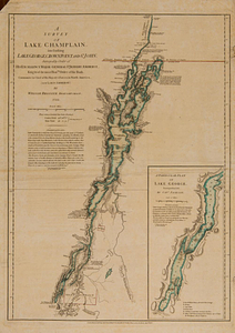
A survey of Lake Champlain, including Lake George, Crown Point and St. John : surveyed by order of his excellency Major-General...
306.
A survey of the defile and that part of York Island adjacent to Fort Knyphausen
307.
A survey of the peninsula of Charles Town shewing the three posts now garrison'd by his majesty's troops for the winter : 10th...
308.
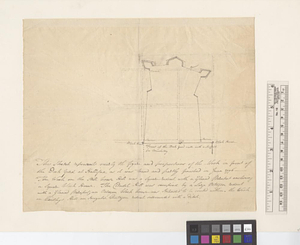
This sketch represents nearly the figure and proportions of the work in front of the dock yard at Hallifax as it was traced and...
309.
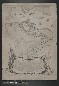
To his e[xcellency] G. Washington commander in chief of the armies of the United States of America this plan of the investment...
310.
To his excellency General Washington, commander in chief of the armies of the United States of America : this plan of the...
311.
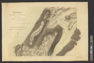
A topographical chart of the bay of Narraganset in the province of New England, with all the isles contained therein, among...
312.
The United States of America laid down from the best authorities, agreeable to the peace of 1783
313.
Valley of the Hudson River from Fishkill to Teller's Point
314.
Verplanks
315.
Verplanks Point
316.
View from the blockhouse : Dorchester Neck
317.
View of Dorchester Neck from Enoch Brown's
318.
View of Dorchester Neck, from the mess house on Fort Hill
319.
View of Dorchester Neck, from the mess house on Fort Hill
320.
A view of the Great Bridge near Norfolk in Virginia where the action happened between a detachment of the 14th Regt: & a body...
‹ Prev
Next ›
1
2
…
12
13
14
15
16
17
18
19
20
…
85
86


![To his e[xcellency] G. Washington commander in chief of the armies of the United States of America this plan of the investment of York and Goucester [sic] has been surveyed and laid down, and is most humbly dedicated](https://bpldcassets.blob.core.windows.net/derivatives/metadata/commonwealth-oai:9g552g940/image_thumbnail_300.jpg)