Toggle navigation
LMEC Home
Exhibitions
Georeferencing
Tools for Teachers
Collections
My Favorites
Sign Up / Log In
Search
Search the map portal
Map Collection
Map Collection
Map Sets
Search
Search
Search for
Search In
All Fields
Creator
Title
Subject
Place
Search All Digital Collections
Advanced Search
305 Results
My Search
Start Over
More Like
commonwealth:z603vs53w
Remove constraint More Like: commonwealth:z603vs53w
Filter your Search
Place
North and Central America
238
United States
169
New York
31
Suffolk (county)
31
Boston
29
Canada
27
North America
27
York (county)
18
more
Place
»
Topic
Yorktown (Va.)--History--Siege, 1781--Maps--Early works to 1800
19
North America--Maps--Early works to 1800
18
Boston (Mass.)--History--Revolution, 1775-1783--Maps--Early works to 1800
16
United States--Maps--Early works to 1800
10
Vues d'optique
10
Gibraltar--History--Siege, 1779-1783--Maps--Early works to 1800
9
New York (N.Y.)--Pictorial works--Early works to 1800
9
United States--History--French and Indian War, 1754-1763--Maps--Early works to 1800
9
more
Topic
»
Date
Date range begin
–
Date range end
Current results range from
1740
to
1799
View distribution
Creator
Faden, William, 1749-1836
35
Jefferys, Thomas, -1771
29
Le Rouge, Georges-Louis
23
Des Barres, Joseph F. W. (Joseph Frederick Wallet), 1722-1824
22
Sayer, Robert, 1725-1794
19
Korn, Christoph Heinrich, 1726-1783
11
Raspe, Gabriel Nicolaus, 1712-1785
11
Simcoe, John Graves, 1752-1806
10
more
Creator
»
Format
Maps/Atlases
262
Prints
32
Manuscripts
27
Drawings/Illustrations
9
Books
2
Georeferenced
Yes
11
No
294
Collection
American Revolutionary War-Era Maps
304
Richard H. Brown Revolutionary War Map Collection at Mount Vernon
293
Boston and New England Maps
4
Harvard Map Collection
4
Library of Congress Collection
4
Maritime Charts and Atlases
2
New-York Historical Society Collection
2
Urban Maps
2
more
Collection
»
Available to use
Creative Commons license
302
No known restrictions
3
Search Constraints
Sort by relevance
relevance
title
date (asc)
date (desc)
Number of results to display per page
50 per page
10
per page
20
per page
50
per page
100
per page
View results as:
grid view
map view
Search Results
1.
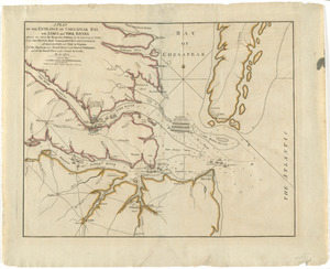
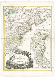
A plan of the entrance of Chesapeak Bay, with James and York rivers : wherein are shewn the respective positions (in the...
2.
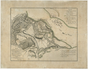
Plan de l'armée de Cornwallis attaquée et faitte prisoniere dans York Town : le 19 8bre par l'armée combinée Francaise et...
3.
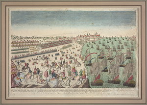
Reddition de l'armée Angloises commandée par Mylord Comte de Cornwallis aux armees combinées des Etats Unis de l'Amerique et...
4.
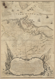
To His Excellency Genl. Washington, Commander in Chief of the armies of the United States of America : this plan of the...
5.
Carte du theatre de la guerre presente en Amerique
6.
Carte generale des colonies angloises dans l'Amerique Septentrionale pour l'intelligence de la guerre presente : d'apres des...
7.
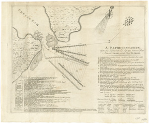
A representation, of the sea fight, on the 5th of Sepr. 1781, between Rear Admiral Graves and the Count de Grasse
8.
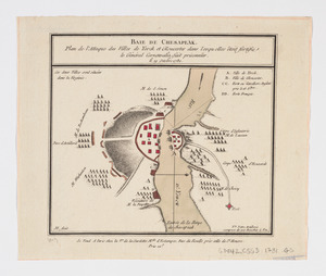
Baie de Chesapeak : plan de l'attaque des villes de Yorck et Gloucester dans lesquelles êtoit fortifie le Général Cornwalia,...
9.
Carte generale des colonies angloises dans l'Amerique Septentrionale pour l'intelligence de la guerre presente : d'apres des...
10.
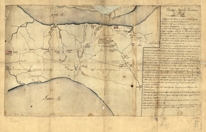
Notes sur les environs de York
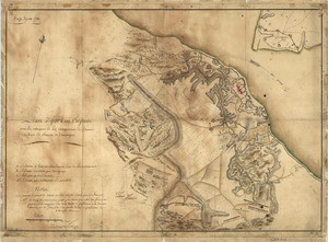
11.
Notes sur les environs de York: Plan donné par des arpenteurs du pays
12.
Plan des ouvrages faits à York-town en Virginie
13.
A plan of the entrance of Chesapeak Bay, with James and York Rivers : wherein are shown the respective positions (in the...
14.
A plan of the entrance of Chesapeak Bay, with James and York rivers : wherein are shewn the respective positions (in the...
15.
A plan of the posts of York and Gloucester in the province of Virginia, established by His Majesty's army under the command of...
16.
Plan of the siege of York Town in Virginia
17.
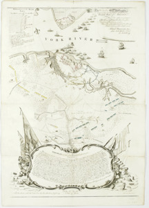
Siege d'York, 1781 : Plan d'York en Virginie avec les attaques et les campemens de l'Armée combinée de France et d'Amérique
18.
To His Excellency Genl. Washington, Commander in Chief of the armies of the United States of America : this plan of the...
19.
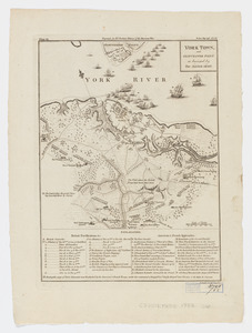
York Town, and Gloucester Point : as besieged by the Allied Army
20.
[A map of part of Pennsylvania & Maryland intended to shew, at one view, the several places proposed for opening a...
21.
Abriss der stadt Gibraltar und der darinn befindlichen festen platze, nebst dem meerbusen von Algesiras
22.
An accurate map of His Majesty's province of New-Hampshire in New England : taken from actual surveys of all the inhabited...
23.
An accurate map of Staten Island : with that part of New York, Long Island and the Jerseys, which is the rendesvous of the two...
24.
An accurate map of the country round Boston in New England from the best authorities
25.
Action at Spencer's ordinary : June 26th. 1781
26.
Affair at Quintin's Bridge : 18th March 1778
27.
Allgemeine charte von Nord America als den sitz des krieges zwischen den Konigl. Engl. truppen u:den provinzialen
28.
Ambuscade of the Indians at Kingsbridge : August 31st. 1778
29.
L'Amerique divisée en septentrionale et méridionale, subdivisée en ses principales parties, dressée sur les relations les...
30.
L'Amerique divisée en ses principaux États
31.
L'Amerique Septentrionale
32.
Amérique septentrionale avec les routes, distances en miles, limites et etablissements françois et anglois
33.
Amerique Septentrionale divisée en ses principales parties, ou sont distingués les vns des autres les estats suivant qu'il...
34.
Amérique Septentrionale dressée sur les relations les plus modernes des voyageurs et navigateurs, ou se remarquent les Etats...
35.
L'Amerique Septentrionale, ou se remarquent les Etats Unis
36.
Antigue : levée par Robert Baker, Arpenteur General de l'Isle ; traduit de l'Anglais
37.
The attack and defeat of the American fleet under Benedict Arnold, by the King's fleet commanded by Capt. Thos. Pringle, upon...
38.
Attack of the rebels upon Fort Penobscot in the province of New England in which their fleet was totally destroyed and their...
39.
Attaque de l'armée des provinciaux dans Long Island du 27. Aoust 1776 : dessin de l'isle de New-York et des Etats
40.
La Barbade
41.
Barre et port de Charles-Town levé en 1776 : avec les attaques du Fort Sulivan du 28 juin 1776 par l'escadre anglaise...
42.
Battle of Brandywine in which the rebels were defeated, September the 11th. 1777, by the army under the command of General Sr....
43.
Baye de Chesapeake en 4 feuilles avec les bas fonds, passes, entrées, sondes et routes ou l'on donne les parties navigables...
44.
Baye et port de Boston
45.
Bequia ou Becouya, le plus septentrionale des Granadilles : levé en 1763
46.
[Boston Neck, with the British lines and John Hancock's house]
47.
Bowles's new and accurate map of Europe, divided into it's [sic] empires, kingdoms, states, republicks and principalities :...
48.
Bowles's new and accurate map of North America and the West Indies : exhibiting the extent and boundaries of the United States,...
49.
British camp at Trudruffrin from the 18th. to the 21st. of September 1777 : with the attack made by Major General Grey against...
50.
[Cambridge with Washington's headquarters]
‹ Prev
Next ›
1
2
3
4
5
6
7


![[A map of part of Pennsylvania & Maryland intended to shew, at one view, the several places proposed for opening a communication between the waters of the Delaware & Chesopeak Bays]](https://bpldcassets.blob.core.windows.net/derivatives/images/commonwealth:z603vt12v/image_thumbnail_300.jpg)


![[Boston Neck, with the British lines and John Hancock's house]](https://bpldcassets.blob.core.windows.net/derivatives/images/commonwealth:dz010v61c/image_thumbnail_300.jpg)
![Bowles's new and accurate map of Europe, divided into it's [sic] empires, kingdoms, states, republicks and principalities](https://bpldcassets.blob.core.windows.net/derivatives/images/commonwealth:q524mt678/image_thumbnail_300.jpg)

![[Cambridge with Washington's headquarters]](https://bpldcassets.blob.core.windows.net/derivatives/images/commonwealth:dz010v63x/image_thumbnail_300.jpg)