Toggle navigation
LMEC Home
Exhibitions
Georeferencing
Tools for Teachers
Collections
My Favorites
Sign Up / Log In
Search
Search the map portal
Map Collection
Map Collection
Map Sets
Search
Search
Search for
Search In
All Fields
Creator
Title
Subject
Place
Search All Digital Collections
Advanced Search
142 Results
My Search
Start Over
More Like
commonwealth:z603vr10w
Remove constraint More Like: commonwealth:z603vr10w
Filter your Search
Place
North and Central America
96
North America
36
Middle Atlantic
35
United States
35
Virginia
31
New England
21
Maryland
17
New Jersey
12
more
Place
»
Topic
Middle Atlantic States--Maps--Early works to 1800
36
Virginia--Maps--Early works to 1800
32
North America--Maps--Early works to 1800
30
New England--Maps--Early works to 1800
21
Maryland--Maps--Early works to 1800
19
United States--Maps--Early works to 1800
15
Pennsylvania--Maps--Early works to 1800
13
Northeastern States--Maps--Early works to 1800
12
more
Topic
»
Date
Date range begin
–
Date range end
Current results range from
1590
to
1899
View distribution
Creator
Jefferys, Thomas, -1771
7
Kitchin, Thomas, 1718-1784
7
Lodge, John, -1796
6
Sayer, Robert, 1725-1794
6
Gibson, J. (John), active 1750-1792
5
Hinton, John, -1781
5
Russell, John, active 1733-1795
5
Anville, Jean Baptiste Bourguignon d', 1697-1782
4
more
Creator
»
Format
Maps/Atlases
142
Manuscripts
2
Georeferenced
Yes
9
No
133
Collection
American Revolutionary War-Era Maps
109
New York Public Library Collection
78
Norman B. Leventhal Map Center Collection
42
Mapping Boston Collection
8
Richard H. Brown Revolutionary War Map Collection at Mount Vernon
7
Sidney R. Knafel Map Collection at Phillips Academy
6
Maritime Charts and Atlases
5
Massachusetts Historical Society Map Collection
3
more
Collection
»
Available to use
Creative Commons license
100
No known restrictions
36
Search Constraints
Sort by relevance
relevance
title
date (asc)
date (desc)
Number of results to display per page
50 per page
10
per page
20
per page
50
per page
100
per page
View results as:
grid view
map view
Search Results
1.
A map of the most inhabited part of Virginia containing the whole province of Maryland with part of Pensilvania, New Jersey and...
2.
A map of the most inhabited part of Virginia containing the whole province of Maryland with part of Pensilvania, New Jersey and...
3.
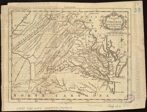
A New and accurate map of Virginia : and part of Maryland and Pennsylvania
4.
Carte de la Virginie, du Maryland et de l'etat de Delaware
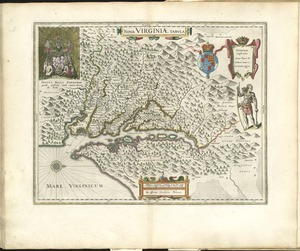
5.
Carte de la Virginie et du Maryland
6.
A draught of Virginia from the Capes to York in York River and to Kuiquotan or Hamton in James River
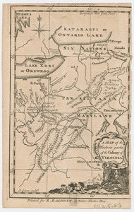
7.
A map of the country between Will's Creek & Monongahela River shewing the rout and encampments of the English army in 1755
8.
A map of the country between Will's Creek & Monongahela River shewing the rout and encampments of the English army in 1755
9.
A map of Virginia and Maryland
10.
A new map of Virginia, Mary-land and the improved parts of Penn-sylvania & New Jersey
11.
Nova Virginiae tabula
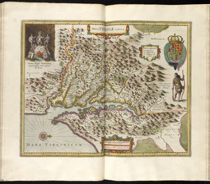
12.
Nova Virginiae tabula
13.
Virginia and Maryland
14.
Virginia Marylandia et Carolina in America septentrionali Brittannorum industria excultæ
15.
Virginia, Maryland, Pennsilvania, east & west New Jarsey
16.
A map of the seat of war in the southern part of Virginia, North Carolina, and the northern part of South Carolina
17.
An exact map of New England, New York, Pensylvania & New Jersey, from the latest surveys
18.
An exact map of New Jersey, Pensylvania [sic], New York, Maryland & Virginia, from the latest surveys
19.
La Pensilvania, la Nuova York, il Jersey Settentrio[na]le : con la parte occidentale del Connecticut, Massachusset-s-bay e...
20.
[A map of part of Pennsylvania & Maryland intended to shew, at one view, the several places proposed for opening a...
21.
A map of Maryland with the Delaware counties and the southern part of New Jersey &c
22.
A New map of the province of Maryland in North America
23.
PLAN OF THE PENINSULA OF CHESOPEAK BAY
24.
The states of Maryland and Delaware, from the latest surveys
25.
Americæ pars, nunc Virginia dicta, primum ab Anglis inuenta, sumtibus Dn. Walteri Raleigh, equestris ordinis Viri, Anno Dn̄i....
26.
Carte des environs du Fort Pitt et de la nouvelle province Indiana : dediée a M. Franklin
27.
Map of the western parts of the colony of Virginia
28.
Map of the western parts of the colony of Virginia, as far as the Mississipi
29.
MAP of the Western parts of the COLONY of VIRGINIA, as far as the Mississipi
30.
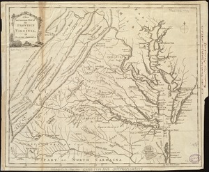
A new and accurate map of the province of Virginia in North America
31.
A new map of Virginia from the best authorities
32.
Noua Anglia, Nouum Belgium, et Virginia
33.
A plan of the entrance of Chesapeak Bay, with James and York Rivers : wherein are shown the respective positions (in the...
34.
To His Excellency Genl. Washington, Commander in Chief of the armies of the United States of America : this plan of the...
35.
Virginia
36.
Virginia et Nova Francia
37.
Virginiae item et Floridae Americae provincarum, nova descriptio
38.
Virginiae item et Floridae Americae provinciarum, nova descriptio
39.
Virginiae partis australis et Floridae partis orientalis, interjacentium[que] regionum nova descriptio
40.
Virginiae partis australis, et Floridae partis orientalis, interjacentiumq[ue] regionum nova descriptio
41.
Belgii Novi, Angliae Novae, et partis Virginiae : novissima delineatio
42.
Carta particolare della costa di Florida è di Virginia
43.
Carte de la Nouvelle Angleterre, New York, Pensilvanie et Nouveau Jersay suivant les cartes angloises
44.
Carte de la Nouvelle Angleterre, Nouvelle Yorck, et Pensilvanie : pour servir à l'Histoire générale des voyages
45.
Carte de la Nouvelle Angleterre, Nouvelle York, Nouvelle Jersey et Pensilvanie
46.
Carte réduite du nord des Etat-Unis avec l'intérieur du pays : pour servir à l'intelligence de cette histoire ; copieé par...
47.
A chart of the sea coast of New Foundland, New Scotland, New England, New York, New Jersey, with Virginia and Maryland
48.
Karte von Neu England, Neu Yorck und Pensilvanien
49.
A map exhibiting a general view of the roads and inland navigation of Pennsylvania, and part of the adjacent states :...
50.
Map no. I
‹ Prev
Next ›
1
2
3


![An exact map of New Jersey, Pensylvania [sic], New York, Maryland & Virginia, from the latest surveys](https://bpldcassets.blob.core.windows.net/derivatives/images/commonwealth:z603vp67m/image_thumbnail_300.jpg)
![La Pensilvania, la Nuova York, il Jersey Settentrio[na]le](https://bpldcassets.blob.core.windows.net/derivatives/images/commonwealth:z603vq53g/image_thumbnail_300.jpg)
![[A map of part of Pennsylvania & Maryland intended to shew, at one view, the several places proposed for opening a communication between the waters of the Delaware & Chesopeak Bays]](https://bpldcassets.blob.core.windows.net/derivatives/images/commonwealth:z603vt12v/image_thumbnail_300.jpg)


![Virginiae partis australis et Floridae partis orientalis, interjacentium[que] regionum nova descriptio](https://bpldcassets.blob.core.windows.net/derivatives/images/commonwealth:6t053p120/image_thumbnail_300.jpg)
![Virginiae partis australis, et Floridae partis orientalis, interjacentiumq[ue] regionum nova descriptio](https://bpldcassets.blob.core.windows.net/derivatives/images/commonwealth:st74cw930/image_thumbnail_300.jpg)


