Toggle navigation
LMEC Home
Exhibitions
Georeferencing
Tools for Teachers
Collections
My Favorites
Sign Up / Log In
Search
Search the map portal
Map Collection
Map Collection
Map Sets
Search
Search
Search for
Search In
All Fields
Creator
Title
Subject
Place
Search All Digital Collections
Advanced Search
125 Results
My Search
Start Over
More Like
commonwealth:z603vq72p
Remove constraint More Like: commonwealth:z603vq72p
Filter your Search
Place
United States
61
North and Central America
52
North America
46
Canada
15
New Jersey
8
Northeastern United States
7
Middle Atlantic
6
Mississippi River
5
more
Place
»
Topic
United States--Maps--Early works to 1800
60
North America--Maps--Early works to 1800
38
Canada--Maps--Early works to 1800
13
Great Britain--Colonies--America--Maps--Early works to 1800
12
New Jersey--Maps--Early works to 1800
7
North America--Maps
7
Northeastern States--Maps--Early works to 1800
7
British--America--Maps--Early works to 1800
5
more
Topic
»
Date
Date range begin
–
Date range end
Current results range from
1707
to
1899
View distribution
Creator
Kitchin, Thomas, 1718-1784
9
Faden, William, 1749-1836
6
Jefferys, Thomas, -1771
6
Lodge, John, -1796
6
Gibson, J. (John), active 1750-1792
5
Hinton, John, -1781
5
Russell, John, active 1733-1795
5
Anville, Jean Baptiste Bourguignon d', 1697-1782
4
more
Creator
»
Format
Maps/Atlases
125
Georeferenced
Yes
9
No
116
Collection
American Revolutionary War-Era Maps
115
New York Public Library Collection
78
Norman B. Leventhal Map Center Collection
29
Richard H. Brown Revolutionary War Map Collection at Mount Vernon
9
New-York Historical Society Collection
4
British Library Collection
2
Mapping Boston Collection
2
Boston Athenaeum, Cartographic Collection
1
more
Collection
»
Available to use
Creative Commons license
92
No known restrictions
31
Search Constraints
Sort by relevance
relevance
title
date (asc)
date (desc)
Number of results to display per page
20 per page
10
per page
20
per page
50
per page
100
per page
View results as:
grid view
map view
Search Results
1.
The United States of North America : with the British & Spanish territories according to the treaty
2.
The United States of North America, with the British & Spanish territories according to the treaty
3.
An accurate map of the United States of America : according to the Treaty of Peace of 1783
4.
Carte du theatre de la guerre presente en Amerique
5.
Carte du theatre de la guerre presente en Amerique
6.
Carte generale des colonies angloises dans l'Amerique Septentrionale pour l'intelligence de la guerre presente : d'apres des...
7.
Carte générale des Etats Unis de l'Amérique Septentrionale : renfermant aussi quelques provinces Angloises adjacentes
8.
Carte génerale des Etats-Unis de l'Amérique Septentrionale : divisée en ses 17 provinces
9.
A map of the United States of America, as settled by the peace of 1783
10.
A map of the United States of North America : drawn from a number of critical researches
11.
A new and correct map of North America : in which the places of the principal engagements during the present war are accurately...
12.
A new and correct map of North America : in which the places of the principal engagements during the present war are accurately...
13.
A new and correct map of North America with the West India Islands : divided according to the last treaty of peace, concluded...
14.
A New map of North America with the West India Islands : divided according to the preliminary articles of peace, signed at...
15.
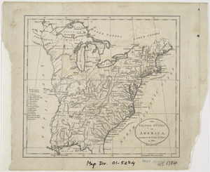
The United States of America, according to the Treaty of Peace of 1784
16.
A MAP of the BRITISH COLONIES in North America : WITH THE Roads, Distances, Limits, and Extent of the SETTLEMENTS, Humbly...
17.
An accurate map of the English colonies in North America, bordering on the river Ohio
18.
An accurate map of the United States of America, with part of the surrounding provinces agreeable to the Treaty of Peace of 1783
19.
L'Amerique Septentrionale, ou se remarquent les Etats Unis
20.
Amplissimae regionis Mississipi seu provinciae Ludovicianae â R.P. Ludovico Hennepin Francisc. Miss. in America septentrionali...
‹ Prev
Next ›
1
2
3
4
5
6
7