Toggle navigation
LMEC Home
Exhibitions
Georeferencing
Tools for Teachers
Collections
My Favorites
Sign Up / Log In
Search
Search the map portal
Map Collection
Map Collection
Map Sets
Search
Search
Search for
Search In
All Fields
Creator
Title
Subject
Place
Search All Digital Collections
Advanced Search
148 Results
My Search
Start Over
More Like
commonwealth:z603vp66b
Remove constraint More Like: commonwealth:z603vp66b
Filter your Search
Place
North and Central America
102
United States
40
Middle Atlantic
35
North America
35
New Jersey
30
New England
21
Pennsylvania
20
Northeastern United States
14
more
Place
»
Topic
Middle Atlantic States--Maps--Early works to 1800
36
New Jersey--Maps--Early works to 1800
30
North America--Maps--Early works to 1800
28
Pennsylvania--Maps--Early works to 1800
26
New England--Maps--Early works to 1800
21
Northeastern States--Maps--Early works to 1800
16
United States--Maps--Early works to 1800
15
Virginia--Maps--Early works to 1800
10
more
Topic
»
Date
Date range begin
–
Date range end
Current results range from
1630
to
1899
View distribution
Creator
Jefferys, Thomas, -1771
10
Sayer, Robert, 1725-1794
10
Kitchin, Thomas, 1718-1784
8
Faden, William, 1749-1836
7
Gibson, J. (John), active 1750-1792
5
Hinton, John, -1781
5
Lodge, John, -1796
5
Russell, John, active 1733-1795
5
more
Creator
»
Format
Maps/Atlases
148
Manuscripts
4
Georeferenced
Yes
14
No
134
Collection
American Revolutionary War-Era Maps
126
New York Public Library Collection
84
Norman B. Leventhal Map Center Collection
39
Richard H. Brown Revolutionary War Map Collection at Mount Vernon
10
Mapping Boston Collection
7
Sidney R. Knafel Map Collection at Phillips Academy
7
Maritime Charts and Atlases
6
Boston Athenaeum, Cartographic Collection
2
more
Collection
»
Available to use
Creative Commons license
108
No known restrictions
32
Search Constraints
Sort by relevance
relevance
title
date (asc)
date (desc)
Number of results to display per page
20 per page
10
per page
20
per page
50
per page
100
per page
View results as:
grid view
map view
Search Results
1.
La Pensilvania, la Nuova York, il Jersey Settentrio[na]le : con la parte occidentale del Connecticut, Massachusset-s-bay e...
2.
Pensylvania Nova Jersey et Nova York cum Regionibus ad Fluvium Delaware in America sitis
3.
Seat of war in the environs of Philadeliphia
4.
Seat of war in the environs of Philadeliphia
5.
Carte de la Pensylvanie et du Nouveau Jersey
6.
New Engelland, New York, New Yersey und Pensilvania
7.
A new map of Virginia, Mary-land and the improved parts of Penn-sylvania & New Jersey
8.
A map exhibiting a general view of the roads and inland navigation of Pennsylvania, and part of the adjacent states :...
9.
Map no. I
10.
Position der Koenigl;Grosbrittanischen und derer vereinigten provinzial armée in New York und dem Jerseys in Nord America im...
11.
A New and accurate map of Virginia : and part of Maryland and Pennsylvania
12.
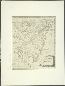
A New and accurate map of New Jersey : from the best authorities
13.
The Province of New Jersey : divided into East and West, commonly called the Jerseys
14.
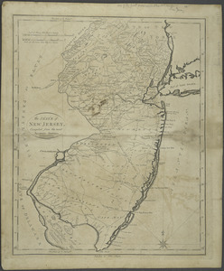
The State of New Jersey : compiled from the most accurate surveys
15.
An exact map of New England, New York, Pensylvania & New Jersey, from the latest surveys
16.
A map of the most inhabited part of Virginia containing the whole province of Maryland : with part of Pensilvania, New Jersey...
17.
[A map of part of Pennsylvania & Maryland intended to shew, at one view, the several places proposed for opening a...
18.
Carte des environs du Fort Pitt et de la nouvelle province Indiana : dediée a M. Franklin
19.
[Environs of Philadelphia]
20.
Karte von Neu England, Neu Yorck und Pensilvanien : sur Allgemeinen historie der reisen
‹ Prev
Next ›
1
2
3
4
5
…
7
8
![La Pensilvania, la Nuova York, il Jersey Settentrio[na]le](https://bpldcassets.blob.core.windows.net/derivatives/images/commonwealth:z603vq53g/image_thumbnail_300.jpg)


![[A map of part of Pennsylvania & Maryland intended to shew, at one view, the several places proposed for opening a communication between the waters of the Delaware & Chesopeak Bays]](https://bpldcassets.blob.core.windows.net/derivatives/images/commonwealth:z603vt12v/image_thumbnail_300.jpg)

![[Environs of Philadelphia]](https://bpldcassets.blob.core.windows.net/derivatives/images/commonwealth:7h149x76d/image_thumbnail_300.jpg)
