Toggle navigation
LMEC Home
Exhibitions
Georeferencing
Tools for Teachers
Collections
My Favorites
Sign Up / Log In
Search
Search the map portal
Map Collection
Map Collection
Map Sets
Search
Search
Search for
Search In
All Fields
Creator
Title
Subject
Place
Search All Digital Collections
Advanced Search
61 Results
My Search
Start Over
More Like
commonwealth:z603vn906
Remove constraint More Like: commonwealth:z603vn906
Filter your Search
Place
South America
51
Mesoamerica
50
North America
50
America
46
North and Central America
46
Americas
4
World
2
Topic
Western Hemisphere--Maps--Early works to 1800
58
America--Maps--Early works to 1800
52
America--Discovery and exploration--Maps--Early works to 1800
2
Central America--Maps--Early works to 1800
2
North America--Maps--Early works to 1800
2
South America--Maps--Early works to 1800
2
World maps--Early works to 1800
2
1739
1
more
Topic
»
Date
Date range begin
–
Date range end
Current results range from
1542
to
1794
View distribution
Creator
Danckerts, Justus, 1635-1701
3
L'Isle, Guillaume de, 1675-1726
3
Ortelius, Abraham, 1527-1598
3
Aa, Pieter van der, 1659-1733
2
Allard, Huych, 1625-1691
2
Bry, Theodor de, 1528-1598
2
Crépy (Firm)
2
La Condamine, Charles-Marie de, 1701-1774
2
more
Creator
»
Format
Maps/Atlases
61
Georeferenced
Yes
2
No
59
Collection
Norman B. Leventhal Map Center Collection
51
American Revolutionary War-Era Maps
8
Sidney R. Knafel Map Collection at Phillips Academy
6
New York Public Library Collection
3
Mapping Boston Collection
2
Richard H. Brown Revolutionary War Map Collection at Mount Vernon
1
Available to use
No known restrictions
49
Creative Commons license
6
Search Constraints
Sort by date (desc)
relevance
title
date (asc)
date (desc)
Number of results to display per page
20 per page
10
per page
20
per page
50
per page
100
per page
View results as:
grid view
map view
Search Results
1.
A map of the world on a globular projection : exhibiting particularly the nautical researches of Captain James Cook, F.R.S. :...
2.
Amérique ou Indes Occidentales, avec les nouvelles découvertes du Capit'e Cook, depuis le Détroit de Behrings ou du Nord,...
3.
L'Amerique divisée en ses principaux États
4.
A new map of the whole continent of America, divided into North and South and West Indies : wherein are exactly described the...
5.
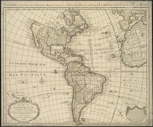
L'Amerique : suivant le R.P. Charlevoix Jte., Mr. de la Condamine, et plusieurs autres nouvle. observations
6.
Chart of the track of the Dolphin, Tamar, Swallow & Endeavour through the South Seas ; & of the track of M. Bougainville round...
7.
A new projection of the Western Hemisphere of the Earth on a plane : shewing the proportions of its several parts nearly as on...
8.
Carte d'Amerique divisées en ses principales parties
9.
A new general map of America
10.
America
11.
L'Amerique divisée par grand etats
12.
L'Amerique : divisée en ses principaux etats, assujetie aux observations astronomiqes
13.
The Earth's Western planisphere
14.
Nieuwe kaart van het westelykste deel der weereld, dienende tot aanwyzing van de scheepstogten der Nederlanderen naar Westindie...
15.
Carta del nuovo continente : nella maggior sua lunghezza diametrale dal fiume della Plata fin oltre il lago degli Assiniboils
16.
Americae mappa generalis : secundum legitimas projectionis stereographicae regulas relationesque recentissimas et observationes...
17.
L'Amérique suivant le R.P. Charlevoix Jte, Mr. de La Condamine et plusieurs autres nouvle. observations
18.
Nieuwe kaart van America uitgegeven te Amsterdam
19.
Les Colonies des Européens en Amerique
20.
Carte d'Amerique : dressée pour l'usage du roy
‹ Prev
Next ›
1
2
3
4