Toggle navigation
LMEC Home
Exhibitions
Georeferencing
Tools for Teachers
Collections
My Favorites
Sign Up / Log In
Search
Search the map portal
Map Collection
Map Collection
Map Sets
Search
Search
Search for
Search In
All Fields
Creator
Title
Subject
Place
Search All Digital Collections
Advanced Search
205 Results
My Search
Start Over
More Like
commonwealth:z603vn73j
Remove constraint More Like: commonwealth:z603vn73j
Filter your Search
Place
North and Central America
140
United States
71
West Indies
59
Caribbean Sea
19
Canada
14
North America
14
Florida
10
Atlantic Ocean
9
more
Place
»
Topic
Manuscript maps--Early works to 1800
138
West Indies--Maps--Early works to 1800
60
Caribbean Area--Maps--Early works to 1800
19
North America--Maps--Early works to 1800
8
Mexico, Gulf of--Maps--Early works to 1800
7
Añasco (P.R.)--Maps--Early works to 1800
6
Central America--Maps--Early works to 1800
6
Coasts--Florida--Maps--Early works to 1800
6
more
Topic
»
Date
Date range begin
–
Date range end
Current results range from
1511
to
1899
View distribution
Creator
Dumont de Montigny
14
Adlum, John, 1759-1836
9
Bingham, William, 1752-1804
9
Sayer, Robert, 1725-1794
6
Jefferys, Thomas, -1771
5
De Brahm, John Gerar William, 1717-approximately 1799
4
Green, John, -1757
4
Moll, Herman, d. 1732
4
more
Creator
»
Format
Maps/Atlases
205
Manuscripts
141
Georeferenced
Yes
15
No
190
Collection
American Revolutionary War-Era Maps
161
Library of Congress Collection
100
Norman B. Leventhal Map Center Collection
61
Newberry Library Collection
38
Maritime Charts and Atlases
32
Urban Maps
8
Boston and New England Maps
4
Richard H. Brown Revolutionary War Map Collection at Mount Vernon
4
more
Collection
»
Available to use
Creative Commons license
105
No known restrictions
61
Search Constraints
Sort by relevance
relevance
title
date (asc)
date (desc)
Number of results to display per page
20 per page
10
per page
20
per page
50
per page
100
per page
View results as:
grid view
map view
Search Results
1.
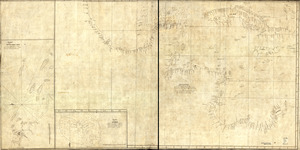
Descripcion de la costa de Tierra Firme desde el Cavo de la Agusa hasta la Barra de Palmas diga de la Trinidad : Con todas las...
2.
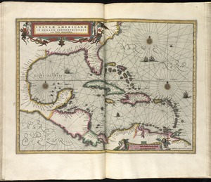
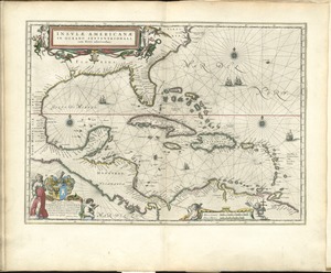
Insulae Americanae in Oceano Septentrionali cum terris adiacentibus
3.
Insulae Americanae in Oceano Septentrionali cum terris adiacentibus
4.
Pascaerte van Westindien de Vaste Kusten en de Eylanden
5.
Carte du Cap Franc̨ois de Saint Domingue, de l'isle de Cuba, de la Jamaique avec le canal de Bahama, l'entrée du fleuve St....
6.
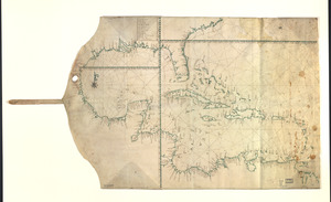
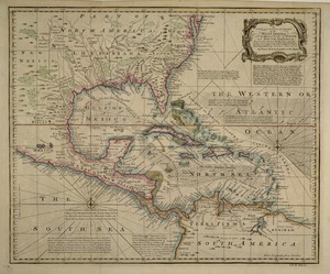
Map showing Caribbean area including West Indies and Gulf of Mexico
7.
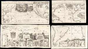
Carte de la Mer du Sud et des costes d'Amerique et d'Asie situées sur cette mer : Carte de la Mer du Nord et des costes...
8.
Carte des isles Antilles et du Golfe du Mexique : avec la majeure partie de la nouvelle Espagne
9.
Carte du Golphe du Mexique et des isles Antilles : reduite de la grande carte angloise de Popple
10.
Culiacanae, Americae regionis, descriptio : Hispaniolae, Cubae, aliarumque insularum circumiacientium, delineatio
11.
Grand theatre de la guerre en Amerique suivant les plus nouvelles observations des Espagnols, Anglois, François & Hollandois
12.
Insulae Americanae in Oceano Septentrionali, cum terris adiacentibus
13.
A map of the West-Indies &c. Mexico or New Spain : also ye trade winds, and ye several tracts made by ye galeons and flota from...
14.
A map of the West-Indies or the islands of America in the North Sea : with ye adjacent countries; explaning [sic] what belongs...
15.
A map of the West-Indies or the islands of America in the North Sea : with ye adjacent countries; explaning [sic] what belongs...
16.
A new & accurate map of the West Indies and the adjacent parts of North & South America
17.
A new and accurate chart of the West Indies : with the adjacent coasts of North and South America
18.
Pascaarte vande vaste cust en eylanden van Westindien, als mede de Virginis en Nieu-Nederland, van C. Droge tot C. Cod
19.
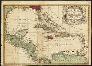
The West Indies exhibiting the English, French, Spanish, Dutch & Danish settlements
20.
Ysla de Cuba
‹ Prev
Next ›
1
2
3
4
5
…
10
11