Toggle navigation
LMEC Home
Exhibitions
Georeferencing
Tools for Teachers
Collections
My Favorites
Sign Up / Log In
Search
Search the map portal
Map Collection
Map Collection
Map Sets
Search
Search
Search for
Search In
All Fields
Creator
Title
Subject
Place
Search All Digital Collections
Advanced Search
160 Results
My Search
Start Over
More Like
commonwealth:z603vn03v
Remove constraint More Like: commonwealth:z603vn03v
Filter your Search
Place
North and Central America
135
United States
75
Rhode Island
17
Canada
13
Connecticut
10
Massachusetts
10
San Juan
8
Florida
7
more
Place
»
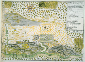
Topic
Manuscript maps--Early works to 1800
138
Rhode Island--Maps--Early works to 1800
14
Connecticut--Maps--Early works to 1800
10
Massachusetts--Maps--Early works to 1800
10
Añasco (P.R.)--Maps--Early works to 1800
6
Coasts--Florida--Maps--Early works to 1800
6
Coasts--Puerto Rico--Añasco--Maps--Early works to 1800
6
Coasts--Puerto Rico--Mayagüez--Maps--Early works to 1800
6
more
Topic
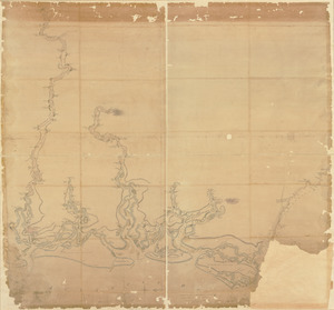
»
Date
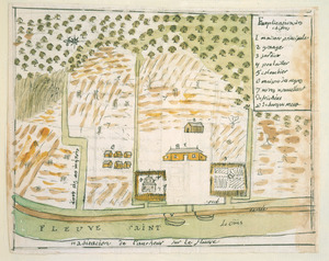
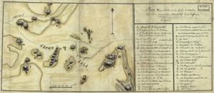
Date range begin
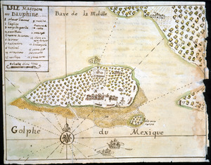
–
Date range end
Current results range from
1700
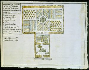
to
1909
View distribution
Creator
Dumont de Montigny
14
Adlum, John, 1759-1836
9
Bingham, William, 1752-1804
9
Des Barres, Joseph F. W. (Joseph Frederick Wallet), 1722-1824
7
De Brahm, John Gerar William, 1717-approximately 1799
4
Real Escuela de Navegación (Cádiz, Spain)
4
Bew, John, -1793
2
Dampierre, chevalier de, fl. 1756
2
more
Creator
»
Format
Maps/Atlases
160
Manuscripts
140
Georeferenced
Yes
3
No
157
Collection
American Revolutionary War-Era Maps
154
Library of Congress Collection
97
Newberry Library Collection
39
Maritime Charts and Atlases
24
Norman B. Leventhal Map Center Collection
18
Boston and New England Maps
12
Urban Maps
8
Sidney R. Knafel Map Collection at Phillips Academy
4
more
Collection
»
Available to use
Creative Commons license
99
No known restrictions
18
Search Constraints
Sort by relevance
relevance
title
date (asc)
date (desc)
Number of results to display per page
100 per page
10
per page
20
per page
50
per page
100
per page
View results as:
grid view
map view
Search Results
1.
1. Prise de Newport par d'Estaing, 1778 : 2. Embossage de Ternay à Newport, 1780
2.
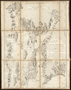
Port de Rhode Island et Narraganset Baye : publié à la requête du Vicomte Howe par le Chevalier des Barres ; traduit de...
3.
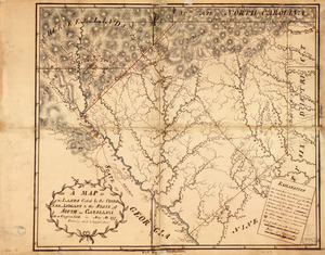
An accurate map of Rhode Island, part of Connecticut and Massachusets, shewing Admiral Arbuthnot's station in blocking up...
4.
An accurate map of Rhode Island, part of Connecticut and Massachusets, shewing Admiral Arbuthnot's station in blocking up...
5.
Combat naval à la hauteur de la Baye de Chézapeake [sic] le 5 7bre. 1781
6.
Carte du Cap Franc̨ois de Saint Domingue, de l'isle de Cuba, de la Jamaique avec le canal de Bahama, l'entrée du fleuve St....
7.
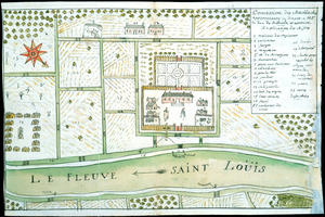
Carte du Fort Rozalie des Natches franc̦ois avec ses dependances et village des sauvages
8.
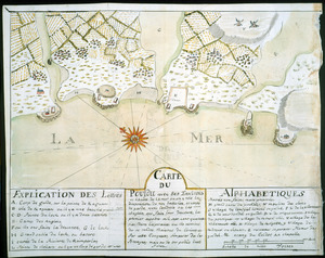
Carte du Pouldu avec ses environs et la côte de la mer : ou on y voit la disposition de nos batteries, et corps de garde, avec...
9.
Carte d'un partie de l'Amerique Septentrionale : ou est tracée notre route d'Halifax à New York, par Quebec, Montreal, le Lac...
10.
Concession des Chaoüachas appartenante cy devant a Mgr. le duc de Belleisle et associez
11.
[Continuation of Plan du detroit de Belle Isle et du Golphe St. Laurent]
12.
Copy of a map presented to the Congres [sic]
13.
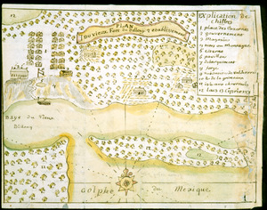
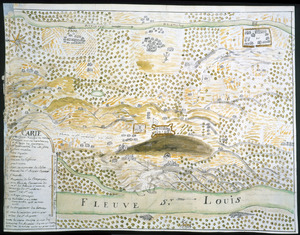
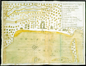
Fort St. Loüis ou Nouveau Billoxy, 3eme etablissement
14.
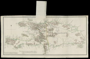
I. de St. Domingue
15.
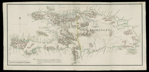
I. de St. Domingue
16.
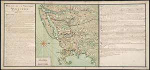
Partie de la Novvelle Angleterre contenant les villes, les bourgs, et le commerce des habitans
17.
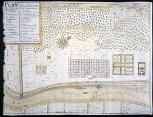
Plan de la Nlle. Orleans, ville capitalle de la Louissianne
18.
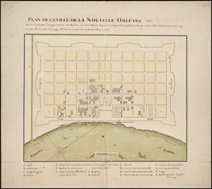
Plan de la ville de la Nouvelle Orleans : ou l'on à marqué l'augmentation des maisons qui sont baties depuis le 3. septembre...
19.
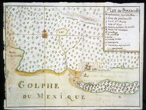
Plan de Pensacolle
20.
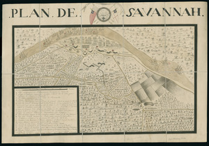
Plan de Savannah
21.
Plan du detroit de Belle Isle et du Golphe St. Laurent pour la coste du nord
22.
Plan du Fort du Sault de St. Louis et du village des sauvages Iroquois
23.
A plan of York Town and Gloucester, in the province of Virginia, shewing the works constructed for the defence of those posts...
24.
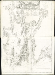
A chart of the harbour of Rhode Island and Narraganset Bay
25.
A chart of the harbour of Rhode Island and Narraganset Bay
26.
Plan de la baie de Narraganset dans la Nouvelle Angleterre : avec toutes les îles qu'elle renferme parmi lesquelles se...
27.
A plan of the town of Newport in the province of Rhode Island
28.
A plan of the town of Newport in the province of Rhode Island
29.
Maps illustrating cruises of John Paul Jones in British waters : [Great Britain and Ireland]
30.
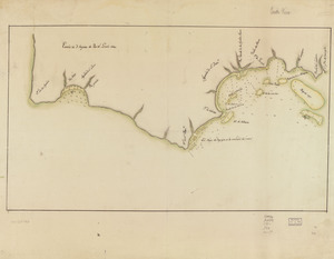
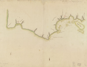
[Coast of New England from Chatham Harbor to Naragansett Bay]
31.
[Coast of New England from Chatham Harbor to Naragansett Bay]
32.
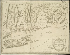
A map of the colonies of Connecticut and Rhode Island, divided into counties & townships, from the best authorities
33.
A map of the colony of Rhode Island : with the adjacent parts of Connecticut, Massachusetts Bay, &c
34.
A map of the country adjacent to the north boundary line of the colony of Rhode Island as the same was run by commissioners...
35.
A map of the province of Massachusets Bay and colony of Rhode Island, with part of Connecticut, New Hampshire, and Vermont
36.
A map of the province of Massachusets Bay and colony of Rhode Island, with part of Connecticut, New Hampshire, and Vermont
37.
A new and accurate map of Connecticut and Rhode Island, from the best authorities
38.
A new and accurate map of the colony of Massachusets Bay, in North America, from a late survey
39.
A new and accurate map of the colony of Massachusets Bay, in North America, from a late survey
40.
A new and accurate map of the present seat of war in North America : from a late survey
41.
20 tracts, Charleston
42.
Amerique Septentrionale : Acadie ou Nouvelle Ecosse aux anglois : Annapolis Royal
43.
Armstrong County
44.
Barbadoes
45.
Boston & harbour
46.
Boston Harbor, Massachusetts
47.
[Boston Harbour, with the surroundings, &c]
48.
Boston, its environs and harbour : with the rebels works raised against that town in 1775
49.
Boston, S. West part : No. 25
50.
Campement de l'armée à Tombecbe
51.
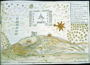
[Campement] de l'armée franc̦oise [devant u]n village des ennemis, les Chicachas le 26 [de mais] 1736
52.
Cantonment of His Majesty's forces in N. America : according to the disposition now made & to be compleated as soon as...
53.
Cantonment of the forces in North America 11th. Octr. 1765
54.
Carta esférica de la canal entre Puerto Rico y Santo Domingo
55.
Carta esférica de la Ysla de la Granada
56.
Carte angloise de la Baye de Hudson ou la compagnie apellee Hudson Bay fait son commerce : tirée de la liasse des concecions...
57.
Carte de la coste de la Louisiane, depuis la Baye de St. Bernard jusqu'a celle de Saint Joseph : ou tous les ports, rades, et...
58.
Carte de la rivire du Cannada, la Terre Nevf, Cape Britton et la cotte de Lacadie
59.
Carte de l'entrée du port et rade de Pensacola
60.
Cawanesque
61.
Chart of the sea coast from latitude 27⁰00ʹ00ʺ to 27⁰20ʹ00ʺ, with Little Inlet & River into Hillsborough River ; Chart of the...
62.
Chart of the sea coast from lattde. 26⁰20ʹ00ʺ to 26⁰ & 40ʹ00ʺ with the head of Sharkshead River ; Chart of New Inlet ; Chart of...
63.
Copia, del mapa de las Indias Occidentales : y del manifiesto que presentò D. Thomas Southuel, à la Superioridad, en el año...
64.
Costa desde la Mobila asta la Bahía de Sn. Josef
65.
Cours de l'Ohio depuis sa source jusqu'a sa jonction avec la Riviere d'Ouabache et les pais voisons
66.
Cuba, ciudad capittal de la ysla del mismo nombre y su famoso puerto sittuado en la costa del sur de gra. ysla, los 20 grados y...
67.
Descripción ychonográfica de la ciudad, puerto y bahía de Santiago de Cuba situado en 20⁰6ʹ de latitud norte y en longd. de...
68.
Dotted line map of Washington, D.C., 1791, before Aug. 19th
69.
Draft of roads in New Jersey
70.
A draught of Lake George, and part of Hudson's River taken September 1756
71.
Fort Edward to Crown Point
72.
Habitation de l'autheur sur le fleuve
73.
Isle Massacre ou Dauphine
74.
Jefferson, Venango & Armstrong
75.
Land ownership map of the William Bingham estate in Potter County, Pennsylvania
76.
Lines run in the Jersies for determining boundaries between that Province & New York
77.
Logement de l'autheur a la Nlle. Orleans
78.
Manuscript survey of a property in Kittery, Maine
79.
Map of part of the city of Washington shewing the situation of the mansion house, grave yard & buildings belonging to Mr....
80.
A map of Potomack and James rivers in North America shewing their several communications with the navigable waters of the new...
81.
Map of the coast of Georgia, bordering on Camden and Glynn counties : showing also the course and soundings of the Alatamaha,...
82.
Map of the country between and bordering the Delaware River and Chesapeake Bay : showing roads to Philadelphia and localities
83.
A Map of the lands ceded by the Cherokee Indians to the State of South-Carolina : at a congress held in May, A.D. 1777;...
84.
Map showing coast in the regions of Aguadilla, Añasco, and Mayagüez
85.
Map showing coast in the regions of Aguadilla, Añasco, and Mayagüez
86.
A map with part of the Florida coast from Cape Blaise to Apalachie : with the boundaries betwixt East & West Floridas, 160...
87.
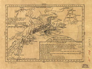
Mapa de una parte de la America Septentrional
88.
New Hampshire
89.
Nuevo plano de Puerto Rico
90.
Pansacola o Santta María de Galbe, puerto y presidio del Ry. de España situado en la costa del nortte del Seno Mexicano, los...
91.
Part of New Jersey
92.
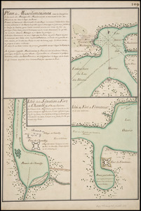
Plan de Missilimakinak avec la description de la route du Missisipi ; Idée de la situation du fort de Chambly, et des ses...
93.
Plan du Fort des Yachoux, concession de Mgr. le duc de Belle Isle et associez, detruit 1729
94.
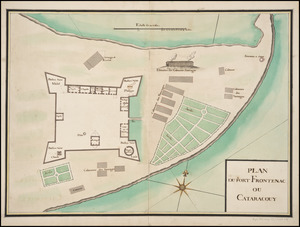
Plan du Fort Frontenac ou Cataracouy
95.
Plan du port et de la ville de Louisbourg : avec ses batteries et sa perspective, où est réprésenté les batteries faites...
96.
Plan du vieux Fort du Billoxi, 2 etablissement
97.
Plan d'une partie de la rade de Boston pour faire connaitre le dispositif de ses deffenses
98.
Plan of a rout undertaken in winter, Jany. 26th : from Quebec, the capital of Canada, to the frontier settlements of the...
99.
A plan of a survey made to explore the country for a road between Connecticut River & St. Francis
100.
A plan of Becket protracted by a scale of 120 rods to an inch
‹ Prev
Next ›
1
2


![Combat naval à la hauteur de la Baye de Chézapeake [sic] le 5 7bre. 1781](https://bpldcassets.blob.core.windows.net/derivatives/images/commonwealth:z603vn12t/image_thumbnail_300.jpg)


![[Continuation of Plan du detroit de Belle Isle et du Golphe St. Laurent]](https://bpldcassets.blob.core.windows.net/derivatives/images/commonwealth:z603vm96n/image_thumbnail_300.jpg)
![Copy of a map presented to the Congres [sic]](https://bpldcassets.blob.core.windows.net/derivatives/images/commonwealth:z603vn16x/image_thumbnail_300.jpg)


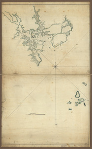
![[Coast of New England from Chatham Harbor to Naragansett Bay]](https://bpldcassets.blob.core.windows.net/derivatives/images/commonwealth:7h149x27g/image_thumbnail_300.jpg)
![[Coast of New England from Chatham Harbor to Naragansett Bay]](https://bpldcassets.blob.core.windows.net/derivatives/images/commonwealth:7h149z37x/image_thumbnail_300.jpg)


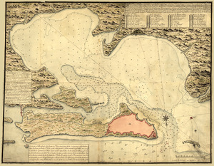
![[Boston Harbour, with the surroundings, &c]](https://bpldcassets.blob.core.windows.net/derivatives/images/commonwealth:t722hs94d/image_thumbnail_300.jpg)


![[Campement] de l'armée franc̦oise [devant u]n village des ennemis, les Chicachas le 26 [de mais] 1736](https://bpldcassets.blob.core.windows.net/derivatives/images/commonwealth:z603vn65v/image_thumbnail_300.jpg)


![Chart of the sea coast from latitude 27⁰00ʹ00ʺ to 27⁰20ʹ00ʺ, with Little Inlet & River into Hillsborough River ; Chart of the sea coast from latitude 26⁰40ʹ00ʺ to [27⁰]00ʹ00ʺ, the Leech Shoal & Hillsborough River](https://bpldcassets.blob.core.windows.net/derivatives/images/commonwealth:q524nd97p/image_thumbnail_300.jpg)