Toggle navigation
LMEC Home
Exhibitions
Georeferencing
Tools for Teachers
Collections
My Favorites
Sign Up / Log In
Search
Search the map portal
Map Collection
Map Collection
Map Sets
Search
Search
Search for
Search In
All Fields
Creator
Title
Subject
Place
Search All Digital Collections
Advanced Search
265 Results
My Search
Start Over
More Like
commonwealth:z603vm790
Remove constraint More Like: commonwealth:z603vm790
Filter your Search
Place
North and Central America
260
New England
118
United States
81
New York
75
Maine
52
New Hampshire
30
Canada
24
Massachusetts
22
more
Place
»
Topic
New England--Maps
120
New York (State)--Maps
81
Maine--Maps
50
Railroads--New England--Maps
50
New Hampshire--Maps
31
Railroads--New York (State)--Maps
21
Massachusetts--Maps
20
Vermont--Maps
15
more
Topic
»
Date
Date range begin
–
Date range end
Current results range from
1700
to
2015
View distribution
Creator
United States. Post Office Dept
12
Carleton, Osgood, 1742-1816
7
Carey, Mathew, 1760-1839
6
Holland, Samuel, 1728-1801
5
Lewis, Samuel, 1753 or 4-1822
5
Geological Survey (U.S.)
4
National Publishing Company (Boston, Mass.)
4
Norman, John, 1748?-1817
4
more
Creator
»
Format
Maps/Atlases
265
Manuscripts
6
Objects/Artifacts
1
Georeferenced
Yes
29
No
236
Collection
Norman B. Leventhal Map Center Collection
183
Boston and New England Maps
115
American Revolutionary War-Era Maps
78
William L. Clements Library Collection
33
American Antiquarian Society Collection
26
Massachusetts Historical Society Map Collection
14
David Judkins Weaver Papers
4
Sidney R. Knafel Map Collection at Phillips Academy
4
more
Collection
»
Available to use
No known restrictions
184
Creative Commons license
16
Search Constraints
Sort by relevance
relevance
title
date (asc)
date (desc)
Number of results to display per page
20 per page
10
per page
20
per page
50
per page
100
per page
View results as:
grid view
map view
Search Results
41.
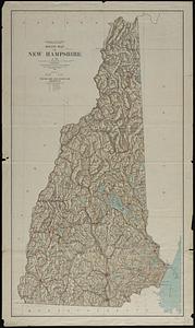
New Hampshire
42.
New Hampshire
43.
New Hampshire
44.
New-Hampshire : from late survey
45.
Post route map of the states of New Hampshire, Vermont showing post offices with the intermediate distances on mail routes in...
46.
Relief map of New Hampshire
47.
The State of New Hampshire
48.
The State of New Hampshire
49.
The state of New Hampshire : compiled chiefly from actual surveys
50.
The state of New Hampshire
51.
Tri-state trolley map showing Boston & Northern and Old Colony Street Railway Companies' systems and connecting lines
52.
An accurate map, of the District of Maine : being part of the commonwealth of Massachusetts
53.
An accurate map, of the district of Maine being part of the commonwealth of Massachusetts : compiled pursuant to an act of the...
54.
Bangor & Aroostook Railroad and connections : including northern Maine hunting and fishing region
55.
The coast from St. Johns, New Brunswick, to Goldsborough Bay, Maine
56.
The coast of Maine from modern Portland to Desert Island
57.
The district of Main from the latest surveys
58.
Fishing & hunting resorts of Maine, northern New Hampshire, and part of Canada and the provinces, Rangeley & Moosehead Lakes as...
59.
Lumberman's map of northern Maine
60.
Maine
‹ Prev
Next ›
1
2
3
4
5
6
7
…
13
14