Toggle navigation
LMEC Home
Exhibitions
Georeferencing
Tools for Teachers
Collections
My Favorites
Sign Up / Log In
Search
Search the map portal
Map Collection
Map Collection
Map Sets
Search
Search
Search for
Search In
All Fields
Creator
Title
Subject
Place
Search All Digital Collections
Advanced Search
265 Results
My Search
Start Over
More Like
commonwealth:z603vm790
Remove constraint More Like: commonwealth:z603vm790
Filter your Search
Place
North and Central America
260
New England
118
United States
81
New York
75
Maine
52
New Hampshire
30
Canada
24
Massachusetts
22
more
Place
»
Topic
New England--Maps
120
New York (State)--Maps
81
Maine--Maps
50
Railroads--New England--Maps
50
New Hampshire--Maps
31
Railroads--New York (State)--Maps
21
Massachusetts--Maps
20
Vermont--Maps
15
more
Topic
»
Date
Date range begin
–
Date range end
Current results range from
1700
to
2015
View distribution
Creator
United States. Post Office Dept
12
Carleton, Osgood, 1742-1816
7
Carey, Mathew, 1760-1839
6
Holland, Samuel, 1728-1801
5
Lewis, Samuel, 1753 or 4-1822
5
Geological Survey (U.S.)
4
National Publishing Company (Boston, Mass.)
4
Norman, John, 1748?-1817
4
more
Creator
»
Format
Maps/Atlases
265
Manuscripts
6
Objects/Artifacts
1
Georeferenced
Yes
29
No
236
Collection
Norman B. Leventhal Map Center Collection
183
Boston and New England Maps
115
American Revolutionary War-Era Maps
78
William L. Clements Library Collection
33
American Antiquarian Society Collection
26
Massachusetts Historical Society Map Collection
14
David Judkins Weaver Papers
4
Sidney R. Knafel Map Collection at Phillips Academy
4
more
Collection
»
Available to use
No known restrictions
184
Creative Commons license
16
Search Constraints
Sort by relevance
relevance
title
date (asc)
date (desc)
Number of results to display per page
20 per page
10
per page
20
per page
50
per page
100
per page
View results as:
grid view
map view
Search Results
21.
Map showing the comparative merits, and benefits to Massachusetts, of the proposed extension of the New York and Massachusetts...
22.
A new and accurate map of the present seat of war in North America
23.
New England and New York in 1697
24.
Post route map of the states of New Hampshire, Vermont, Massachusetts, Rhode Island, Connecticut, and parts of New York and Maine
25.
Rail road map of New England & eastern New York
26.
Rail road map of New England & eastern New York
27.
Rand McNally official 1920 auto trails map : District number 6 : New England, eastern New York
28.
Sherman & Smith's rail road, steam boat & stage route map of New England, New-York, and Canada
29.
Williams' telegraph and rail road map of the New England states, eastern protion of New York state and Canada : compiled from...
30.
Penobscot Bay
31.
Colton's New Hampshire
32.
Colton's New Hampshire
33.
Hammond's new road map of eastern Massachusetts and southern New Hampshire
34.
Manuscript maps of U.S. states
35.
A map of 100 miles round Boston
36.
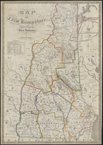
Map of New Hampshire : compiled from the latest authorities
37.
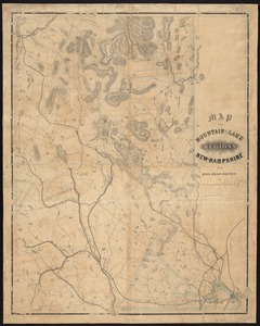
Map of the mountain and lake regions of New-Hampshire with rail-road routes
38.
A map of the states of New Hampshire and Vermont
39.
Map showing the proposed line of the Manchester Rail Road as petitioned for by S.D. Bell & others
40.
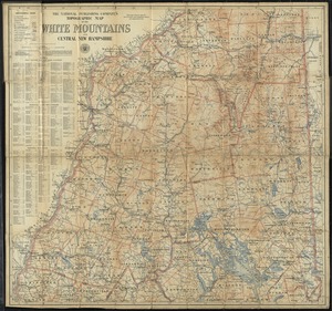
The National Publishing Company's topographic map of the White Mountains and central New Hampshire
‹ Prev
Next ›
1
2
3
4
5
6
…
13
14