Toggle navigation
LMEC Home
Exhibitions
Georeferencing
Tools for Teachers
Collections
My Favorites
Sign Up / Log In
Search
Search the map portal
Map Collection
Map Collection
Map Sets
Search
Search
Search for
Search In
All Fields
Creator
Title
Subject
Place
Search All Digital Collections
Advanced Search
249 Results
My Search
Start Over
More Like
commonwealth:z603vm77f
Remove constraint More Like: commonwealth:z603vm77f
Filter your Search
Place
North and Central America
245
Massachusetts
234
United States
227
Suffolk (county)
44
Boston
43
Rhode Island
31
Connecticut
19
New England
12
more
Place
»
Topic
Massachusetts--Maps
235
Boston (Mass.)--Maps
46
Rhode Island--Maps
32
Railroads--Massachusetts--Maps
31
Connecticut--Maps
20
Roads--Massachusetts--Maps
19
New England--Maps
14
Coasts--Massachusetts--Maps
10
more
Topic
»
Date
Date range begin
–
Date range end
Current results range from
1746
to
2020
View distribution
Creator
MassGIS (Office : Mass.)
20
Geo. H. Walker & Co
15
Massachusetts. Executive Office of Environmental Affairs
14
Boston Public Library. Norman B. Leventhal Map and Education Center
9
Applied Geographics, Inc.
7
Carleton, Osgood, 1742-1816
7
Geological Survey (U.S.)
7
Geo. H. Walker & Co.
6
more
Creator
»
Format
Maps/Atlases
247
Manuscripts
3
Ephemera
1
Prints
1
Georeferenced
Yes
64
No
185
Collection
Norman B. Leventhal Map & Education Center Collection
205
Boston and New England Maps
169
American Revolutionary War-Era Maps
33
Applied Geographics, Inc. Records
20
David Judkins Weaver Papers
18
Massachusetts Historical Society Map Collection
14
Urban Maps
11
Sidney R. Knafel Map Collection at Phillips Academy
8
more
Collection
»
Available to use
No known restrictions
197
Creative Commons license
25
Search Constraints
Sort by relevance
relevance
title
date (asc)
date (desc)
Number of results to display per page
20 per page
10
per page
20
per page
50
per page
100
per page
View results as:
grid view
map view
Search Results
161.
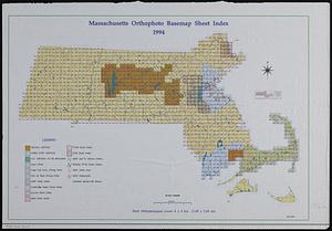
Massachusetts orthophoto basemap sheet index
162.
Massachusetts outdoor recreation plan 1966 : public outdoor recreation areas
163.
Massachusetts, Rhode-Island and Connecticut
164.
Massachusetts river basins
165.
Massachusetts river basins
166.
Massachusetts tourists map : showing tourways, picnic sites, beaches, and camp grounds
167.
Massachusetts Turnpike map : the main street of Massachusetts
168.
Massachusetts watersheds land use
169.
Massachusetts, we have a special place for you
170.
Massachusetts with Connecticut and Rhode Island
171.
The Matthews-Northrup up-to-date map of Massachusetts
172.
Metacomet-Monadnock Trail : an analysis of landuse
173.
Motor routes that intersect the Bay Circuit
174.
National Highways map of the state of Massachusetts showing one thousand miles of national highways proposed by the National...
175.
The National Publishing Company's railroad, post office, township and county map of Massachusetts, Rhode Island and Connecticut...
176.
National topographic map of Massachusetts and Rhode Island : showing counties, townships, cities, villages and post offices ......
177.
New map of Massachusetts
178.
New map of Massachusetts : compiled from the latest and best authorities and corrected by permission from the survey ordered by...
179.
New map of Massachusetts compiled from the latest and best authorities
180.
New map of the vicinity of Boston, with the dates of settlement, population in 1840, and distance from the capital
‹ Prev
Next ›
1
2
…
5
6
7
8
9
10
11
12
13