Toggle navigation
LMEC Home
Exhibitions
Georeferencing
Tools for Teachers
Collections
My Favorites
Sign Up / Log In
Search
Search the map portal
Map Collection
Map Collection
Map Sets
Search
Search
Search for
Search In
All Fields
Creator
Title
Subject
Place
Search All Digital Collections
Advanced Search
140 Results
My Search
Start Over
More Like
commonwealth:z603vk92b
Remove constraint More Like: commonwealth:z603vk92b
Filter your Search
Place
North and Central America
101
Canada
64
United States
55
Suffolk (county)
33
Boston
32
Nova Scotia
22
New England
10
Minas Basin
9
more
Place
»
Topic
Coasts--Nova Scotia--Maps
63
Boston (Mass.)--Buildings, structures, etc--Maps, Manuscript--Early works to 1800
17
Fortification--Massachusetts--Boston--Maps, Manuscript--Early works to 1800
11
Atlantic Coast (N.S.)--Maps
10
Atlantic Coast (New England)--Maps
10
Coasts--Nova Scotia--Pictorial works
10
Boston (Mass.)--History--Siege, 1775-1776--Maps, Manuscript--Early works to 1800
8
Chignecto Bay (N.B. and N.S.)--Maps
8
more
Topic
»
Date
Date range begin
–
Date range end
Current results range from
1758
to
1889
View distribution
Creator
Des Barres, Joseph F. W. (Joseph Frederick Wallet), 1722-1824
94
Montrésor, John, 1736-1799
5
Page, Thomas Hyde, Sir, 1746-1821
4
Birch, C. E. (Charles E.)
2
Browne, William, Captain
2
De Berniere, Henry
2
Dessez, L. (Leon)
2
Holland, Samuel, 1728-1801
2
more
Creator
»
Format
Maps/Atlases
139
Manuscripts
35
Prints
1
Georeferenced
Yes
2
No
138
Collection
American Revolutionary War-Era Maps
136
Library of Congress Collection
136
Norman B. Leventhal Map Center Collection
4
Maritime Charts and Atlases
2
Available to use
Creative Commons license
136
No known restrictions
4
Search Constraints
Sort by date (desc)
relevance
title
date (asc)
date (desc)
Number of results to display per page
20 per page
10
per page
20
per page
50
per page
100
per page
View results as:
grid view
map view
Search Results
1.
North America, Atlantic coast of the United States, Halifax to New York with southern part of Nova Scotia : compiled from the...
2.
North America, Atlantic coast of the United States Halifax to New York with southern part of Nova Scotia : compiled from the...
3.
A new chart of ye coast of New Found Land, New Scotland and New England &c.
4.
A chart of the North-American coast, for the navigation between Halifax and Philadelphia
5.
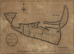
Map of the island of Nantucket
6.
A new and accurate chart of the harbour of Boston in New England in North America
7.
Annapolis Royal
8.
Annapolis Royal ; St. Mary's Bay
9.
Barrington Bay
10.
Cape Prospect ... Cape Sambro ... ; The high lands of Haspotagoen ... ; The Ovens at the entrance of Lunenburg Bay ; Cape Sable...
11.
Cape St. Mary n.e. one mile ; South entrance of Grand Passage ; St. Marys Bay
12.
Charlotte Bay
13.
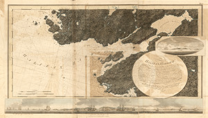
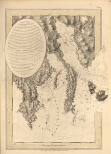
[Chignecto Bay and vicinity]
14.
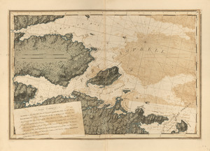
The environs of Fort Cumberland in the Bay of Fundy
15.
Halifax Harbour ... Catch Harbour ...
16.
Leith Harbour ; Prospect Harbour ; Bristol Bay ; Sambro Harbour
17.
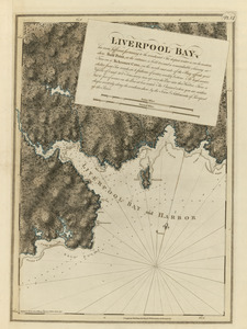
Liverpool Bay
18.
Port Amherst ; Port Haldimand
19.
Port Amherst ; Port Haldimand
20.
Port Campbell
‹ Prev
Next ›
1
2
3
4
5
6
7


![[Chignecto Bay and vicinity]](https://bpldcassets.blob.core.windows.net/derivatives/images/commonwealth:z603vj91v/image_thumbnail_300.jpg)