Toggle navigation
LMEC Home
Exhibitions
Georeferencing
Tools for Teachers
Collections
My Favorites
Sign Up / Log In
Search
Search the map portal
Map Collection
Map Collection
Map Sets
Search
Search
Search for
Search In
All Fields
Creator
Title
Subject
Place
Search All Digital Collections
Advanced Search
300 Results
My Search
Start Over
More Like
commonwealth:z603vj614
Remove constraint More Like: commonwealth:z603vj614
Filter your Search
Place
North and Central America
237
United States
146
Canada
75
Suffolk (county)
61
Boston
60
Nova Scotia
24
Boston Harbor
16
Minas Basin
9
more
Place
»
Topic
Manuscript maps--Early works to 1800
138
Coasts--Nova Scotia--Maps
62
Fortification--Massachusetts--Boston--Maps--Early works to 1800
30
Boston (Mass.)--History--Revolution, 1775-1783--Maps--Early works to 1800
26
Boston (Mass.)--Buildings, structures, etc--Maps, Manuscript--Early works to 1800
17
Boston (Mass.)--History--Siege, 1775-1776--Maps--Early works to 1800
11
Fortification--Massachusetts--Boston--Maps, Manuscript--Early works to 1800
11
Coasts--Nova Scotia--Pictorial works
10
more
Topic
»
Date
Date range begin
–
Date range end
Current results range from
1700
to
1899
View distribution
Creator
Des Barres, Joseph F. W. (Joseph Frederick Wallet), 1722-1824
95
Dumont de Montigny
14
Adlum, John, 1759-1836
9
Bingham, William, 1752-1804
9
Page, Thomas Hyde, Sir, 1746-1821
9
Aitken, Robert, 1735-1802
7
Montrésor, John, 1736-1799
7
Beaurain, Jean de, 1696-1771
5
more
Creator
»
Format
Maps/Atlases
297
Manuscripts
172
Drawings/Illustrations
2
Prints
1
Georeferenced
Yes
9
No
291
Collection
American Revolutionary War-Era Maps
294
Library of Congress Collection
228
Newberry Library Collection
39
Boston and New England Maps
20
Norman B. Leventhal Map Center Collection
20
Maritime Charts and Atlases
18
Urban Maps
14
Mapping Boston Collection
10
more
Collection
»
Available to use
Creative Commons license
250
No known restrictions
11
Search Constraints
Sort by date (desc)
relevance
title
date (asc)
date (desc)
Number of results to display per page
20 per page
10
per page
20
per page
50
per page
100
per page
View results as:
grid view
map view
Search Results
81.
Plano del puerto de Sn. Juan de Puerto Rico
82.
Port Campbell
83.
Pto. Rico
84.
Puerto Rico
85.
Savannah
86.
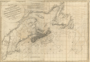
The south west coast of the peninsula of Nova Scotia
87.
[Southwest coast of Nova Scotia from Cape Sable to Cape St. Mary]
88.
The State of New Jersey
89.
A view of the entrance of Petit Passage ; Grand Passage in the Bay Fundy, on the western shore of Nova Scotia
90.
The Wolves, (a cluster of isles) lying s.e. off the entrance of Passamaquadi Bay ; Grand Manan Island ... ; View of the shore...
91.
The world with all modern discoveries
92.
Cape Blowmedown ; Cape Split ; The entrance of Mines Bason ; Isle Haut and Cape Chegnecto
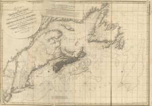
93.
[Chignecto Bay and vicinity]
94.
The coast of Nova Scotia, New England, New-York, Jersey, the Gulph and River of St. Lawrence : the islands of Newfoundland,...
95.
The coast of Nova Scotia, New England, New-York, Jersey, the Gulph and River of St. Lawrence : the islands of Newfoundland,...
96.
Crow Harbor, on the south shore of Chedabuctou Bay
97.
Egmont Harbor
98.
Egmont Harbor
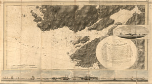
99.
Halifax Harbour ... Catch Harbour ...
100.
The isthmus of Nova Scotia
‹ Prev
Next ›
1
2
3
4
5
6
7
8
9
…
14
15
![[Southwest coast of Nova Scotia from Cape Sable to Cape St. Mary]](https://bpldcassets.blob.core.windows.net/derivatives/images/commonwealth:t722hs72c/image_thumbnail_300.jpg)


![[Chignecto Bay and vicinity]](https://bpldcassets.blob.core.windows.net/derivatives/images/commonwealth:z603vj89t/image_thumbnail_300.jpg)