Toggle navigation
LMEC Home
Exhibitions
Georeferencing
Tools for Teachers
Collections
My Favorites
Sign Up / Log In
Search
Search the map portal
Map Collection
Map Collection
Map Sets
Search
Search
Search for
Search In
All Fields
Creator
Title
Subject
Place
Search All Digital Collections
Advanced Search
159 Results
My Search
Start Over
More Like
commonwealth:z603vj42x
Remove constraint More Like: commonwealth:z603vj42x
Filter your Search
Place
North and Central America
120
United States
76
Canada
61
Suffolk (county)
54
Boston
53
Nova Scotia
21
Boston Harbor
12
Minas Basin
9
more
Place
»
Topic
Coasts--Nova Scotia--Maps
62
Fortification--Massachusetts--Boston--Maps--Early works to 1800
30
Boston (Mass.)--History--Revolution, 1775-1783--Maps--Early works to 1800
22
Boston (Mass.)--Buildings, structures, etc--Maps, Manuscript--Early works to 1800
16
Fortification--Massachusetts--Boston--Maps, Manuscript--Early works to 1800
11
Coasts--Nova Scotia--Pictorial works
10
Atlantic Coast (N.S.)--Maps
8
Boston (Mass.)--History--Siege, 1775-1776--Maps, Manuscript--Early works to 1800
8
more
Topic
»
Date
Date range begin
–
Date range end
Current results range from
1758
to
1782
View distribution
Creator
Des Barres, Joseph F. W. (Joseph Frederick Wallet), 1722-1824
95
Page, Thomas Hyde, Sir, 1746-1821
9
Aitken, Robert, 1735-1802
7
Montrésor, John, 1736-1799
6
Beaurain, Jean de, 1696-1771
5
Faden, William, 1749-1836
3
Gage, Thomas, 1721-1787
3
Pelham, Henry, 1749-1806
3
more
Creator
»
Format
Maps/Atlases
158
Manuscripts
34
Prints
1
Georeferenced
Yes
7
No
152
Collection
American Revolutionary War-Era Maps
158
Library of Congress Collection
136
Boston and New England Maps
15
Norman B. Leventhal Map Center Collection
15
Mapping Boston Collection
10
Richard H. Brown Revolutionary War Map Collection at Mount Vernon
6
Urban Maps
5
Harvard Map Collection
2
Available to use
Creative Commons license
154
No known restrictions
5
Search Constraints
Sort by date (asc)
relevance
title
date (asc)
date (desc)
Number of results to display per page
20 per page
10
per page
20
per page
50
per page
100
per page
View results as:
grid view
map view
Search Results
1.
Grundriss von der Stadt Boston und ihren Gegenden
2.
Plan de la ville et du port de Boston : capitale de la Nouvelle Angleterre : erigée prémierement en 1630, et en 1735 elle fut...
3.
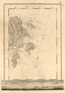
[Boston Harbour, with the surroundings, &c]
4.
A general & particular plan of the island of Castle William near Boston : shewing the works in their original & present state,...
5.
White Haven
6.
White Haven
7.
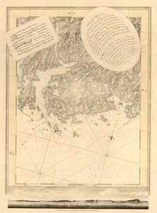
[Battle of Bunker Hill]
8.
Boston, its environs and harbour : with the rebels works raised against that town in 1775
9.
Boston, S. West part : No. 25
10.
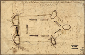
[Bunker Hill--rough sketch]
11.
Canso Harbor
12.
Canso Harbor
13.
A correct view of the late battle at Charlestown : June 17th, 1775
14.
A draught of the towns of Boston and Charles Town and the circumjacent country : shewing the works thrown up by His Majesty's...
15.
Exact plan of General Gage's lines on Boston Neck in America
16.
Exact plan of General Gage's lines on Boston Neck in America
17.
Exact plan of General Gage's lines on Boston Neck in America
18.
Exact plan of General Gage's lines on Boston Neck in America
19.
Major Genl. Howe's encampment on Bunkers Hill at Charles T : June 1775
20.
A Map of forty miles north, thirty miles west, and twentyfive miles south of Boston : including an accurate draft of the...
‹ Prev
Next ›
1
2
3
4
5
…
7
8


![[Boston Harbour, with the surroundings, &c]](https://bpldcassets.blob.core.windows.net/derivatives/images/commonwealth:t722hs94d/image_thumbnail_300.jpg)


![[Battle of Bunker Hill]](https://bpldcassets.blob.core.windows.net/derivatives/images/commonwealth:z603vj11x/image_thumbnail_300.jpg)


![[Bunker Hill--rough sketch]](https://bpldcassets.blob.core.windows.net/derivatives/images/commonwealth:z603vj151/image_thumbnail_300.jpg)