Toggle navigation
LMEC Home
Exhibitions
Georeferencing
Tools for Teachers
Collections
My Favorites
Sign Up / Log In
Search
Search the map portal
Map Collection
Map Collection
Map Sets
Search
Search
Search for
Search In
All Fields
Creator
Title
Subject
Place
Search All Digital Collections
Advanced Search
274 Results
My Search
Start Over
More Like
commonwealth:z603vg73h
Remove constraint More Like: commonwealth:z603vg73h
Filter your Search
Place
North and Central America
236
United States
109
New York
77
Pennsylvania
48
New Jersey
37
Canada
27
New England
22
North America
17
more
Place
»
Topic
New York (State)--Maps
81
Pennsylvania--Maps
50
New Jersey--Maps
37
United States--History--Revolution, 1775-1783--Maps
28
New England--Maps
24
Railroads--New York (State)--Maps
20
United States--Maps
20
Canada--Maps
17
more
Topic
»
Date
Date range begin
–
Date range end
Current results range from
1700
to
1976
View distribution
Creator
Reid, John, 1764?-1828
11
Kitchin, Thomas, 1718-1784
10
Farwell, John Whittemore, 1843-1929
9
Bellin, Jacques Nicolas, 1703-1772
8
Carleton, Osgood, 1742-1816
8
United States. Post Office Dept
7
Carey, Mathew, 1760-1839
6
Gibson, J. (John), active 1750-1792
6
more
Creator
»
Format
Maps/Atlases
274
Manuscripts
12
Georeferenced
Yes
31
No
243
Collection
American Revolutionary War-Era Maps
196
American Antiquarian Society Collection
138
Norman B. Leventhal Map Center Collection
82
William L. Clements Library Collection
50
Boston and New England Maps
14
MacLean Collection Map Library
1
Maritime Charts and Atlases
1
Massachusetts Historical Society Map Collection
1
more
Collection
»
Available to use
No known restrictions
83
Creative Commons license
3
Search Constraints
Sort by relevance
relevance
title
date (asc)
date (desc)
Number of results to display per page
100 per page
10
per page
20
per page
50
per page
100
per page
View results as:
grid view
map view
Search Results
1.
An Exact map of New England, New York, Pensylvania & New Jersey, : from the latest surveys
2.
Map of the canals and rail roads for transporting anthracite coal from the several coal fields to the city of New York
3.
Map of the State of New York with part of the states of Pennsylvania, New Jersey &c
4.
A survey of the empire group : with a complete distance table, a compendious index of cities and post offices, with populations...
5.
A survey of the empire group : with a complete distance table, a compendious index of cities and post offices, with populations...
6.
The provinces of New York, and New Jersey, : with part of Pensilvania [sic], and the province of Quebec
7.
Carte de la Nouvelle Angleterre, Nouvelle Yorck, et Pensilvanie. : Pour servir à l'Histoire générale des voyages
8.
A chorographical map of the country round Philadelphia = Carte particuliere des environs de Philadelphia
9.
A compleat plan of part of the province of Pennsylvania East and West Jersey shewing the transactions of the royal army under...
10.
An historical map of Pennsylvania : showing the Indian names of streams and villages, and paths of travel : the sites of old...
11.
A map of the Delaware and Chesapeak bays with the peninsula between them
12.
Part of the modern counties of Monmouth, Middlesex, Somerset, Hunterdon, Mercer, Burlington, and Ocean in New Jersey and...
13.
Post route map of the states of Pennsylvania, New Jersey, Delaware, and Maryland and of the District of Columbia with adjacent...
14.
Seat of war in the environs of Philadelphia
15.
Part of the modern counties of Union, Somerset, Hunterdon, Morris, Essex, Bergen, Passaic, Sussex, and Warren in New Jersey and...
16.
Southern New York and northern New Jersey
17.
Map of the country embracing the several routes examined with a view to a national road from Washington to Lake Ontario
18.
The State of New Jersey
19.
A map of the state of Pennsylvania
20.
1st. sheet of De Witt's state-map of New York
21.
Map of Genessee Lands
22.
A Map of New England & ye country adjacent, : extending northward to Quebec, & westward to Niagara, on Lake Ontario; shewing...
23.
A Map of that part of America which was the principal seat of war in 1756
24.
A Map of the country between Crown Point and Ford Edward
25.
Bridge from Staten Island to the Jersies, by Cn. Laird's description
26.
From Freehold toward Trenton
27.
Manuscript maps of U.S. states, possibly drawn by a schoolchild
28.
Map of American camp in New Jersey and surrounding countryside
29.
Map of the rail roads of New Jersey 1887
30.
A new and accurate map of New Jersey, from the best authorities
31.
New Jersey
32.
New Jersey showing forest area and its relation to the principal watersheds
33.
Northern New Jersey
34.
Northern New Jersey, showing the iron-ore & limestone districts
35.
A plan of the northern part of New Jersey : shewing the positions of the American and British armies after crossing the North...
36.
Post route map of the State of New Jersey showing post offices with the intermediate distances on mail routes in operation on...
37.
Post route map of the state of New Jersey showing post offices with the intermediate distances on mail routes in operation on...
38.
The principal part of the province of New Jersey shewing the road and distances to the several towns between the North River...
39.
Rand, McNally & Co.'s New Jersey
40.
Relief map of New Jersey
41.
The road from New Bridge and Hackinsack to Burlington
42.
Situation of ye rebels just before the attack upon Trenton
43.
The State of New Jersey : from original surveys based on the triangulation of the U.S. Coast and Geodetic Survey
44.
The state of New Jersey : economic geology
45.
The state of New Jersey, compiled from the most authentic information
46.
Clemens' map of Pennsylvania
47.
Delaware Bay and Chesapeake Bay
48.
Delaware Bay and Chesapeake Bay
49.
A draft of the Ohio from an Indian account
50.
Geological and topographical map of the anthracite fields of Pennsylvania : constructed from original explorations and surveys
51.
Geological map of south-west Pennsylvania, with special reference to the Pittsburgh coal bed
52.
Grundriss von Philadelphia der hauptstadt in Pensylvanien und umliegenden Gegend
53.
Manuscript maps of U.S. states
54.
A map of part of Pennsylvania & Maryland intended to shew, at one view, the several places ...
55.
A map of Pensylvania, with part of the adjacent states, from the latest surveys
56.
A map of Pensylvania, with part of the adjacent states, from the latest surveys
57.
Map of the anthracite coalfields of Pennsylvania
58.
A map of the country between Will's Creek & Monongahela River shewing the rout and encampments of the English army, in 1755
59.
A map of the state of Pennsylvania
60.
A map of the western parts of the colony of Virginia
61.
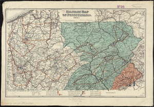
Military map of Pennsylvania
62.
A new county map of the state of Pennsylvania and adjoining states : showing the route of the Central & other rail roads &c....
63.
The new war map of Virginia, Maryland & Pennsylvania
64.
Oil and gas fields of Pennsylvania
65.
Part of the modern counties of Philadelphia, Bucks, Chester, Montgomery, Lehigh, Northampton, Lancaster, and Lebanon
66.
Part of the modern counties of Philadelphia, Bucks, Montgomery, Delaware, Chester, and Lancaster in Pennsylvania; New Castle in...
67.
Pennsylvania
68.
Pennsylvania
69.
Plan of the Indian countrys through which the troops marchd in 1764 under the command of Col. Henry Bouquet
70.
A plan of the river Ohio from Fort Pitt to the Mississipi : by order of ye chief engineer
71.
Post route map of the state of Pennsylvania showing post offices and the intermediate distances on mail routes in operation on...
72.
Post route map of the state of Pennsylvania showing post offices with the intermediate distances on mail routes in operation on...
73.
Progress of the British army from Elk River to Philadelphia, 1777
74.
Rail road map of Pennsylvania
75.
Rail road map of Pennsylvania
76.
Sketch from information of the different roads about Freehold in the Jerseys
77.
A sketch of the several Indian roads leading from Fort Pitt to Sioto, Lake Erie &c. : takn. from a draft (made on a tour thro'...
78.
Sketch showing a feasible canal route, Allegheny River to Lake Erie.
79.
The state of Pennsylvania : reduced with permission from Reading Howells map
80.
The tourist's pocket map of Pennsylvania : exhibiting its internal improvements, roads, distances, &c
81.
15 lots of 440a each in Great Lot no. 4 of Macomb purchase : 6600 acres within 2 miles of the St. Lawrence Turnpike & 1/2 mile...
82.
An accurate map of New York in North America from a late survey
83.
A chorographical map of the northern department of North-America : drawn from the latest and most accurate observations
84.
Connecticut with portions of New York & Rhode Island
85.
E.P. Dutton & Co.'s railroad, steam boat & stage route map of New England, New-York and Canada
86.
Four wood lots in no 3
87.
Fragment of map showing two small fortifications
88.
French draught of Lake Champlain & Lake George with remarks of an English prisoner who return'd from Quebec to Fort Edward by...
89.
Hale's map of the central & western parts of Massachusetts, with a part of New-York
90.
The Johnans. Turner farm
91.
M. Progues wood land
92.
Map exhibiting the rail road, canal, lake and river routes from New York and Boston to the west, via Ogdensburgh, Buffalo and...
93.
Map exhibiting the rail road routes leading from Boston, to Ogdensburg and Buffalo, N.Y
94.
A map of a piece of land surveyd for Peter Coem in lot no 3 belonging the Henry Livingston esqr & laid down from a scale of 10...
95.
Map of Ho-De-No-Sau-Nee-Ga or the people of the long house : compiled 1851 by Lewis H. Morgan & Ely S. Parker a Seneca sachem...
96.
A map of lot no 1 in the Hardenbergh Patent
97.
Map of Morris's Purchase or West Geneseo in the state of New York : exhibiting part of the Lakes Erie and Ontario, the...
98.
Map of New England exhibiting the rail road & telegraphic lines now in operation
99.
A map of New York showing counties, manors, townships, and estates, ca. 1778
100.
A map of New York showing counties, manors, townships, and estates, ca. 1778
‹ Prev
Next ›
1
2
3