Toggle navigation
LMEC Home
Exhibitions
Georeferencing
Tools for Teachers
Collections
My Favorites
Sign Up / Log In
Search
Search the map portal
Map Collection
Map Collection
Map Sets
Search
Search
Search for
Search In
All Fields
Creator
Title
Subject
Place
Search All Digital Collections
Advanced Search
476 Results
My Search
Start Over
More Like
commonwealth:z603vg107
Remove constraint More Like: commonwealth:z603vg107
Filter your Search
Place
United States
336
North and Central America
185
Canada
63
North America
31
West Indies
23
Great Lakes
16
New England
15
New York
14
more
Place
»
Topic
United States--Maps
314
Canada--Maps
54
Elections--United States--Maps
36
Railroads--United States--Maps
34
North America--Maps
30
West Indies--Maps
24
Great Lakes (North America)--Maps
16
New England--Maps
15
more
Topic
»
Date
Date range begin
–
Date range end
Current results range from
1744
to
2020
View distribution
Creator
Paullin, Charles Oscar, 1868 or 1869-1944
70
Wright, John Kirtland, 1891-1969
70
Geological Survey (U.S.)
15
Bellin, Jacques Nicolas, 1703-1772
13
Reid, John, 1764?-1828
11
Carleton, Osgood, 1742-1816
9
Farwell, John Whittemore, 1843-1929
9
Kitchin, Thomas, 1718-1784
9
more
Creator
»
Format
Maps/Atlases
474
Manuscripts
13
Prints
2
Books
1
Objects/Artifacts
1
Posters
1
Georeferenced
Yes
77
No
399
Collection
Norman B. Leventhal Map Center Collection
301
American Revolutionary War-Era Maps
174
American Antiquarian Society Collection
138
William L. Clements Library Collection
33
Boston and New England Maps
3
MacLean Collection Map Library
3
David Judkins Weaver Papers
2
Mapping Boston Collection
2
more
Collection
»
Available to use
No known restrictions
227
Creative Commons license
5
Search Constraints
Sort by relevance
relevance
title
date (asc)
date (desc)
Number of results to display per page
100 per page
10
per page
20
per page
50
per page
100
per page
View results as:
grid view
map view
Search Results
1.
Karte von den seen in Canada
2.
America Septentrionalis : a Domino d'Anville in Galliis edita nune in Anglia Coloniss in Interiorem Virginiam deductis nec non...
3.
The British governments in Nth. America : laid down agreeable to the proclamation of Octr. 7, 1763
4.
Carte des pays connus sous le nom de Canada, : dans laquelle sont distinguées les possessions françoises, et angl?
5.
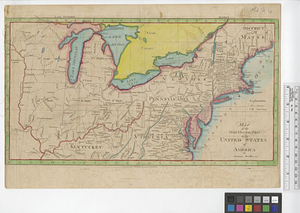
A General map of North America; : from the latest observations
6.
A Map of the British dominions in North America as settled by the late treaty of Peace 1763
7.
A map of the British empire, in North America
8.
A Map of the present seat of war in North America
9.
A New & accurate map of North America, : including the British acquisitions gain'd by the late war, 1763
10.
A new map of the British empire in Nth. America
11.
An accurate map of Canada, with the adjacent countries; exhibiting the late seat of war between the English & French in those...
12.
A new map of Canada, also the north parts of New England and New York; with Nova Scotia and Newfound Land
13.
Aboriginal map of North America, denoting the boundaries and the locations of various Indian tribes
14.
Dinsmore's complete map of the railroads & canals in the United States & Canada
15.
Dinsmore's new railroad map of the United States and the Canadas, showing all the railroads completed and in progress,...
16.
The Dominion of Canada from the latest surveys and data
17.
General railway map engraved expressly for the Official guide of the railways and steam navigation lines of the United States,...
18.
A Map exhibiting the frontiers of Canada and the United States : intended to illustrate the operations of the British &...
19.
Map of North America : showing all routes to Alaska and Klondike country
20.
Relief map of Canada and the United States
21.
Schonberg's imperial map of the United States and Canada : constructed, drawn and compiled from the latest and best authorities...
22.
Trans-continental map : showing the main lines and proposed extensions of the various trans-continental railroad systems of the...
23.
The United States of North America with the British & Spanish territories according to the treaty
24.
L'Isle de Terre-Neuve, l'Acadie, ou la Nouvelle Ecosse, : l'Isle St. Jean et la partie orientale du Canada
25.
A Map of that part of America which was the principal seat of war in 1756
26.
A new and accurate map of Quebec and its boundaries: from a late survey
27.
An Accurate map of the United States of America. : According to the Treaty of Peace of 1783
28.
Amplissima regionis Mississipi : seu provinciae Ludoviciana à R.P. Ludovico Hennepin Francise Miss. in America Septentrionali...
29.
Carte de la Floride, de la Louisiane, et pays voisins. : Pour servir à l'Histoire générale des voyages
30.
A correct map of the United States of North America. : Including the British and Spanish territories, carefully laid down...
31.
A Map of the United States
32.
A new & accurate map of Louisiana, with part of Florida and Canada, : and the adjacent countries drawn from surveys assisted by...
33.
Partie de l'Amerique Septentrionale, : qui comprend le cours de l'Ohio, la Nlle. Angleterre, la Nlle. York, le New Jersey, la...
34.
The United States according to the definitive treaty of peace signed at Paris, Septr. 3d, 1783
35.
The United States of America : laid down from the best authorities agreeable to the peace of 1783. : This map and chart is...
36.
Carta rappresentante i cinque laghi del Canada
37.
Carte des lacs du Canada dressée sur les manuscrits du Depost des Cartes, Plans et Journaux de la Marine et sur le journal du...
38.
Carte des lacs du Canada pour servir à l'Histoire générale des voyages
39.
An exact map of the five Great Lakes, with part of Pensilvania, New York, Canada and Hudsons Bay territories from the best surveys
40.
The Great Lakes and the Ohio, ca. 1800
41.
Les lacs du Canada et Nouvelle Angleterre
42.
A map of the five Great Lakes with part of Pensilvania, New York, Canada and Hudsons Bay territories &c.
43.
A map of the north west parts of the United States of America
44.
Map of the northern part of the United States of America
45.
Partie occidentale de la Nouvelle France ou Canada
46.
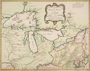
Partie occidentale du Canada contenant les cinq Grands Lacs, avec les pays circonvoisons
47.
Partie occidentale du Canada contenant les cinqs grands lac [sic], avec les pays criconvoisins [sic]
48.
Upper Canada and the Great Lakes region
49.
British America, comprehending Canada, Labrador, New-Foundland, Nova Scotia &c
50.
British possessions in North America
51.
The British possessions in North America from the best authorities
52.
The British possessions in North America from the best authorities
53.
Canada
54.
Canada and Nova Scotia
55.
Canada and Nova Scotia
56.
Carte de la Nouvelle-France, augmentée depuis la derniere, servant a la navigation faicte en son vray Meridien par le Sr. de...
57.
Carte du Golphe de St. Laurent et pays voisins pour servir à l'histoire générale des voyages
58.
Coal areas of Canada
59.
Dawson's map of the Dominion of Canada
60.
Dominion of Canada
61.
E.P. Dutton & Co.'s railroad, steam boat & stage route map of New England, New-York and Canada
62.
Government map of part of the Huron and Ottawa Territory, Ontario
63.
A map of Canada
64.
A map of New England, and Nova Scotia; with part of New York, Canada, and New Britain & the adjacent islands of New Found Land...
65.
Map of the Dominion of Canada
66.
A map of the province of Upper Canada, describing all the new settlements, townships, & cc. with the countries adjacent, from...
67.
Map of the provinces of upper & lower Canada with the adjacent parts of the United States of America, &c
68.
Map shewing the railways of Canada, to accompany annual report on railway statistics 1884
69.
Map showing mounted police stations in north-western Canada
70.
Map to accompany the report on the exploratory survey of the Canadian Pacific Railway
71.
Minerals
72.
A new and accurate map of the present seat of war in North America
73.
New map of the Dominion of Canada
74.
La Nouvelle France ou Canada
75.
Relief map of the Dominion of Canada
76.
Williams' telegraph and rail road map of the New England states, eastern protion of New York state and Canada : compiled from...
77.
19th annual convention of the National Association of Real Estate Boards : at Tulsa, June 7 to June 11 in 1926
78.
2005 significant U.S. hurricane strikes
79.
The 2100 project : an atlas for the Green New Deal
80.
38,000,000 escaped -- 10,000,000 died
81.
Abolition of Slavery, 1863
82.
The adventures of Mark Twain
83.
Alden's pictorial map of the United States of North America
84.
Alien and Sedition Acts, February 25, 1799, Votes on resolutions for repeal
85.
America : beauty, wonders, inspiration, progress, without end
86.
America the wonderland : a pictorial map of the United States
87.
American explorations in the West, 1803-1852
88.
Amérique Septentrionale
89.
Appletons' railway map of the United States and Canada
90.
Appletons' railway map of the United States and the Canadas : representing railways in actual operation, and those in the...
91.
Armour food source map
92.
Base-map of the United States
93.
Being a map of the United States in the year 1831 when the Country Gentleman first made its appearance as the Genesee Farmer
94.
Broadway of America an all year ... all weather comfortable route from coast to coast
95.
Cantonment of the forces in N. America 1766
96.
Carte des Etats-Unis
97.
Carte des Etats-Unis de l'Amérique-Nord : pour servir aux observations géologiqueir
98.
Carte générale des États-Unis de l'Amérique avec les plans des principales villes
99.
Case's map of the United States, the British provinces, Mexico, and part of the West Indies : compiled from the latest...
100.
Catholic America : a pictorial map portraying the contribution of Catholics in the development of the United States of America...
‹ Prev
Next ›
1
2
3
4
5


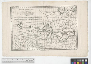
![Partie occidentale du Canada contenant les cinqs grands lac [sic], avec les pays criconvoisins [sic]](https://bpldcassets.blob.core.windows.net/derivatives/metadata/commonwealth-oai:tx31vg299/image_thumbnail_300.jpg)