Toggle navigation
LMEC Home
Exhibitions
Georeferencing
Tools for Teachers
Collections
My Favorites
Sign Up / Log In
Search
Search the map portal
Map Collection
Map Collection
Map Sets
Search
Search
Search for
Search In
All Fields
Creator
Title
Subject
Place
Search All Digital Collections
Advanced Search
8174 Results
My Search
Start Over
More Like
commonwealth:x633f945h
Remove constraint More Like: commonwealth:x633f945h
Filter your Search
Place
North and Central America
4,923
United States
3,613
Suffolk (county)
1,026
Boston
999
Europe
963
Canada
427
France
269
Massachusetts
249
more
Place
»
Topic
Boston (Mass.)--Maps
574
United States--Maps
270
Real property--Massachusetts--Boston--Maps
174
Massachusetts--Maps
160
Landowners--Massachusetts--Boston--Maps
132
North America--Maps--Early works to 1800
103
New England--Maps
99
Europe--Maps
78
more
Topic
»
Date
Date range begin
–
Date range end
Current results range from
1482
to
2023
View distribution
Creator
United States. Hydrographic Office
357
O.H. Bailey & Co
148
Des Barres, Joseph F. W. (Joseph Frederick Wallet), 1722-1824
125
United States. Post Office Dept
120
Ptolemy, 2nd cent
100
Walling, Henry Francis, 1825-1888
94
Jefferys, Thomas, -1771
84
Geological Survey (U.S.)
82
more
Creator
»
Format
Maps/Atlases
8,115
Manuscripts
219
Prints
51
Books
36
Objects/Artifacts
10
Drawings/Illustrations
8
Posters
4
Georeferenced
Yes
869
No
7,305
Collection
Norman B. Leventhal Map Center Collection
8,168
Boston and New England Maps
2,189
Urban Maps
1,925
Maritime Charts and Atlases
757
American Revolutionary War-Era Maps
626
Boston Redevelopment Authority Collection
86
Mapping Boston Collection
6
Library of Congress Collection
5
more
Collection
»
Available to use
No known restrictions
8,021
Creative Commons license
58
Search Constraints
Sort by relevance
relevance
title
date (asc)
date (desc)
Number of results to display per page
100 per page
10
per page
20
per page
50
per page
100
per page
View results as:
grid view
map view
Search Results
7101.
Southern Asia
7102.
Southern British Columbia : map showing disposition of lands
7103.
Southern coast of China, harbor of Hongkong and approaches : compiled from the latest information, 1886
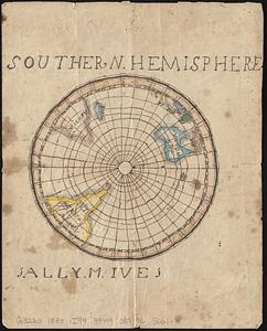
7104.
Southern hemisphere
7105.
Southern Luzon : showing portion of theatre of operations ; 8th Army Corps, Major General Elwell S. Otis commanding
7106.
Southern Luzon, showing portion of theatre of operations : 8th Army Corps, Major General Elwell S. Otis commanding
7107.
Southern Mississippi and Alabama showing the approaches to Mobile
7108.
The southern part of the Province of New York : with part of the adjoining colonies
7109.
Southern provinces of the United States
7110.
Southern Railway system
7111.
Southern shore of the Caribbean Sea, Costa Rica, Port of Limon
7112.
Southern States
7113.
Southern Vancouver Island, British Columbia
7114.
Southington, Conn : 1878
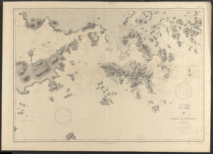
7115.
Southville and Cordaville, Massachusetts, 1887
7116.
[Southwest coast of Nova Scotia from Cape Sable to Cape St. Mary]
7117.
The southwest Pacific
7118.
The southwestern railroad system United States and Mexico
7119.
La souverainete de Dombes
7120.
Les Souverainetez de Sedan et Raucourt et la Prevosté de Doncheri
7121.
Les Souverainetez de Sedan et Raucourt et la Prevosté de Doncheri
7122.
La Spagnuola
7123.
Spagnvola
7124.
Spagnvola
7125.
Spain & Portugal
7126.
Spain and Portugal
7127.
Spain and Portugal
7128.
Spain and Portugal
7129.
Spain and Portugal, from the best authorities
7130.
Spain and Portugal from the best authorities
7131.
The Spainish Netherlands, vulgarly called Flanders, devided into its X provinces, wherein are delineated the fortified towns...
7132.
Spain--south coast, Port Málaga : from the Spanish government survey of 1872
7133.
Spanish North America
7134.
Spanish North America, southern part
7135.
Spartanburg, South Carolina : the city of success ; city map and street directory
7136.
Special map of Rossland, British Columbia
7137.
Special plans to chart no. 318
7138.
Specialkarte der Asiatischen Türkey : oestliches blatt
7139.
Special-karte der eisenbahn-, post- u. dampfschiff-verbindungen Mittel-Europa's mit angabe aller eisenbahn-, post- u....
7140.
Special-karte der Europäischen Türkey
7141.
Special-karte der Fränkischen Schweiz und der umgegend von Nürnberg : (aus Reymann's Special-karte von Central-Europa)
7142.
Specialkarte des Grossen Salzsee's von Utah und Seiner Umgebungen : nach den aufnahmen von Frémont und Stansbury
7143.
Specialkarte vom kriegsschauplatz am Rhein 1870 (Erfurt bis Paris) : Belgien, nordöstliches Frankreich, Luxembourg,...
7144.
Spencer
7145.
Spencer, Mass : 1877
7146.
Spencer, Massachusetts, 1892
7147.
Spezialkarte der Samoa-Inseln
7148.
Spezielle reise- und gebirgs-karte vom Lande Tyrol mit den angrenzenden theilen von Süd Bayern, Salzburg, der Schweiz,...
7149.
Spherical projection world
7150.
Sportsmen's fishing map of the United States and neighboring waters
7151.
Springfield
7152.
Springfield : surveyed by direction of the town 1826
7153.
Springfield, Ohio
7154.
Springfield, Vt
7155.
Springvale, Maine : looking west
7156.
Spry Harbour : Port Pallisser ; Port North ; Port Parker ; Beaver Harbour ; Fleming River
7157.
S.R.I. Bavariae : circulus atque electoratus tam cum adjacentibus quam insertis regionibus accuratissime in suasquasque...
7158.
S.R.I. Sueviae Circulus atq[ue] Ducatus una cum insertis et adjacentibus Regionibus, accuratissime in earundem particulares...
7159.
S.R.I. Westphaliae circulus, in omnes ejusdem subjacentes provincias exactissime distinctus
7160.
St. Christophers
7161.
St. Christophers or St. Kitts
7162.
St. Croix County, Wis.
7163.
St. Helena : this island belongs to ye English east India Company whose ships usually touch here for a recruit of fresh water...
7164.
St. Joe National Forest, Idaho
7165.
St. Johnsbury, county seat of Caledonia County, Vt : 1884
7166.
St. Lawrence Bay showing Lutke's Harbor
7167.
St. Lawrence Bay showing Lutke's Harbor
7168.
St. Mihiel - B
7169.
[St. Peter's Bay, on the south shore of Cape Breton Island]
7170.
St. Stephen, New Brunswick and Calais, Maine : 1889
7171.
St. Thomas, Province, Ontario Canada, 1875
7172.
St. Vincent, from an actual survey made in the year 1773 : after the treaty with the Caribs
7173.
Staaten am Atlantischen Ocean
7174.
Stamford, Conn
7175.
Standard railway map of South Africa = Standaard spoorwegkaart van Suidafrika
7176.
Standard Russo-Japanese war map July 1904
7177.
Stanford's enlarged map of the seat of war
7178.
Stanford's library map of the world on Mercator's projection
7179.
Stanford's military map of the seat of war
7180.
Stanford's shilling map of the seat of war
7181.
Stannard & Son's, panoramic birds-eye view, of Berlin & its defences, the principal Prussian ports on the Baltic, with Denmark...
7182.
Stannard & Son's, panoramic birds-eye view of France & Prussia and the surrounding countries likely to be involved in the War,...
7183.
Stannard & Son's, panoramic birds-eye view of the French & Prussian provinces, on the banks of the Rhine, shewing all the...
7184.
Stannard & Son's, perspective view, of the immediate seat of war & recent battle fields, shewing all the fortifications and...
7185.
State of Alabama
7186.
State of Arkansas
7187.
State of California
7188.
State of Chiapas
7189.
State of Colorado
7190.
State of Colorado
7191.
State of Florida
7192.
The State of Florida : compiled in the Bureau of Topographical Engineers from the best authorities
7193.
State of Florida
7194.
State of Idaho
7195.
State of Illinois
7196.
State of Illinois
7197.
State of Illinois
7198.
State of Illinois coal fields and producing districts
7199.
State of Indiana
7200.
State of Indiana
‹ Prev
Next ›
1
2
…
68
69
70
71
72
73
74
75
76
…
81
82