Toggle navigation
LMEC Home
Exhibitions
Georeferencing
Tools for Teachers
Collections
My Favorites
Sign Up / Log In
Search
Search the map portal
Map Collection
Map Collection
Map Sets
Search
Search
Search for
Search In
All Fields
Creator
Title
Subject
Place
Search All Digital Collections
Advanced Search
8174 Results
My Search
Start Over
More Like
commonwealth:x633f945h
Remove constraint More Like: commonwealth:x633f945h
Filter your Search
Place
North and Central America
4,923
United States
3,613
Suffolk (county)
1,026
Boston
999
Europe
963
Canada
427
France
269
Massachusetts
249
more
Place
»
Topic
Boston (Mass.)--Maps
574
United States--Maps
270
Real property--Massachusetts--Boston--Maps
174
Massachusetts--Maps
160
Landowners--Massachusetts--Boston--Maps
132
North America--Maps--Early works to 1800
103
New England--Maps
99
Europe--Maps
78
more
Topic
»
Date
Date range begin
–
Date range end
Current results range from
1482
to
2023
View distribution
Creator
United States. Hydrographic Office
357
O.H. Bailey & Co
148
Des Barres, Joseph F. W. (Joseph Frederick Wallet), 1722-1824
125
United States. Post Office Dept
120
Ptolemy, 2nd cent
100
Walling, Henry Francis, 1825-1888
94
Jefferys, Thomas, -1771
84
Geological Survey (U.S.)
82
more
Creator
»
Format
Maps/Atlases
8,115
Manuscripts
219
Prints
51
Books
36
Objects/Artifacts
10
Drawings/Illustrations
8
Posters
4
Georeferenced
Yes
869
No
7,305
Collection
Norman B. Leventhal Map Center Collection
8,168
Boston and New England Maps
2,189
Urban Maps
1,925
Maritime Charts and Atlases
757
American Revolutionary War-Era Maps
626
Boston Redevelopment Authority Collection
86
Mapping Boston Collection
6
Library of Congress Collection
5
more
Collection
»
Available to use
No known restrictions
8,021
Creative Commons license
58
Search Constraints
Sort by date (asc)
relevance
title
date (asc)
date (desc)
Number of results to display per page
20 per page
10
per page
20
per page
50
per page
100
per page
View results as:
grid view
map view
Search Results
7461.
Rand McNally standard map of Alaska
7462.
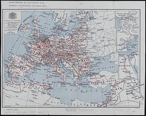
Reseau parcouru par les voitures de la Compagnie Internationale des Wagons-lits
7463.
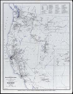
Revised map of western hydroelectric systems showing transmission lines, power plants and some major undeveloped power sites as...
7464.
Soil reconnoissance, Montana 1925 : Chouteau County
7465.
South western districts
7466.
Southeast States road map
7467.
Standard railway map of South Africa = Standaard spoorwegkaart van Suidafrika
7468.
State of Virginia : stations and transmission lines used in public service in 1925 and gaging stations
7469.
Structure map of northeastern Oklahoma
7470.
19th annual convention of the National Association of Real Estate Boards : at Tulsa, June 7 to June 11 in 1926
7471.
Atlas of the city of Lawrence and the towns of Methuen, Andover and North Andover, Massachusetts
7472.
The attack on Bunker Hill in the peninsula of Charlestown the 17th of June 1775
7473.
Chicago motor coach pictorial map of Chicago
7474.
The colour of an old city : a map of Boston, decorative and historical
7475.
The Commonwealth of Connecticut
7476.
Eizan chōjō hitome happō chōkanzu
7477.
Geologic map of Oklahoma
7478.
A kite view of Philadelphia and the Sesqui Centennial International Exposition
7479.
Map of Boston boundary line changes
7480.
A map of Cape Cod
‹ Prev
Next ›
1
2
…
370
371
372
373
374
375
376
377
378
…
408
409