Toggle navigation
LMEC Home
Exhibitions
Georeferencing
Tools for Teachers
Collections
My Favorites
Sign Up / Log In
Search
Search the map portal
Map Collection
Map Collection
Map Sets
Search
Search
Search for
Search In
All Fields
Creator
Title
Subject
Place
Search All Digital Collections
Advanced Search
8859 Results
My Search
Start Over
More Like
commonwealth:x633f915s
Remove constraint More Like: commonwealth:x633f915s
Filter your Search
Place
North and Central America
6,011
United States
4,859
Massachusetts
2,079
Europe
1,396
Suffolk (county)
1,046
Boston
1,019
Canada
454
Asia
442
more
Place
»
Topic
Boston (Mass.)--Maps
586
United States--Maps
282
North America--Maps--Early works to 1800
240
Real property--Massachusetts--Boston--Maps
175
Massachusetts--Maps
162
Landowners--Massachusetts--Boston--Maps
133
New England--Maps
102
Europe--Maps
79
more
Topic
»
Date
Date range begin
–
Date range end
Current results range from
1482
to
2023
View distribution
Creator
United States. Hydrographic Office
595
O.H. Bailey & Co
148
Des Barres, Joseph F. W. (Joseph Frederick Wallet), 1722-1824
123
United States. Post Office Dept
120
Ptolemy, 2nd cent
100
Jefferys, Thomas, -1771
94
Walling, Henry Francis, 1825-1888
94
Sayer, Robert, 1725-1794
89
more
Creator
»
Format
Maps/Atlases
8,799
Manuscripts
217
Prints
56
Books
36
Objects/Artifacts
10
Drawings/Illustrations
8
Posters
5
Georeferenced
Yes
872
No
7,987
Collection
Norman B. Leventhal Map & Education Center Collection
8,707
Boston and New England Maps
2,234
Urban Maps
2,023
Maritime Charts and Atlases
1,083
American Revolutionary War-Era Maps
754
Boston Redevelopment Authority Collection
87
MacLean Collection Map Library
67
New York Public Library Collection
36
more
Collection
»
Available to use
No known restrictions
8,556
Creative Commons license
121
Search Constraints
Sort by relevance
relevance
title
date (asc)
date (desc)
Number of results to display per page
20 per page
10
per page
20
per page
50
per page
100
per page
View results as:
grid view
map view
Search Results
7581.
South Acton, Mass : 1886
7582.
South Africa
7583.
South Africa
7584.
South Africa
7585.
South America
7586.
South America
7587.
South America
7588.
South America
7589.
South America
7590.
South America : reduced from the sheet map
7591.
South America, anchorages in Magellan Strait : from the most recent British surveys
7592.
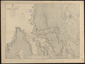
South America, Chile, Port of Valdivia and approaches : from a Chilean government survey in 1868-70 corrected to 1882
7593.
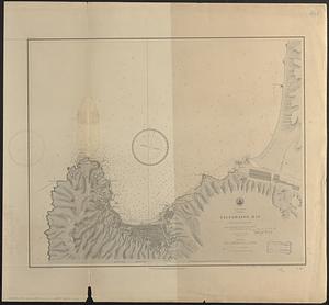
South America, Chili, Valparaiso Bay : from a Chilian survey in 1877
7594.
South America, coast of Peru, Ancon Bay : from an Italian survey in 1883
7595.
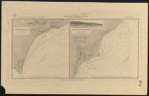
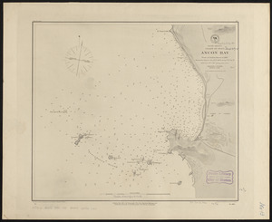
South America, coast of Peru, Callao Bay and vicinity : from a British survey in 1840, and a French survey in 1876
7596.
South America, coast of Peru, Pisco Bay : from the latest French and English charts, 1885
7597.
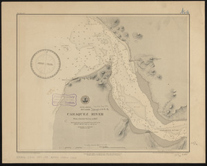
South America, Ecuador, Caraquez River : from a British survey in 1847
7598.
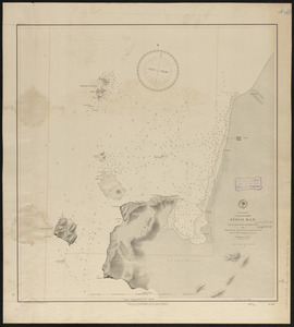
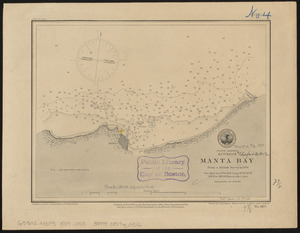
South America, Ecuador, Manta Bay : from a British survey in 1876
7599.
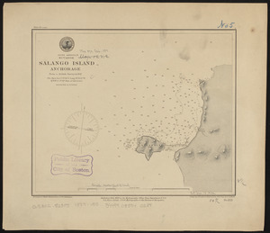
South America, Ecuador, Salango Island anchorage : from a British survey in 1847
7600.
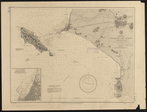
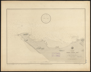
South America, Ecuador, Santa Eléna Bay : from a British survey in 1847
‹ Prev
Next ›
1
2
…
376
377
378
379
380
381
382
383
384
…
442
443