Toggle navigation
LMEC Home
Exhibitions
Georeferencing
Tools for Teachers
Collections
My Favorites
Sign Up / Log In
Search
Search the map portal
Map Collection
Map Collection
Map Sets
Search
Search
Search for
Search In
All Fields
Creator
Title
Subject
Place
Search All Digital Collections
Advanced Search
1119 Results
My Search
Start Over
More Like
commonwealth:ws85d512w
Remove constraint More Like: commonwealth:ws85d512w
Filter your Search
Place
North and Central America
1,118
United States
1,115
Suffolk (county)
1,004
Boston
1,002
Massachusetts
795
Roxbury
87
Middlesex (county)
42
Downtown Boston
38
more
Place
»
Topic
Boston (Mass.)--Maps
752
Real property--Massachusetts--Boston--Maps
253
City planning--Massachusetts--Boston--Maps
219
Landowners--Massachusetts--Boston--Maps
169
Urban renewal--Massachusetts--Boston--Maps
141
Buildings--Massachusetts--Boston--Maps
125
Roxbury (Boston, Mass.)--Maps
89
Land use--Massachusetts--Boston--Maps
48
more
Topic
»
Date
Date range begin
–
Date range end
Current results range from
1743
to
2023
View distribution
Creator
Boston Redevelopment Authority
228
Bromley, George Washington
80
Bromley, Walter Scott
79
G.W. Bromley & Co.
57
Geo. H. Walker & Co.
29
Geo. H. Walker & Co
27
Hopkins, Griffith Morgan, Jr.
27
Boynton, George W., d. 1884
21
more
Creator
»
Format
Maps/Atlases
1,118
Manuscripts
10
Drawings/Illustrations
1
Georeferenced
Yes
105
No
1,014
Collection
Boston and New England Maps
808
Norman B. Leventhal Map & Education Center Collection
744
Urban Maps
717
Boston Redevelopment Authority Collection
247
Massachusetts Real Estate Atlases
143
American Revolutionary War-Era Maps
26
Mapping Boston Collection
20
William L. Clements Library Collection
10
more
Collection
»
Available to use
No known restrictions
919
Creative Commons license
36
Search Constraints
Sort by relevance
relevance
title
date (asc)
date (desc)
Number of results to display per page
20 per page
10
per page
20
per page
50
per page
100
per page
View results as:
grid view
map view
Search Results
321.
Map of the town of Roxbury : surveyed by order of the town authorities
322.
Map of the town of Roxbury
323.
Parcel 22
324.
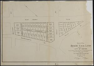
Plan of the Roxbury Canal lands belonging to the city of Boston to be sold by public auction on Saturday May 19th 1883 at 3...
325.
A plan of the salt marsh and upland in Roxbury, lying the east side of the Mill Creek
326.
Roxbury
327.
Roxbury - N. Dorchester G.N.R.P. : preliminary land use plan
328.
Roxbury - N. Dorchester G.N.R.P. : preliminary circulation plan
329.
Roxbury-N. Dorchester G.N.R.P. r-50 : existing & proposed community facilities
330.
Roxbury-N. Dorchester G.N.R.P. r-50 : existing circulation
331.
Roxbury-N. Dorchester G.N.R.P. r-50 : proposed treatment and title I projects
332.
Roxbury-N. Dorchester G.N.R.P. r-50 : proposed circulation
333.
Roxbury-N. Dorchester G.N.R.P. r-50 : proposed land use
334.
Roxbury-N. Dorchester G.N.R.P. r-50 : existing population density
335.
Ruggles Center : existing condition plan
336.
Ruggles Center : site area diagram
337.
Topographical map of Cedar Square, Roxbury
338.
Utility map, Washington Park project r-24
339.
Views of the area around Dudley Station in Roxbury
340.
Washington Park urban renewal area : existing land use
‹ Prev
Next ›
1
2
…
13
14
15
16
17
18
19
20
21
…
55
56