Toggle navigation
LMEC Home
Exhibitions
Georeferencing
Tools for Teachers
Collections
My Favorites
Sign Up / Log In
Search
Search the map portal
Map Collection
Map Collection
Map Sets
Search
Search
Search for
Search In
All Fields
Creator
Title
Subject
Place
Search All Digital Collections
Advanced Search
8189 Results
My Search
Start Over
More Like
commonwealth:wd376648f
Remove constraint More Like: commonwealth:wd376648f
Filter your Search
Place
North and Central America
4,938
United States
3,628
Suffolk (county)
1,037
Boston
1,010
Europe
963
Canada
427
France
269
Massachusetts
261
more
Place
»
Topic
Boston (Mass.)--Maps
584
United States--Maps
270
Real property--Massachusetts--Boston--Maps
174
Massachusetts--Maps
160
Landowners--Massachusetts--Boston--Maps
132
North America--Maps--Early works to 1800
103
New England--Maps
99
Europe--Maps
78
more
Topic
»
Date
Date range begin
–
Date range end
Current results range from
1482
to
2023
View distribution
Creator
United States. Hydrographic Office
357
O.H. Bailey & Co
148
Des Barres, Joseph F. W. (Joseph Frederick Wallet), 1722-1824
124
United States. Post Office Dept
120
Ptolemy, 2nd cent
100
Walling, Henry Francis, 1825-1888
94
Jefferys, Thomas, -1771
84
Geological Survey (U.S.)
82
more
Creator
»
Format
Maps/Atlases
8,130
Manuscripts
215
Prints
51
Books
36
Objects/Artifacts
10
Drawings/Illustrations
8
Posters
5
Georeferenced
Yes
872
No
7,317
Collection
Norman B. Leventhal Map Center Collection
8,176
Boston and New England Maps
2,196
Urban Maps
1,929
Maritime Charts and Atlases
754
American Revolutionary War-Era Maps
627
Boston Redevelopment Authority Collection
88
Mapping Boston Collection
10
William L. Clements Library Collection
10
more
Collection
»
Available to use
No known restrictions
8,027
Creative Commons license
56
Search Constraints
Sort by relevance
relevance
title
date (asc)
date (desc)
Number of results to display per page
50 per page
10
per page
20
per page
50
per page
100
per page
View results as:
grid view
map view
Search Results
1.
Boston Harbor, Mass : map of Charles River from Brookline Street bridge to its mouth
2.
Boston water works : map showing the several sources of supply already constructed, also the drainage areas of Lake Cochituate...
3.
Broad Canal, Cambridge : condition of retaining walls and bed of Canal, inspection for Committee on Charles River Dam, Oct. 30,...
4.
Charles River
5.
Charles River embankment : Boston district
6.
Compiled plan, showing Millers Creek and a portion of Charles River
7.
Lechmere Canal, Cambridge : condition of retaining walls and bed of canal, inspection for Committee on Charles River Dam, Nov....
8.
Map of Charles River showing principal sources of pollution
9.
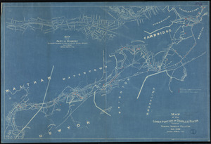
Map of the lower portion of Charles River showing principal sources of pollution
10.
New Boston and Charles River Bay
11.
[Plan for proposed Charles River Park]
12.
Plan of Charles River : from the Waltham line to Boston harbor
13.
Plan of Charles River and Warren bridges, with the vicinity
14.
Proposed Charles River Park
15.
Proposed Charles River Park
16.
Public reservations on the banks of the Charles River between Watertown and Cragies Bridge
17.
Sketch plan showing the existing and proposed public reservations upon the banks of the Charles between Waltham line and...
18.
Boston Bay and Harbor
19.
Boston Harbor
20.
Boston Harbor & vicinity
21.
Boston Harbor, Massachusetts
22.
Boston Harbor, Massachusetts
23.
Boston Harbor, Massachusetts
24.
Boston Harbour : from the survey of A.S. Wadsworth Esq. U.S.N. and the chart of Des Barres
25.
Boston Inner Harbor Massachusetts
26.
Changes in the bed of Boston Harbor from a comparison of the surveys of 1835-61
27.
A chart exhibiting the normal course & velocity of the tidal current at ebb in Boston Harbor
28.
Chart of Boston Harbor : from the best authorities, 1873
29.
Chart of Boston Harbor and Massachusetts Bay : with map of the adjacent country
30.
Chart of Boston Harbour : surveyed in 1817
31.
Copy of a plan of South Bay
32.
Copy of part of plan of inner harbor of Boston, showing commissioners' lines
33.
Eldridge's new chart no. 4 Boston Harbor : compiled from the latest surveys
34.
Eldridge's new chart of Boston Harbor : compiled from the latest surveys
35.
Extract from the plan of the coast survey of Boston Harbor, 1847
36.
J. Schedler's relief map of Boston and environs
37.
Map of Boston Harbor : showing commissioners' lines, wharves &c
38.
Map of Boston Harbor
39.
Map of Boston inner harbor
40.
Map of Boston inner harbor to accompany report under chapter 93, resolves of 1907, December 1, 1907
41.
Map of Boston proper, Charlestown, South Boston and East Boston : showing original territory of old Boston, the areas filled...
42.
Map of the eastern junc. Broad Sound Pier, & Pt. Shirley railroad : steamboat lines and connections : established for the...
43.
Map showing the routes of The Winthrop Steamboat Co
44.
Map showing the terminal facilities of Boston
45.
New chart of Boston Harbor
46.
Plan for the occupation of flats owned by the Commonwealth in Boston Harbor
47.
Plan of Boston and its vicinity
48.
Plan of Boston and its vicinity
49.
[Plan of channels and flats as they were before the 200 feet outside of the Mill Dam was filled up]
50.
Plan of location of projected ship canal from Taunton River to Boston Harbor, through Weymouth Fore River ... Frank W. Hodgdon,...
‹ Prev
Next ›
1
2
3
4
5
…
163
164


![[Plan for proposed Charles River Park]](https://bpldcassets.blob.core.windows.net/derivatives/images/commonwealth:cf95jc91c/image_thumbnail_300.jpg)


![[Plan of channels and flats as they were before the 200 feet outside of the Mill Dam was filled up]](https://bpldcassets.blob.core.windows.net/derivatives/images/commonwealth:b8516207x/image_thumbnail_300.jpg)
