Toggle navigation
LMEC Home
Exhibitions
Georeferencing
Tools for Teachers
Collections
My Favorites
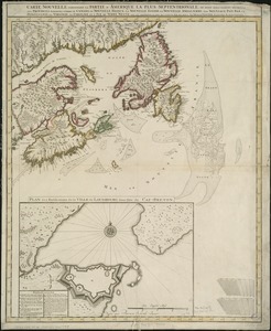
Sign Up / Log In
Search
Search the map portal
Map Collection
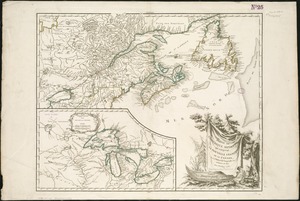
Map Collection
Map Sets
Search
Search
Search for
Search In
All Fields
Creator
Title
Subject
Place
Search All Digital Collections
Advanced Search
8180 Results
My Search
Start Over
More Like
commonwealth:w9505s824
Remove constraint More Like: commonwealth:w9505s824
Filter your Search
Place
North and Central America
4,923
United States
3,609
Suffolk (county)
1,026
Boston
999
Europe
963
Canada
438
France
269
Massachusetts
249
more
Place
»
Topic
Boston (Mass.)--Maps
574
United States--Maps
270
Real property--Massachusetts--Boston--Maps
174
Massachusetts--Maps
160
Landowners--Massachusetts--Boston--Maps
132
North America--Maps--Early works to 1800
106
New England--Maps
99
Europe--Maps
78
more
Topic
»
Date
Date range begin
–
Date range end
Current results range from
1482
to
2023
View distribution
Creator
United States. Hydrographic Office
357
O.H. Bailey & Co
148
Des Barres, Joseph F. W. (Joseph Frederick Wallet), 1722-1824
123
United States. Post Office Dept
120
Ptolemy, 2nd cent
100
Walling, Henry Francis, 1825-1888
94
Jefferys, Thomas, -1771
85
Geological Survey (U.S.)
82
more
Creator
»
Format
Maps/Atlases
8,121
Manuscripts
217
Prints
51
Books
36
Objects/Artifacts
10
Drawings/Illustrations
8
Posters
4
Georeferenced
Yes
869
No
7,311
Collection
Norman B. Leventhal Map Center Collection
8,162
Boston and New England Maps
2,184
Urban Maps
1,925
Maritime Charts and Atlases
750
American Revolutionary War-Era Maps
632
Boston Redevelopment Authority Collection
86
Library and Archives Canada Collection
8
Richard H. Brown Revolutionary War Map Collection at Mount Vernon
3
more
Collection
»
Available to use
No known restrictions
8,022
Creative Commons license
53
Search Constraints
Sort by relevance
relevance
title
date (asc)
date (desc)
Number of results to display per page
20 per page
10
per page
20
per page
50
per page
100
per page
View results as:
grid view
map view
Search Results
1.
British colonies in North America : drawn from the best authorities
2.
British dominions in America, drawn from the latest and best authorities
3.
Le Canada, ou Nouvelle France, &c : ce qui est le plus advance vers le Septentrion est tiré de diverses relations des Anglois,...
4.
Carte du Canada ou de la Nouvelle France et des decouvertes qui y ont été faites
5.
Carte d'une partie de l'Amérique Septentrionale pour servir à l'intelligence du mémoire sur les prétentions des Anglois au...
6.
Carte minéralogique, où l'on voit la nature des terreins du Canada et de la Louisiane
7.
Carte nouvelle contenant la partie d'Amerique la plus septentrionale, ou sont exactement dêcrites les provinces suivantes...
8.
A map of Canada and the north part of Louisiana with the adjacent countrys
9.
Map of the United States in North America : with the British, French and Spanish dominions adjoining, according to the treaty...
10.
A New and correct map of the British colonies in North America comprehending eastern Canada with the province of Quebec, New...
11.
A new chart of the coast of New England, Nova Scotia, New France or Canada, with the islands of Newfoundld. Cape Breton St....
12.
A new map of North America
13.
A new map of the United States of North America with the British dominions on that continent &c
14.
Partie de l'Amérique septent? qui comprend la Nouvelle France ou le Canada
15.
Partie orientale de la Nouvelle France ou du Canada
16.
Partie orientale de la Nouvelle France ou du Canada
17.
Partie orientale du Canada, avec la Nouvelle Angleterre, l'Acadie, et la Terre-Neuve
18.
Pas-caert van Terra Nova, Nova Francia, Nieuw-Engeland en de groote rivier van Canada
19.
Paskaerte Zÿnde de Noordelijckfte Zeekuften van America van Groenland door de Straet Davis en de Straet Hudson tot Terra Neuf
20.
Théatre de la guerre en Amerique, avec les Isles Antilles : projetté et assujettie aux observations
‹ Prev
Next ›
1
2
3
4
5
…
408
409