Toggle navigation
LMEC Home
Exhibitions
Georeferencing
Tools for Teachers
Collections
My Favorites
Sign Up / Log In
Search
Search the map portal
Map Collection
Map Collection
Map Sets
Search
Search
Search for
Search In
All Fields
Creator
Title
Subject
Place
Search All Digital Collections
Advanced Search
8168 Results
My Search
Start Over
More Like
commonwealth:q524n4636
Remove constraint More Like: commonwealth:q524n4636
Filter your Search
Place
North and Central America
4,917
United States
3,603
Suffolk (county)
1,026
Boston
999
Europe
963
Canada
431
France
269
Massachusetts
249
more
Place
»
Topic
Boston (Mass.)--Maps
574
United States--Maps
270
Real property--Massachusetts--Boston--Maps
174
Massachusetts--Maps
160
Landowners--Massachusetts--Boston--Maps
132
North America--Maps--Early works to 1800
104
New England--Maps
99
Europe--Maps
78
more
Topic
»
Date
Date range begin
–
Date range end
Current results range from
1482
to
2023
View distribution
Creator
United States. Hydrographic Office
357
O.H. Bailey & Co
148
Des Barres, Joseph F. W. (Joseph Frederick Wallet), 1722-1824
123
United States. Post Office Dept
120
Ptolemy, 2nd cent
100
Walling, Henry Francis, 1825-1888
94
Jefferys, Thomas, -1771
84
Geological Survey (U.S.)
82
more
Creator
»
Format
Maps/Atlases
8,109
Manuscripts
216
Prints
51
Books
36
Objects/Artifacts
10
Drawings/Illustrations
8
Posters
4
Georeferenced
Yes
869
No
7,299
Collection
Norman B. Leventhal Map Center Collection
8,163
Boston and New England Maps
2,184
Urban Maps
1,925
Maritime Charts and Atlases
750
American Revolutionary War-Era Maps
621
Boston Redevelopment Authority Collection
86
Richard H. Brown Revolutionary War Map Collection at Mount Vernon
4
Newberry Library Collection
1
Available to use
No known restrictions
8,022
Creative Commons license
50
Search Constraints
Sort by relevance
relevance
title
date (asc)
date (desc)
Number of results to display per page
20 per page
10
per page
20
per page
50
per page
100
per page
View results as:
grid view
map view
Search Results
1.
A map of the several dispositions of the English Fleet & Army on the River St. Laurence to the taking of Quebec
2.
A correct plan of the environs of Quebec, and of the battle fought on the 13th September, 1759 : together with a particular...
3.
An authentic plan of the River St. Laurence, from Sillery to the Fall of Montmerenci : with the operations of the Siege of...
4.
An authentic plan of the River St. Laurence, from Sillery to the Fall of Montmorenci : with the operations of the Siege of...
5.
A plan of Quebec and environs, with its defences and the occasional entrenched camps of the French commanded by Marquis de...
6.
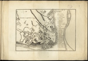
Plan de la ville de Quebec
7.
A plan of Quebec
8.
A plan of Quebec the capital of New France or Canada
9.
Vorstellung einiger Gegenden und Plaetze in Nord-America unter Franzoesisch und Englische Jurisdiction gehoerig
10.
[Bay of Seven Islands]
11.
[Chart of the coast of Quebec from the Riviere St. Jean to Grand Hermine Bay]
12.
[Chart of the gulf and river of St. Lawrence]
13.
An exact chart of the river St. Laurence, from Fort Frontenac to the island of Anticosti shewing the soundings, rocks, shoals...
14.
Pascaerte van Terra Nova Nova Francia Nievw Engeland En de Groote Revier van Canada
15.
[The St. Lawrence River from the Chaudiere River to Pointe aux Coques]
16.
Carte d'un partie de l'Amerique Septentrionale : ou est tracée notre route d'Halifax à New York, par Quebec, Montreal, le Lac...
17.
The coast of New Schotland, New England, the gulph and river of St. Laurence : the islands of New Foundland, Cape Breton, St....
18.
A new and accurate map of the English empire in North America : representing their rightful claim as confirmed by charters, and...
19.
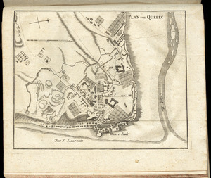
Plan von Quebec
20.
An exact chart of the river St. Laurence, from Fort Frontenac to the island of Anticosti shewing the soundings, rocks, shoals...
‹ Prev
Next ›
1
2
3
4
5
…
408
409


![[Bay of Seven Islands]](https://bpldcassets.blob.core.windows.net/derivatives/images/commonwealth:7h149v48t/image_thumbnail_300.jpg)
![[Chart of the coast of Quebec from the Riviere St. Jean to Grand Hermine Bay]](https://bpldcassets.blob.core.windows.net/derivatives/images/commonwealth:7h149v50v/image_thumbnail_300.jpg)
![[Chart of the gulf and river of St. Lawrence]](https://bpldcassets.blob.core.windows.net/derivatives/images/commonwealth:7h149v39v/image_thumbnail_300.jpg)


![[The St. Lawrence River from the Chaudiere River to Pointe aux Coques]](https://bpldcassets.blob.core.windows.net/derivatives/images/commonwealth:7h149v425/image_thumbnail_300.jpg)