Toggle navigation
LMEC Home
Exhibitions
Georeferencing
Tools for Teachers
Collections
My Favorites
Sign Up / Log In
Search
Search the map portal
Map Collection
Map Collection
Map Sets
Search
Search
Search for
Search In
All Fields
Creator
Title
Subject
Place
Search All Digital Collections
Advanced Search
304 Results
My Search
Start Over
More Like
commonwealth:q524mv49j
Remove constraint More Like: commonwealth:q524mv49j
Filter your Search
Place
North and Central America
234
United States
163
New York
32
Suffolk (county)
31
Boston
29
Canada
27
North America
27
Charleston (county)
10
more
Place
»
Topic
North America--Maps--Early works to 1800
18
Boston (Mass.)--History--Revolution, 1775-1783--Maps--Early works to 1800
16
Vues d'optique
10
Gibraltar--History--Siege, 1779-1783--Maps--Early works to 1800
9
New York (N.Y.)--History--Revolution, 1775-1783--Maps--Early works to 1800
9
New York (N.Y.)--Pictorial works--Early works to 1800
9
United States--History--French and Indian War, 1754-1763--Maps--Early works to 1800
9
United States--Maps--Early works to 1800
9
more
Topic
»
Date
Date range begin
–
Date range end
Current results range from
1740
to
1943
View distribution
Creator
Faden, William, 1749-1836
35
Jefferys, Thomas, -1771
29
Le Rouge, Georges-Louis
23
Des Barres, Joseph F. W. (Joseph Frederick Wallet), 1722-1824
21
Sayer, Robert, 1725-1794
19
Korn, Christoph Heinrich, 1726-1783
11
Raspe, Gabriel Nicolaus, 1712-1785
11
Simcoe, John Graves, 1752-1806
10
more
Creator
»
Format
Maps/Atlases
261
Prints
32
Manuscripts
22
Drawings/Illustrations
9
Books
2
Georeferenced
Yes
13
No
291
Collection
American Revolutionary War-Era Maps
297
Richard H. Brown Revolutionary War Map Collection at Mount Vernon
293
Norman B. Leventhal Map Center Collection
11
Boston and New England Maps
4
Maritime Charts and Atlases
2
Urban Maps
2
Available to use
Creative Commons license
293
No known restrictions
11
Search Constraints
Sort by relevance
relevance
title
date (asc)
date (desc)
Number of results to display per page
20 per page
10
per page
20
per page
50
per page
100
per page
View results as:
grid view
map view
Search Results
1.
Grundriss des nördlichen theils der Neujorks Insel : nebst den am 16. Novbr. 1776. eroberten Fort Washington nun das Fort...
2.
A plan of New York Island, and part of Long Island, with the circumjacent country, as far as Dobbs's Ferry to the north, and...
3.
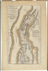
A plan of New York Island, with part of Long Island, Staten Island & east New Jersey, with a particular description of the...
4.
A topographical map of the northn. part of New York Island, exhibiting the plan of Fort Washington, now Fort Knyphausen, with...
5.
B. F. Stevens's facsimile of the unpublished British head quarters coloured manuscript map of New York & environs (1782) :...
6.
Map of military reconnaissance from Fort Taylor to the Coeur d'Alene mission, Washington Territory
7.
Map of military road from Fort Walla Walla on the Columbia to Fort Benton on the Missouri
8.
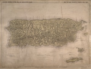
Military map, island of Puerto Rico
9.
Newsmap : week of October 14 to October 21, 215th week of the war, 97th week of U.S. participation. Monday, October 25, 1943
10.
Newsmap : week of December 16 to December 22, 224th week of the war, 106th week of U.S. Participation. Monday, December 27, 1943
11.
Chart and plan of the harbour of New York & the couny. adjacent, from Sandy Hook to Kingsbridge, comprehending the whole of New...
12.
A plan of New York Island, part of Long Island &c. shewing the position of the American and British Armies, before, at, and...
13.
A plan of New York Island, with part of Long Island, Staten Island & east New Jersey, with a particular description of the...
14.
A plan of New York Island, with part of Long Island, Staten Island & east New Jersey, with a particular description of the...
15.
A topographical map of the northn. part of New York Island, exhibiting the plan of Fort Washington, now Fort Knyphausen, with...
16.
[A map of part of Pennsylvania & Maryland intended to shew, at one view, the several places proposed for opening a...
17.
Abriss der stadt Gibraltar und der darinn befindlichen festen platze, nebst dem meerbusen von Algesiras
18.
An accurate map of His Majesty's province of New-Hampshire in New England : taken from actual surveys of all the inhabited...
19.
An accurate map of Staten Island : with that part of New York, Long Island and the Jerseys, which is the rendesvous of the two...
20.
An accurate map of the country round Boston in New England from the best authorities
‹ Prev
Next ›
1
2
3
4
5
…
15
16


![[A map of part of Pennsylvania & Maryland intended to shew, at one view, the several places proposed for opening a communication between the waters of the Delaware & Chesopeak Bays]](https://bpldcassets.blob.core.windows.net/derivatives/images/commonwealth:z603vt12v/image_thumbnail_300.jpg)


