Toggle navigation
LMEC Home
Exhibitions
Georeferencing
Tools for Teachers
Collections
My Favorites
Sign Up / Log In
Search
Search the map portal
Map Collection
Map Collection
Map Sets
Search
Search
Search for
Search In
All Fields
Creator
Title
Subject
Place
Search All Digital Collections
Advanced Search
407 Results
My Search
Start Over
More Like
commonwealth:pz50pg57m
Remove constraint More Like: commonwealth:pz50pg57m
Filter your Search
Place
North and Central America
358
United States
236
North America
68
Canada
59
Ohio
29
New York
23
Pennsylvania
22
Asia
17
more
Place
»
Topic
North America--Maps--Early works to 1800
59
United States--Maps--Early works to 1800
43
Canada--Maps--Early works to 1800
38
Ohio--Maps
28
Great Lakes Region (North America)--Maps--Early works to 1800
12
Pennsylvania--Maps--Early works to 1800
11
Northeastern States--Maps--Early works to 1800
9
United States--Maps
9
more
Topic
»
Date
Date range begin
–
Date range end
Current results range from
1623
to
1999
View distribution
Creator
Jefferys, Thomas, -1771
18
Bellin, Jacques Nicolas, 1703-1772
15
Gibson, J. (John), active 1750-1792
14
Robert Sayer and John Bennett (Firm)
14
Carleton, Osgood, 1742-1816
13
Faden, William, 1749-1836
13
Carey, Mathew, 1760-1839
12
Bowles, Carington, 1724-1793
10
more
Creator
»
Format
Maps/Atlases
405
Manuscripts
3
Paintings
3
Ephemera
1
Objects/Artifacts
1
Prints
1
Georeferenced
Yes
10
No
397
Collection
MacLean Collection Map Library
379
American Revolutionary War-Era Maps
339
Norman B. Leventhal Map & Education Center Collection
19
William L. Clements Library Collection
9
Available to use
No known restrictions
19
Search Constraints
Sort by relevance
relevance
title
date (asc)
date (desc)
Number of results to display per page
20 per page
10
per page
20
per page
50
per page
100
per page
View results as:
grid view
map view
Search Results
161.
Karte derer englischen unternehmungen zur zee aus denen franzosischen kusten ... = Carte des entrep: anglo:ises par mer sur les...
162.
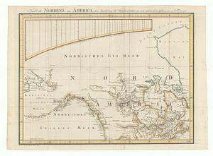
Karte des nordens von America, zur beurtheilung der wahrscheinlichkeit einer north=westlichen durchfahrt
163.
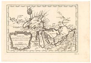
Karte von den seen in Canada zur allgemeinen historie der reisen
164.
Karte von Luisiana, dem laufe des Mississipi und den benachbaerten laendern
165.
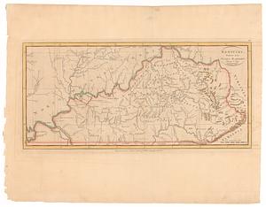
Kentucky, reduced from Elihu Barker's large map
166.
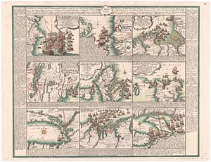
Krigs theatren i America = Seat of war in America
167.
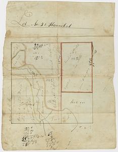
Lot no. 21 Hannibal
168.
A map exhibiting a general view of the roads and inland navigation of Pennsylvania, and part of the adjacent states :...
169.
A map exhibiting a general view of the roads and inland navigation of Pennsylvania, and part of the adjacent states :...
170.
A map, exhibiting a view of the English rights, relative to the ancient limits of Acadia; as supported by express &...
171.
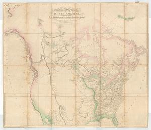
A map exhibiting all the new discoveries, in the interior parts of North America : inscribed by permission to the honorable...
172.
A map exhibiting all the new discoveries in the interior parts of North America inscribed by permission to the honorable...
173.
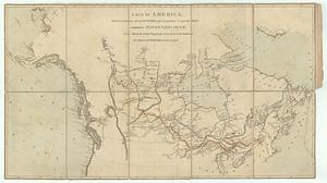
A map exhibiting all the new discoveries in the interior parts of North America inscribed by permission to the honorable...
174.
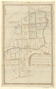
A map of a tract of land granted on the 30th May 1769 to Jacob H. Ten Eyck and three other persons laid into lots
175.
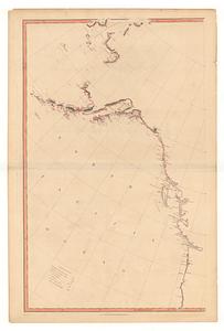
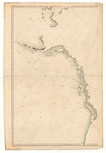
A map of America, between latitudes 40 and 70 north, and longitudes 45 and 180 west : exhibiting Mackenzie's track from...
176.
A map of Canada and the north part of Louisiana with the adjacent countrys
177.
Map of Japan plate
178.
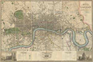
Map of London : from an actual survey made in the years 1824, 1825 & 1826
179.
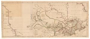
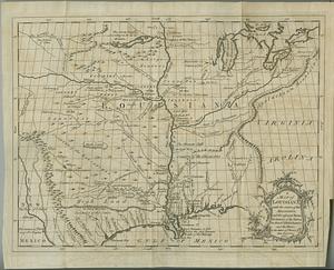
A map of Louisiana with the course of the Missisipi, and the adjacent rivers, the nations of the natives, the French...
180.
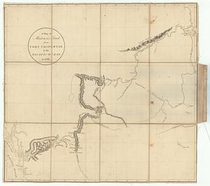
A map of Mackenzie's track, from Fort Chipewyan to Pacific Ocean in 1793
‹ Prev
Next ›
1
2
…
5
6
7
8
9
10
11
12
13
…
20
21