Toggle navigation
LMEC Home
Exhibitions
Georeferencing
Tools for Teachers
Collections
My Favorites
Sign Up / Log In
Search
Search the map portal
Map Collection
Map Collection
Map Sets
Search
Search
Search for
Search In
All Fields
Creator
Title
Subject
Place
Search All Digital Collections
Advanced Search
237 Results
My Search
Start Over
More Like
commonwealth:p8418t692
Remove constraint More Like: commonwealth:p8418t692
Filter your Search
Place
North America
170
North and Central America
82
United States
49
Canada
35
Atlantic Ocean
13
New York
13
Louisbourg
11
Nova Scotia
9
more
Place
»
Topic
North America--Maps--Early works to 1800
180
Great Britain--Colonies--America--Maps--Early works to 1800
15
United States--History--French and Indian War, 1754-1763--Maps--Early works to 1800
15
United States--Maps--Early works to 1800
14
Atlantic Ocean--Maps
11
Canada--Maps--Early works to 1800
11
British--America--Maps--Early works to 1800
10
South America--Maps--Early works to 1800
8
more
Topic
»
Date
Date range begin
–
Date range end
Current results range from
1528
to
1990
View distribution
Creator
Jefferys, Thomas, -1771
16
Sayer, Robert, 1725-1794
16
Mitchell, John, 1711-1768
13
Moll, Herman, d. 1732
11
Anville, Jean Baptiste Bourguignon d', 1697-1782
8
Kitchin, Thomas, 1718-1784
6
Gibson, J. (John), active 1750-1792
5
Hinton, John, -1781
5
more
Creator
»
Format
Maps/Atlases
237
Manuscripts
15
Georeferenced
Yes
5
No
232
Collection
American Revolutionary War-Era Maps
170
Norman B. Leventhal Map Center Collection
127
New York Public Library Collection
32
Richard H. Brown Revolutionary War Map Collection at Mount Vernon
28
New-York Historical Society Collection
24
Mapping Boston Collection
9
Sidney R. Knafel Map Collection at Phillips Academy
9
William L. Clements Library Collection
5
more
Collection
»
Available to use
No known restrictions
142
Creative Commons license
75
Search Constraints
Sort by relevance
relevance
title
date (asc)
date (desc)
Number of results to display per page
100 per page
10
per page
20
per page
50
per page
100
per page
View results as:
grid view
map view
Search Results
1.
Vorstellung einiger Gegenden und Plaetze in Nord-America unter Franzoesisch und Englische Jurisdiction gehoerig
2.
A general map of North America : in which is express'd the several new roads, forts, engagements, &c, taken from actual surveys...
3.
A general map of North America : in which is express'd the several new roads, forts, engagements, &c, taken from actual surveys...
4.
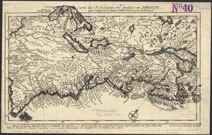
Theodolite's pattern, shewing the provinces in North America which were in the respective possessions of England, France &...
5.
A map of the British and French dominions in North America : with the roads, distances, limits, and extent of the settlements,...
6.
A new and correct map of North America, with the West India islands, divided according to the preliminary articles of peace,...
7.
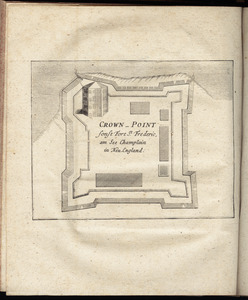
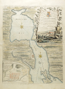
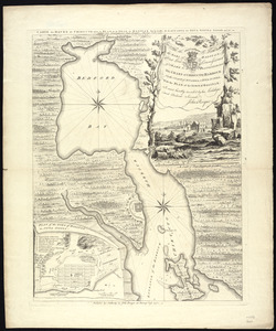
Crown Point : sonst Fort St. Frederic, am See Champlain in Neu England
8.
Amerique Septentrionale : Acadie ou Nouvelle Ecosse aux anglois : Annapolis Royal
9.
Carte du havre de Chibucto avec le plan de la ville de Halifax sur la coste de l'Accadia ou Nova Scotia latitude 44° 31ʹ
10.
Plans des isles, rades, et ports de plusieurs lieux de l'Amérique : tirés de la Carte angloise de Mr. Popple publiée en 1733...
11.
Port Royal appellé aujourd. par les Anglois Annapolis Royal
12.
To the rt. honble. the Earl of Halifax, first lord commissioner of trade & plantations, &c &c this chart of Chibucto Harbour,...
13.
Particular draughts and plans of some of the principal towns and harbours belonging to the English, French, and Spaniards, in...
14.
Plan du port et de la ville de Louisbourg : avec ses batteries et sa perspective, où est réprésenté les batteries faites...
15.
A Plan of the city & fortifications of Louisburg
16.
A plan of the city, and fortifications, of Louisburg
17.
A plan of the city, and fortifications, of Louisburg : from a survey made by Richard Gridley, Lieut. Coll. of the Train of...
18.
Amerique Septentrionale
19.
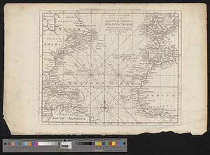
A chart of the gulf stream
20.
[Chart of the Gulf Stream]
21.
Map of the powers at war with Great Britain, 1783
22.
Map of the United States of America, the British provinces, Mexico, the West Indies and Central America, with part of New...
23.
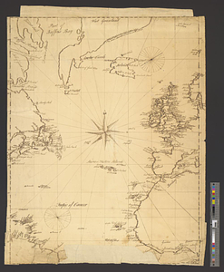
Naval chart of the Pacific and western Atlantic
24.
A new & accurate chart of the western or Atlantic Ocean : drawn from the most approved modern map &c.
25.
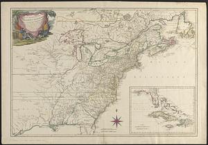
A new and accurate map of the English empire in North America : representing their rightful claim as confirm'd by charters, and...
26.
North Atlantic Ocean, ca. 1785
27.
Track of the U.S. surveying brig Dolphin : from September 1851 to July 1852 : [Atlantic Ocean]
28.
Triangles on Mercator projection between St. Augustine and Cape Breton and St. Augustine and Cape Ortegal
29.
Carte topographique du port et de la ville de Louisbourg, assiegé par les Anglais pendant les mois de Juin, Juillet 1758
30.
A correct plan of the environs of Quebec, and of the battle fought on the 13th September, 1759 : together with a particular...
31.
A map of the country between Will's Creek & Monongahela River shewing the rout and encampments of the English army in 1755
32.
A map of the country between Will's Creek & Monongahela River shewing the rout and encampments of the English army in 1755
33.
A map of the several dispositions of the English Fleet & Army on the River St. Laurence to the taking of Quebec
34.
A new and accurate map of the English empire in North America : representing their rightful claim as confirmed by charters, and...
35.
A new and accurate map of the present war in North America
36.
Plan de la ville de Louisbourg avec les ouvrages d'attaque des Anglais pour sa reddition, ainsi que ceux des assiegés pr. la...
37.
Plan du fort et ville de Louisbourg dans l'Isle Roale
38.
Plan du port et de la ville de Louisbourg en l'Isle Royale, et des attaques faites par les Anglois pendant le siége dépuis le...
39.
A plan of the field of battle and disposition of the troops, as they were on the march at the time of the attack on the 9th of...
40.
A plan of the field of battle and disposition of the troops, as they were on the march at the time of the attack on the 9th of...
41.
[A map of the east coast of America from Newfoundland to the Bay of Honduras]
42.
An accurate map of North America : Describing and distinguishing the British and Spanish dominions of this great continent;...
43.
An accurate map of North America : describing and distinguishing the British and Spanish dominions on this great continent :...
44.
An accurate map of North America : describing and distinguishing the British and Spanish dominions on this great continent :...
45.
An accurate map of North America : describing and distinguishing the British and Spanish dominions of this great continent;...
46.
An accurate map of North America : describing and distinguishing the British, Spanish and French dominions on this great...
47.
An accurate map of the British Empire in Nth. America as settled by the preliminaries in 1762
48.
An accurate map of the British, French & Spanish settlements in Nth. America and the West Indies : as stipulated by the...
49.
An Accurate map of the present seat of war between Great-Britain and her colonies in North America
50.
Acurate charte von Nord-America : aus dem besten quellen
51.
America : with those known parts in that unknowne worlde both people and manner of buildings discribed and inlarged
52.
America septentrionalis
53.
America Septentrionalis : concinnata juxta observationes Dnn Academiae Regalis Scientiarum et nonnullorum aliorum, et juxta...
54.
America Septentrionalis
55.
America Septentrionalis a Domino d'Anville in Galliis edita nunc in Anglia : Coloniis in interiorem Virginiam deductis nec non...
56.
America Settentrionale : colle nuove scoperte fin alle' anno 1688 divisa nelle sue partu secondo lo stato presente
57.
America settentrionale divisa ne' suoi principali stati
58.
America sive novvs orbis respectv Evropaeorvm inferior globi terrestris pars
59.
America sive novvs orbis respectv Evropaeorvm inferior globi terrestris pars
60.
Americae pars Borealis, Florida, Baccalaos, Canada, Corterealis
61.
L'Amerique divisée en septentrionale et méridionale, subdivisée en ses principales parties, dressée sur les relations les...
62.
L'Amérique septentrionale
63.
Amérique Septentrionale
64.
Amérique Septentrionale
65.
Amérique Septentrionale : dressée sur les relations les plus modernes des voyageurs et navigateurs, et divisée suivant les...
66.
Amérique septentrionale
67.
L'Amerique septentrionale
68.
L'Amérique Septentrionale
69.
[Amerique septentrionale]
70.
Amérique septentrionale avec les routes, distances en miles, limites et etablissements françois et anglois
71.
Amérique septentrionale avec les routes, distances en miles, villages, et etablissements François et Anglois
72.
Amerique septentrionale divisée en ses principale parties
73.
Amerique septentrionale divisée en ses principales parties
74.
Amerique septentrionale divisée en ses principales parties : ou sont distingués les uns des autres les etats suivant quils...
75.
Amerique Septentrionale divisée en ses principales parties, ou sont distingués les vns des autres les estats suivant qu'il...
76.
L'Amérique Septentrionale divisée en ses principaux états
77.
Amérique Septentrionale dressée sur les relations les plus modernes des voyageurs et navigateurs, ou se remarquent les Etats...
78.
L'Amerique Septentrionale, ou se remarquent les Etats Unis
79.
Bowles's new and accurate map of North America and the West Indies : exhibiting the extent and boundaries of the United States,...
80.
BOWLES'S NEW POCKET MAP OF THE UNITED STATES OF AMERICA : WITH THE BRITISH POSSESSIONS OF CANADA, NOVA SCOTIA, AND OF...
81.
British colonies in North America : drawn from the best authorities
82.
British dominions in America, drawn from the latest and best authorities
83.
Le Canada, ou Nouvelle France, &c : ce qui est le plus advance vers le Septentrion est tiré de diverses relations des Anglois,...
84.
Le Canada, ou Nouvelle France, la Floride, la Virginie, Pensilvanie, Caroline, Nouvelle Angleterre et Nouvelle Yorck, l'Isle de...
85.
Carte de la Louisiane et des pays voisins : dédiée à M. Rouillé, sécretaire d'État, ayant le Département de la marine
86.
Carte de la Louisiane et des pays voisins dédiée à M. Rouillé sécretaire d'état, ayant le Département de la marine
87.
Carte de la Nouuelle France, augmentée depuis la derniere, seruant a la navigation faicte en son vray Meridien
88.
Carte de la Nouuelle France et de la Louisiane nouuellement découuerte : dediée au Roy l'an 1683
89.
Carte de l'Amérique septentrionale, 1754
90.
Carte de l'Amérique septentrionale, depuis la baye d'Hudson jusqu'au Mississipi : pour servir aux essais historiques et...
91.
Carte de l'Amérique Septle. pour servir à l'intelligence de la guerre entre les Anglois et les insurgents
92.
Carte des possessions angloises & françoises du continent de l'Amérique septentrionale = Kaart van de Engelsche en Fransche...
93.
Carte des possessions angloises dans l'Amerique Septentrionale pour servir d'intelligence à la guerre presente traduite de...
94.
Carte des possessions des Anglois en Amerique, par rapport à leurs differends avec la France
95.
Carte detaillée des possessions angloises dans l'Amerique Septentrionale : construite d'après les dernieres relations et les...
96.
Carte du Mexique et de la Florida : des terres angloises et des Isles Antilles, du cours et des environs de la Riviere de...
97.
Carte d'un partie de l'Amerique Septentrionale : ou est tracée notre route d'Halifax à New York, par Quebec, Montreal, le Lac...
98.
Carte d'une partie de l'Amérique Septentrionale
99.
Carte d'une partie de l'Amérique Septentrionale pour servir à l'intelligence du mémoire sur les prétentions des Anglois au...
100.
Carte générale de l'Amérique séptentrionale : avec les posséssions Angloises dans cette partie du nouveau monde
‹ Prev
Next ›
1
2
3


![[Chart of the Gulf Stream]](https://bpldcassets.blob.core.windows.net/derivatives/images/commonwealth:z603vr47j/image_thumbnail_300.jpg)


![[A map of the east coast of America from Newfoundland to the Bay of Honduras]](https://bpldcassets.blob.core.windows.net/derivatives/images/commonwealth:hx11z584h/image_thumbnail_300.jpg)


![[Amerique septentrionale]](https://bpldcassets.blob.core.windows.net/derivatives/images/commonwealth:8336h2955/image_thumbnail_300.jpg)