Toggle navigation
LMEC Home
Exhibitions
Georeferencing
Tools for Teachers
Collections
My Favorites
Sign Up / Log In
Search
Search the map portal
Map Collection
Map Collection
Map Sets
Search
Search
Search for
Search In
All Fields
Creator
Title
Subject
Place
Search All Digital Collections
Advanced Search
120 Results
My Search
Start Over
More Like
commonwealth:p8418t67h
Remove constraint More Like: commonwealth:p8418t67h
Filter your Search
Place
North and Central America
80
United States
78
Northeastern United States
32
Canada
21
New York
17
North America
15
New England
11
Middle Atlantic
7
more
Place
»
Topic
United States--Maps--Early works to 1800
60
Northeastern States--Maps--Early works to 1800
37
North America--Maps--Early works to 1800
15
Canada--Maps--Early works to 1800
14
New England--Maps--Early works to 1800
12
United States--History--Revolution, 1775-1783--Maps--Early works to 1800
9
Middle Atlantic States--Maps--Early works to 1800
7
New York (State)--Maps--Early works to 1800
7
more
Topic
»
Date
Date range begin
–
Date range end
Current results range from
1635
to
1830
View distribution
Creator
Faden, William, 1749-1836
7
Bellin, Jacques Nicolas, 1703-1772
5
Evans, Lewis, 1700?-1756
5
Pownall, Thomas, 1722-1805
5
Robert Sayer and John Bennett (Firm)
5
Denis, Louis, 1725-1794
4
Sauthier, Claude Joseph
4
Basset (Firm)
3
more
Creator
»
Format
Maps/Atlases
120
Manuscripts
10
Georeferenced
Yes
5
No
115
Collection
American Revolutionary War-Era Maps
98
Norman B. Leventhal Map Center Collection
52
New York Public Library Collection
25
New-York Historical Society Collection
24
Richard H. Brown Revolutionary War Map Collection at Mount Vernon
13
Mapping Boston Collection
8
Maritime Charts and Atlases
3
Sidney R. Knafel Map Collection at Phillips Academy
3
more
Collection
»
Available to use
No known restrictions
68
Creative Commons license
48
Search Constraints
Sort by relevance
relevance
title
date (asc)
date (desc)
Number of results to display per page
100 per page
10
per page
20
per page
50
per page
100
per page
View results as:
grid view
map view
Search Results
1.
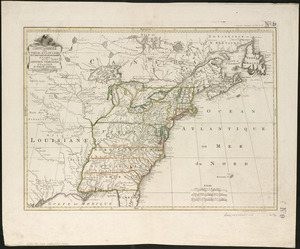
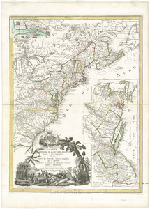
The United States of America laid down from the best authorities, agreeable to the Peace of 1783
2.
A map of the British and French dominions in North America : with the roads, distances, limits, and extent of the settlements,...
3.
A new and correct map of North America, with the West India islands, divided according to the preliminary articles of peace,...
4.
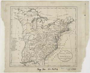
The United States of America laid down from the best authorities, agreeable to the Peace of 1783
5.
Carte du theatre de la guerre presente en Amerique
6.
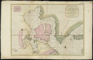
Carte particuliere de l'Amerique septentrionale ou sont compris le Destroit de Davids, le Destroit de Hudson, &c
7.
Carta della Nuova Inghilterra, Nuova Yorc, e Pensilvania
8.
Carte de la Nouvelle Angleterre, New York, Pensilvanie et Nouveau Jersay suivant les cartes angloises
9.
Carte de la partie nord, des Etats Unis, de l'Amérique Septentrionale
10.
Carte des Etats-unis : provinces septentrionales
11.
Carte du théatre de la guerre entre les Anglais et les Américains
12.
Carte du théatre de la guerre entre les Anglais et les Américains
13.
Carte d'une partie du Nord Amerique dans la quelle se trouvent les isles et les provinces suivantes : l'Isle de la Terre-Neuve...
14.
Carte reduite des costes orientales de l'Amerique septentrionale : 1re. feuille contenant L'Isle Royale, L'Accadie, La Baye...
15.
A chart of the sea coast of New Foundland, New Scotland, New England, New York, New Jersey, with Virginia and Maryland
16.
A general map of the middle British colonies in America : Viz. Virginia, Maryland, Delaware, Pensilvania, New-Jersey, New-York,...
17.
A general map of the middle British colonies in America : viz. Virginia, Maryland, Delaware, Pensilvania, New-Jersey, New-York,...
18.
A general map of the middle British colonies in America, viz. Virginia, Maryland, Delaware, Pensilvania, New-Jersey, New York,...
19.
[Globe gore featuring North American coastline]
20.
Karte von Neu England, Neu Yorck und Pensilvanien : sur Allgemeinen historie der reisen
21.
A large draught of New England, New York and Long Island
22.
A map of the middle British colonies in North America : first published by Mr. Lewis Evans, of Philadelphia, in 1755; and since...
23.
A map of the middle British colonies in North America : first published by Mr. Lewis Evans, of Philadelphia, in 1755; and since...
24.
Map of the middle states of America : drawn from the latest and best authorities
25.
Map of the northern provinces of the United States
26.
A map of the Province of New York, with part of Pensilvania, and New England : from an actual survey by Captain Montresor,...
27.
A map of the Province of New York, with part of Pensilvania, and New England : from an actual survey by Captain Montresor,...
28.
A map of the Province of New-York : reduc'd from the large drawing of that province, compiled from actual surveys by order of...
29.
A map of the provinces of New-York and New Jersey, with a part of Pennsylvania and the Province of Quebec
30.
Mappa geographica Provinciæ Nova Eboraci ab Anglis New-York : dictæ ex ampliori delineatione ad exactas dimensiones concinnata...
31.
A new and accurate map of New Jersey, Pensilvania, New York and New England : with the adjacent countries. Drawn from surveys,...
32.
A New and correct map of the British colonies in North America comprehending eastern Canada with the province of Quebec, New...
33.
New Engelland, New York, New Yersey und Pensilvania
34.
A new map of New England, New York, New Iarsey, Pensilvania, Maryland and Virginia
35.
Noui Belgii Nouaeque Angliae nec non partis Virginiae tabula
36.
Nova Anglia Septentrionali Americae implantata Anglorumque coloniis florentissima geographicè exhibita
37.
Nova Belgica et Anglia Nova
38.
Novi Belgii Novaeqve Angliae nec non partis Virginiae Tabula
39.
Part of North America : comprehending the course of Ohio, New England, New York, New Jersey, Pennsylvania, Maryland, Virginia,...
40.
Partie occidentale de la Virginie, Pensylvanie, Maryland, et Caroline septle. la Rivière d'Ohio, et toutes celles qui s'y...
41.
Pas caert van Nieu Nederland, Virginia en Nieu Engelant
42.
Pas-caert van Nieu Nederland, Virginia, Nieu Engeland als mede Penn-silvania, met de stad Philadelfia van Baston tot Carrik = a...
43.
The provinces of New York and New Jersey : with part of Pensilvania, and the Province of Quebec
44.
An accurate map of the English colonies in North America, bordering on the river Ohio
45.
An accurate map of the United States of America : according to the Treaty of Peace of 1783
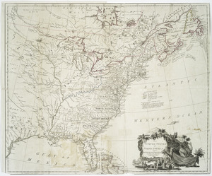
46.
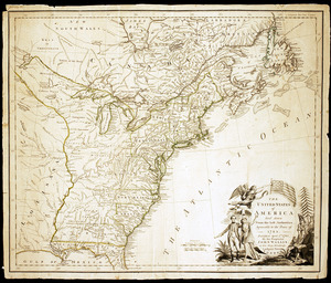
An accurate map of the United States of America, with part of the surrounding provinces agreeable to the Treaty of Peace of 1783
47.
L'Amerique Septentrionale, ou se remarquent les Etats Unis
48.
Amplissimae regionis Mississipi seu provinciae Ludovicianae â R.P. Ludovico Hennepin Francisc. Miss. in America septentrionali...
49.
Amplissimae regionis Mississipi seu Provinciae Ludovicianae â R.P. Ludovico Hennepin Francisc Miss in America Septentrionali...
50.
Bowles's new one-sheet map of the independent states of Virginia, Maryland, Delaware, Pensylvania, New Jersey, New York,...
51.
BOWLES'S NEW POCKET MAP OF THE UNITED STATES OF AMERICA : WITH THE BRITISH POSSESSIONS OF CANADA, NOVA SCOTIA, AND OF...
52.
British dominions in America, drawn from the latest and best authorities
53.
Carta della Nuova Inghilterra, Nuova Iork, e Pensilvania
54.
Carte de la Louisiane cours du Mississipi et pais voisins : dediée à M. le Comte de Maurepas, ministre et secretaire d'etat...
55.
Carte de la Louisiane et du cours de Mississipi
56.
Carte de la Louisiane et du cours du Mississipi avec les colonies anglaises
57.
Carte du Canada et des Etats-Unis de l'Amérique Septentrionale
58.
Carte du Mexique et des Etats Unis d'Amérique, partie meridionale
59.
Carte du theatre de la guerre presente en Amerique
60.
Carte du theatre de la guerre presente en Amerique
61.
Carte d'une partie de l'Amérique Septentrionale pour servir à l'intelligence du mémoire sur les prétentions des Anglois au...
62.
Carte generale des colonies angloises dans l'Amerique Septentrionale pour l'intelligence de la guerre presente : d'apres des...
63.
Carte générale des Etats Unis de l'Amérique Septentrionale : renfermant aussi quelques provinces Angloises adjacentes
64.
Carte génerale des Etats-Unis de l'Amérique Septentrionale : divisée en ses 17 provinces
65.
Carte generale des treize Etats Unis, de l'Amerique septentrionale
66.
Carte generale des treize Etats Unis, de l'Amerique septentrionale = Kaart van de dertien Verénigde Staaten, in Noord Amerika
67.
Carte minéralogique, où l'on voit la nature des terreins du Canada et de la Louisiane
68.
Carte nouvelle de l'Amérique Angloise contenant tout ce que les Anglois possédent sur le continent de l'Amérique...
69.
Carte réduite du nord des Etat-Unis avec l'intérieur du pays : pour servir à l'intelligence de cette histoire ; copieé par...
70.
Charte über die XIII Vereinigte Staaten von Nord-America
71.
A general map of the middle British colonies, in America : viz Virginia, Màriland, Dèlaware, Pensilvania, New-Jersey,...
72.
Map for the interior travels through America : delineating the march of the army
73.
A map of Canada and the north part of Louisiana with the adjacent countrys
74.
A map of Carolana and of the river Meschacebe &c
75.
A Map of the British American plantations, extending from Boston in New England to Georgia : including all the back settlements...
76.
A map of the northern and middle states : comprehending the western territory & the British dominions in North America : from...
77.
Map of the United States exhibiting the post-roads, the situations, connections & distances of the post-offices, stage roads,...
78.
Map of the United States in North America : with the British, French and Spanish dominions adjoining, according to the treaty...
79.
A map of the United States of America, as settled by the peace of 1783
80.
A map of the United States of N. America
81.
A map of the United States of North America : drawn from a number of critical researches
82.
A new and correct map of North America : in which the places of the principal engagements during the present war are accurately...
83.
A new and correct map of North America : in which the places of the principal engagements during the present war are accurately...
84.
A new and correct map of North America with the West India Islands : divided according to the last treaty of peace, concluded...
85.
A new map of North America
86.
A New map of North America with the West India Islands : divided according to the preliminary articles of peace, signed at...
87.
A new map of the United States of North America with the British dominions on that continent &c
88.
Partie de l'Amérique septentrionale, qui comprend le cours de l'Ohio, la Nlle. Angleterre, la Nlle York, le New Jersey, la...
89.
Partie septentrionale des possessions angloise en Amérique : pour servire d'intelligence à la guerre présente entre les...
90.
Schauplatz des Kriegs zwischen Engelland und seinen Collonien in America
91.
States of America, drawn from the best authorities
92.
The United States of America, according to the Treaty of Peace of 1784
93.
The United States of America with the British possessions of Canada, Nova Scotia, & of Newfoundland, divided with the French :...
94.
The United States of America with the British possessions of Canada, Nova Scotia, & of Newfoundland, divided with the French :...
95.
The United States of America with the British possessions of Canada, Nova Scotia, New Brunswick and Newfoundland divided with...
96.
The United States of North America : with the British & Spanish territories according to the treaty
97.
The United States of North America : with the British territories and those of Spain according to the treaty of 1784
98.
The United States of North America, with the British & Spanish territories according to the treaty
99.
The United States of North America, with the British & Spanish territories according to the treaty
100.
The Country twenty five miles round New York
‹ Prev
Next ›
1
2


![[Globe gore featuring North American coastline]](https://bpldcassets.blob.core.windows.net/derivatives/images/commonwealth:qb98n804g/image_thumbnail_300.jpg)