Toggle navigation
LMEC Home
Exhibitions
Georeferencing
Tools for Teachers
Collections
My Favorites
Sign Up / Log In
Search
Search the map portal
Map Collection
Map Collection
Map Sets
Search
Search
Search for
Search In
All Fields
Creator
Title
Subject
Place
Search All Digital Collections
Advanced Search
85 Results
My Search
Start Over
More Like
commonwealth:p8418t535
Remove constraint More Like: commonwealth:p8418t535
Filter your Search
Place
United States
83
North and Central America
82
New York
67
Manhattan
27
Brooklyn (borough)
6
New Jersey
5
Westchester (county)
5
Boston
4
more
Place
»
Topic
New York (N.Y.)--Maps
48
Manhattan (New York, N.Y.)--Maps
25
Real property--New York (State)--New York--Maps
10
United States--History--Revolution, 1775-1783--Maps
10
Brooklyn (New York, N.Y.)--Maps
7
Railroads--New York (State)--New York--Maps
7
Buildings--New York (State)--New York--Maps
6
Landforms--New York (State)--Maps
6
more
Topic
»
Date
Date range begin
–
Date range end
Current results range from
1755
to
1932
View distribution
Creator
Hayward, George, approximately 1800-
4
Dripps, M. (Matthew)
3
Erskine, Robert, 1735-1780
3
Faden, William, 1749-1836
3
Robert Sayer and John Bennett (Firm)
3
De Brahm, Ferdinand Joseph Sebastian
2
De Witt, Simeon, 1756-1834
2
G.W. & C.B. Colton & Co
2
more
Creator
»
Format
Maps/Atlases
85
Manuscripts
9
Georeferenced
Yes
10
No
75
Collection
American Revolutionary War-Era Maps
45
Norman B. Leventhal Map & Education Center Collection
39
Urban Maps
29
New-York Historical Society Collection
24
William L. Clements Library Collection
15
Maps from AAS
4
New York Public Library Collection
2
MacLean Collection Map Library
1
Available to use
No known restrictions
63
Creative Commons license
2
Search Constraints
Sort by relevance
relevance
title
date (asc)
date (desc)
Number of results to display per page
20 per page
10
per page
20
per page
50
per page
100
per page
View results as:
grid view
map view
Search Results
61.
The strangers mercantile guide map of the cities of New York, Brooklyn, Jersey City, Hoboken, etc
62.
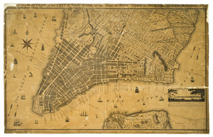
Topographical map of the City and County of New-York, and the adjacent country : with views in the border of the principal...
63.
Various plans and draughts of cities, towns, harbours &c. drawn from the latest authorities
64.
Ville de Manathe ou Nouvelle-Yorc
65.
The Country twenty five miles round New York
66.
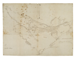
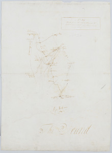
Cross Roads to East Chester, and above : no 19
67.
A general map of the middle British colonies, in America : viz Virginia, Màriland, Dèlaware, Pensilvania, New-Jersey, New-York,...
68.
A map of the British and French dominions in North America : with the roads, distances, limits, and extent of the settlements,...
69.
A map of the state of New York
70.
A new & accurate plan of the city of New York in the state of New York in North America
71.
A new and accurate map of the English empire in North America : representing their rightful claim as confirm'd by charters, and...
72.
A new and correct map of North America, with the West India islands, divided according to the preliminary articles of peace,...
73.
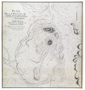
Plan de la position de l'armée sous les ordre de son Excellence le Lieutenant General Bourgoyne à Saratoga etant sur la...
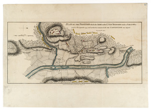
74.
Plan of Niagara with the adjacent country surrendered to the English army under the command of Sr. Willm: Johnson Bart: on the...
75.
Plan of the battle of Monmouth, 28th of June, 78
76.
A plan of the entrance of Chesapeak Bay, with James and York Rivers : wherein are shown the respective positions (in the...
77.
A plan of the operations of the King's army under the command of General Sr. William Howe, K.B. in New York and east New...
78.
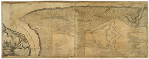
Plan of the position which the army under Lt. Genl. Burgoine took at Saratoga on the 10th of September, 1777, and in which it...
79.
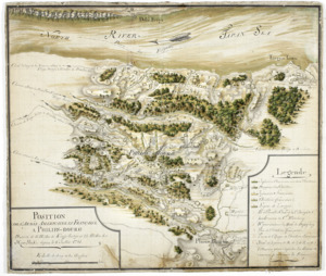
Position de 'larmee Américane et Française a Philips-bourg : distante de 12 milles de Kings-bridge et 25 milles de New-York,...
80.
Road from the White Plains to Bloomer's Mill at Rye Neck, and Cross Roads : no 20
‹ Prev
Next ›
1
2
3
4
5