Toggle navigation
LMEC Home
Exhibitions
Georeferencing
Tools for Teachers
Collections
My Favorites
Sign Up / Log In
Search
Search the map portal
Map Collection
Map Collection
Map Sets
Search
Search
Search for
Search In
All Fields
Creator
Title
Subject
Place
Search All Digital Collections
Advanced Search
8195 Results
My Search
Start Over
More Like
commonwealth:js956m38f
Remove constraint More Like: commonwealth:js956m38f
Filter your Search
Place
North and Central America
4,912
United States
3,602
Suffolk (county)
1,026
Boston
999
Europe
964
Canada
427
France
269
Massachusetts
249
more
Place
»
Topic
Boston (Mass.)--Maps
574
United States--Maps
270
Real property--Massachusetts--Boston--Maps
174
Massachusetts--Maps
160
Landowners--Massachusetts--Boston--Maps
132
North America--Maps--Early works to 1800
103
New England--Maps
99
Europe--Maps
79
more
Topic
»
Date
Date range begin
–
Date range end
Current results range from
1482
to
2023
View distribution
Creator
United States. Hydrographic Office
357
O.H. Bailey & Co
148
Des Barres, Joseph F. W. (Joseph Frederick Wallet), 1722-1824
123
United States. Post Office Dept
120
Ptolemy, 2nd cent
100
Walling, Henry Francis, 1825-1888
94
Jefferys, Thomas, -1771
84
Geological Survey (U.S.)
82
more
Creator
»
Format
Maps/Atlases
8,136
Manuscripts
215
Prints
51
Books
36
Objects/Artifacts
10
Drawings/Illustrations
8
Posters
4
Georeferenced
Yes
869
No
7,326
Collection
Norman B. Leventhal Map Center Collection
8,182
Boston and New England Maps
2,184
Urban Maps
1,925
Maritime Charts and Atlases
750
American Revolutionary War-Era Maps
616
Boston Redevelopment Authority Collection
86
Mapping Boston Collection
19
Sidney R. Knafel Map Collection at Phillips Academy
13
Available to use
No known restrictions
8,022
Creative Commons license
65
Search Constraints
Sort by relevance
relevance
title
date (asc)
date (desc)
Number of results to display per page
100 per page
10
per page
20
per page
50
per page
100
per page
View results as:
grid view
map view
Search Results
7401.
Tabula moder. Gronlandiae et Russiae
7402.
Tabula moder. Indiae Orientalis
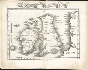
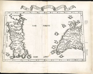
7403.
Tabula moderna Hiber
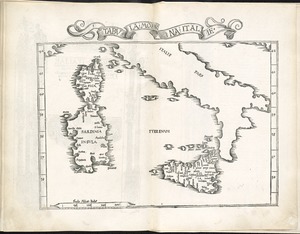
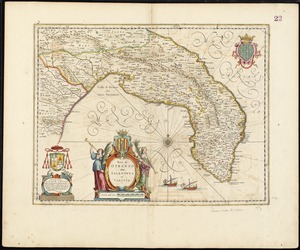
7404.
Tabula moderna Italie
7405.
Tabula novissima atque accuratissima Caraibicarum insularum sive Cannibalum : quae etiam Antillae Gallicae dicuntur, item...
7406.
Tabula Russia vulgo Moscovia
7407.
Tabula Tartariae et majoris partis Regni Chinae
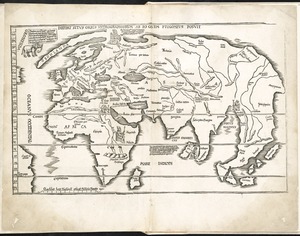
7408.
Tabula V Asiae
7409.
Tabula V Europae
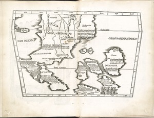
7410.
Tabula VI Asiae
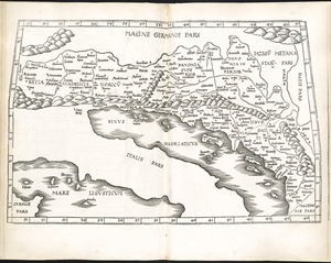
7411.
Tabula VI Europae
7412.
Tabula VII Asiae
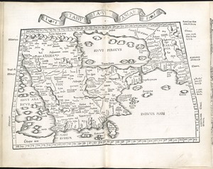
7413.
Tabula VII Europae
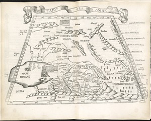
7414.
Tabula VIII Asiae
7415.
Tabula VIII Europae
7416.
Tabula X Asiae
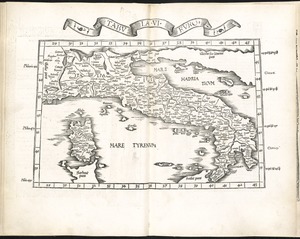
7417.
Tabula X Europae
7418.
Tabula XI Asiae
7419.
Tabula XII Asiae
7420.
Tabulae maximae quibus illustrantur terrae veterum in usum scholarum
7421.
Tabulae maximae quibus illustrantur terrae veterum in usum scholarum
7422.
Tabulae maximae quibus illustrantur terrae veterum in usum scholarum
7423.
Tabulae maximae quibus illustrantur terrae veterum in usum scholarum
7424.
Tackabury's map of United States
7425.
Tactical pilotage chart, TPC
7426.
Tanger
7427.
Taputeouea or Drummond's Island, Kingsmill Group ; Peacock's anchorage at Drummond's Island, Kingsmill Group
7428.
Taputeouea or Drummond's Island, Kingsmill Group ; Peacock's anchorage at Drummond's Island, Kingsmill Group
7429.
Taunton
7430.
Taunton River : drainage area 450 sq. miles
7431.
Tax parcels that would have been underwater in 1630
7432.
Tayabas (northern part)
7433.
Tayabas (southern part)
7434.
Taylor Co., West Va
7435.
Taylor County, Wis.
7436.
Teâtre de la guerre en Amerique telle que'elle est à present possedée par les Espagnols, Anglois, François, et Hollandois...
7437.
Telegraph and rail road map of the New England states
7438.
Telegraph chart
7439.
Temperature chart of the United States : showing the distribution by isothermal curves of the mean annual temperature of the...
7440.
Ten miles around Lynn
7441.
Tennassee : lately the S. Wn. Territory
7442.
Tennessee River basin
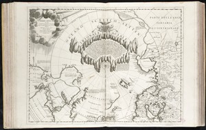
7443.
Tercia Europe tabula continet Gallia
7444.
Terra di Bari et Basilicata
7445.
La Terra di Lavoro ed I principati citeriore ulteriore
7446.
Terra di Lavoro, olim Campania felix
7447.
Terra di Otranto olim Salentina et Iapigia
7448.
Terra Firma and the Caribbé Islands &c
7449.
Terra firma et novum regnum Granatense et Popayan
7450.
Terra firma et novum regnum Granatense et Popayan
7451.
Terra Firma et novum regnum Granatense et Popayan
7452.
Terra Firma et Novum regnum Granatense et Popayan
7453.
Terra nova, ac maris tractus circa Novam Franciam, Angliam, Belgium, Venezuelam Novam, Andalusiam, Guianan, et Brasiliam =...
7454.
Terre Artiche
7455.
Terre ferme ou sont les governations ou gouvernemens de Terre ferme, Cartagene Ste. Marthe, Rio de la Hache, Venezuela,...
7456.
Territorial acquisitions, 1783-1853
7457.
Territories of New Mexico & Arizona
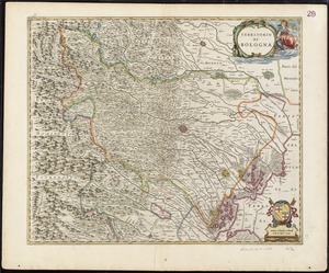
7458.
Territorio di Bologna
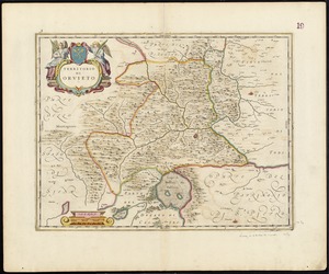
7459.
Territorio di Orvieto
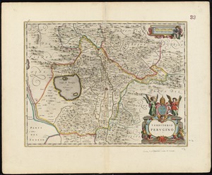
7460.
Territorio Perugino
7461.
Territorium Metense = Le pais Messin
7462.
Territorium Metense = Le pais Messin
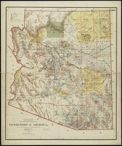
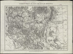
7463.
Territory of Arizona
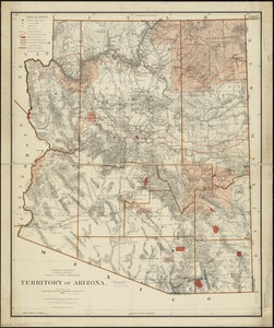
7464.
Territory of Arizona
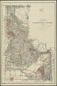
7465.
Territory of Idaho
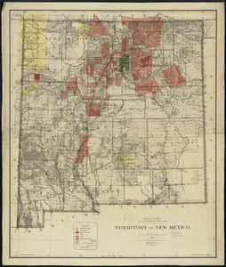
7466.
Territory of New Mexico
7467.
Territory of New Mexico
7468.
Territory of Utah
7469.
Territory of Utah
7470.
Territory of Wyoming
7471.
The territory over possession of which France and England are disputing
7472.
Tertia Affrice tabula continet Cyrenainaycam & Egyptum cum adiacentibus insulis
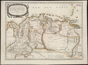
7473.
Tertia Africae tabula
7474.
Tertia Asiae tabula
7475.
Tertia Asie tabula continet Colchide, Iberia, Albania :& maiorem Armenia
7476.
Tertia Europae tabula
7477.
Teton National Forest, Wyoming
7478.
Tetrachia Ducatus Geldriae Neomagensis
7479.
Tetrachia ducatus Geldriae Ruremondana sive Hispanica
7480.
A Texan's map of the United States [of Texas]
7481.
Texas and Pacific Rail Way
7482.
Texas New Yorker travelers' railroad map of the State of Texas
7483.
Texas New Yorker's railroad map of Texas : showing all completed and proposed routes, with principal rivers, county boundaries...
7484.
Tezanos Pinto (Entre Rios)
7485.
[The natural shape of England with the names of rivers, seaports, sands, hills, moors, forrests, and many other remarks which...
7486.
[The south east coast of the island of St. John]
7487.
[The St. Lawrence River from the Chaudiere River to Pointe aux Coques]
7488.
Théatre de la guerre d'orient en 1854
7489.
Theatre de la guerre en Amerique
7490.
Théatre de la guerre en Amerique, avec les Isles Antilles : projetté et assujettie aux observations
7491.
Théatre de la guerre en Amerique, avec les Isles Antilles : projetté et assujettie aux observations
7492.
The theatre of war in North America, with the roads, and tables, of the superficial contents, distances, &ca
7493.
These United States : products & industries
7494.
Thirteenth Amendment, January 31, 1865, Vote on passage of resolution submitting
7495.
Thirty-miles round Boston
7496.
This harbour of Boston
7497.
This harbour of Boston
7498.
This map of North America, according to ye newest and most exact observations is most humbly dedicated by your Lordship's most...
7499.
This map of Scotland
7500.
This map of South America, according to the newest and most exact observations
‹ Prev
Next ›
1
2
…
71
72
73
74
75
76
77
78
79
…
81
82