Toggle navigation
LMEC Home
Exhibitions
Georeferencing
Tools for Teachers
Collections
My Favorites
Sign Up / Log In
Search
Search the map portal
Map Collection
Map Collection
Map Sets
Search
Search
Search for
Search In
All Fields
Creator
Title
Subject
Place
Search All Digital Collections
Advanced Search
8733 Results
My Search
Start Over
More Like
commonwealth:jm217645x
Remove constraint More Like: commonwealth:jm217645x
Filter your Search
Place
North and Central America
5,964
United States
4,882
Massachusetts
2,078
Europe
1,396
Suffolk (county)
1,084
Boston
1,057
Canada
449
Asia
438
more
Place
»
Topic
Boston (Mass.)--Maps
587
United States--Maps
282
Real property--Massachusetts--Boston--Maps
178
Massachusetts--Maps
162
Landowners--Massachusetts--Boston--Maps
133
North America--Maps--Early works to 1800
103
City planning--Massachusetts--Boston--Maps
102
New England--Maps
102
more
Topic
»
Date
Date range begin
–
Date range end
Current results range from
1482
to
2023
View distribution
Creator
United States. Hydrographic Office
595
O.H. Bailey & Co
148
Des Barres, Joseph F. W. (Joseph Frederick Wallet), 1722-1824
123
United States. Post Office Dept
120
Boston Redevelopment Authority
101
Ptolemy, 2nd cent
100
Walling, Henry Francis, 1825-1888
94
Geological Survey (U.S.)
86
more
Creator
»
Format
Maps/Atlases
8,673
Manuscripts
215
Prints
56
Books
36
Objects/Artifacts
10
Drawings/Illustrations
8
Posters
5
Georeferenced
Yes
869
No
7,864
Collection
Norman B. Leventhal Map & Education Center Collection
8,694
Boston and New England Maps
2,271
Urban Maps
2,061
Maritime Charts and Atlases
1,083
American Revolutionary War-Era Maps
616
Boston Redevelopment Authority Collection
125
Available to use
No known restrictions
8,591
Creative Commons license
47
Search Constraints
Sort by relevance
relevance
title
date (asc)
date (desc)
Number of results to display per page
20 per page
10
per page
20
per page
50
per page
100
per page
View results as:
grid view
map view
Search Results
21.
Back Bay park
22.
Boston University buildings
23.
Boylston Street : Fenway to Massachusetts Avenue
24.
Map of the Back Bay Fens showing the public ways bordering and crossing them and the neighboring newly laid out parts of...
25.
Parcel 13 rehabilitation
26.
Plan 1
27.
Plan of region west of Back Bay Park, Boston, Mass. : proposed improvements
28.
Proposed improvement of Back Bay
29.
The Riverway master plan
30.
Rose garden in Fens-Back Bay
31.
Sears Park conceptual site plan with historic waterway
32.
Study of plan for the extension of Commonwealth Avenue on the line of Beacon Street
33.
Back Bay project no. Mass R-47
34.
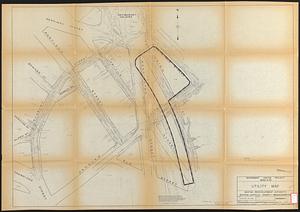
Government Center project Mass. r-35 : utility map
35.
Metropolitan District Commission combined sewer overflow project Dorchester Bay area
36.
Park Plaza building study stage environmental impact analysis : environmental base : sanitary sewerage and storm drainage
37.
Report on improvements to the Boston main drainage system
38.
Utility map, Washington Park project r-24
39.
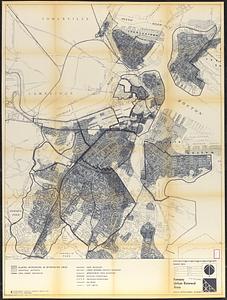
Fenway urban renewal area : major thoroughfares
40.
Fenway urban renewal area : blighted areas
‹ Prev
Next ›
1
2
3
4
5
6
…
436
437