Toggle navigation
LMEC Home
Collections
My Favorites
Exhibitions
Georeferencing
Tools for Teachers
Sign Up / Log In
Search
Search the map portal
Search
Search
Search for
Search in
All Fields
Title
Subject
Place
Creator
Search All Digital Collections
Advanced Search
8901 Results
Search Constraints
My Search
Start Over
More like
commonwealth:jh343z275
Remove constraint More like: commonwealth:jh343z275
Filter your Search
Show filters
Hide filters
Place
North and Central America
6,086
United States
4,990
Massachusetts
2,162
Europe
1,415
Suffolk (county)
1,067
Boston
1,036
Canada
459
Asia
445
more
Place
»
Topic
Boston (Mass.)--Maps
597
United States--Maps
283
Real property--Massachusetts--Boston--Maps
175
Massachusetts--Maps
170
Landowners--Massachusetts--Boston--Maps
133
New England--Maps
106
North America--Maps--Early works to 1800
103
Europe--Maps
81
more
Topic
»
Creator
United States. Hydrographic Office
596
O.H. Bailey & Co
148
Des Barres, Joseph F. W. (Joseph Frederick Wallet), 1722-1824
122
United States. Post Office Dept
120
Ptolemy, 2nd cent
100
Geological Survey (U.S.)
98
Walling, Henry Francis, 1825-1888
94
Jefferys, Thomas, -1771
85
more
Creator
»
Format
Maps/Atlases
8,838
Manuscripts
215
Prints
56
Books
39
Objects/Artifacts
11
Drawings/Illustrations
8
Posters
5
Georeferenced
Yes
966
No
7,935
Collection
Norman B. Leventhal Map & Education Center Collection
8,901
Boston and New England Maps
2,332
Urban Maps
2,043
Maritime Charts and Atlases
1,083
American Revolutionary War-Era Maps
620
Boston Redevelopment Authority Collection
87
Applied Geographics, Inc. Records
1
Mapping Boston Collection
1
Available to use
No known restrictions
8,745
Creative Commons license
61
Sort
by recently added
relevance
title
date (asc)
date (desc)
recently added
Number of results to display per page
20
per page
per page
10
per page
20
per page
50
per page
100
per page
Search Results
1.
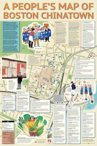
A people's map of Boston Chinatown
2.
Carte topographique d'Allemagne : contenant une partie de l'electorat de Brandenbourg le duche de Magdebourg le principaute...
3.
Carte topographique d'Allemagne : contenant une partie de la Margraviat de Brandenbourg, savoir la Mittel Marck, la bas Lusace,...
4.
Picture map of Massachusetts
5.
Il giro del mondo
6.
Durban Harbour, 1930
7.
Africa
8.
Griebens stadtplan von Berlin
9.
Antwerpen 1930, Wereldtentoonstelling kolonien zeevaart en vlaamsche kunst = Anvers 1930, Exposition internationale coloniale...
10.
Railway diagram of London and its suburbs
11.
Western battle front showing the fighting fronts of the United States Army and her allies : from London, England to Basel,...
12.
San Isabel National Forest, Colorado
13.
Pike National Forest, Colorado
14.
Rogue River National Forest, Oregon and California
15.
Olympic National Forest, Washington
16.
Salmon National Forest, Idaho
17.
Clearwater National Forest, Idaho
18.
Challis National Forest, Idaho
19.
Topographic map of the Yellowstone National Park, Wyoming-Montana-Idaho
20.
Wyoming National Forest, Wyoming
« Previous
Next »
1
2
3
4
5
…
445
446