Toggle navigation
LMEC Home
Exhibitions
Georeferencing
Tools for Teachers
Collections
My Favorites
Sign Up / Log In
Search
Search the map portal
Map Collection
Map Collection
Map Sets
Search
Search
Search for
Search In
All Fields
Creator
Title
Subject
Place
Search All Digital Collections
Advanced Search
8716 Results
My Search
Start Over
More Like
commonwealth:jh343x69g
Remove constraint More Like: commonwealth:jh343x69g
Filter your Search
Place
North and Central America
5,947
United States
4,861
Massachusetts
2,079
Europe
1,396
Suffolk (county)
1,046
Boston
1,019
Canada
470
Asia
438
more
Place
»
Topic
Boston (Mass.)--Maps
586
United States--Maps
294
Real property--Massachusetts--Boston--Maps
175
Massachusetts--Maps
162
Landowners--Massachusetts--Boston--Maps
133
New England--Maps
107
North America--Maps--Early works to 1800
103
Europe--Maps
79
more
Topic
»
Date
Date range begin
–
Date range end
Current results range from
1482
to
2023
View distribution
Creator
United States. Hydrographic Office
595
O.H. Bailey & Co
148
Des Barres, Joseph F. W. (Joseph Frederick Wallet), 1722-1824
123
United States. Post Office Dept
120
Ptolemy, 2nd cent
100
Walling, Henry Francis, 1825-1888
94
Geological Survey (U.S.)
86
Jefferys, Thomas, -1771
85
more
Creator
»
Format
Maps/Atlases
8,656
Manuscripts
215
Prints
56
Books
36
Objects/Artifacts
10
Drawings/Illustrations
8
Posters
5
Georeferenced
Yes
869
No
7,847
Collection
Norman B. Leventhal Map & Education Center Collection
8,694
Boston and New England Maps
2,233
Urban Maps
2,023
Maritime Charts and Atlases
1,083
American Revolutionary War-Era Maps
638
Boston Redevelopment Authority Collection
87
Maps from AAS
14
William L. Clements Library Collection
8
Available to use
No known restrictions
8,552
Creative Commons license
47
Search Constraints
Sort by relevance
relevance
title
date (asc)
date (desc)
Number of results to display per page
20 per page
10
per page
20
per page
50
per page
100
per page
View results as:
grid view
map view
Search Results
1.
Dinsmore's complete map of the railroads & canals in the United States & Canada
2.
Dinsmore's new railroad map of the United States and the Canadas, showing all the railroads completed and in progress,...
3.
E.P. Dutton & Co.'s railroad, steam boat & stage route map of New England, New-York and Canada
4.
General railway map engraved expressly for the Official guide of the railways and steam navigation lines of the United States,...
5.
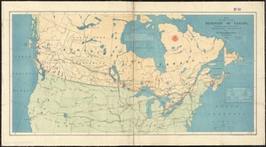
Map of the Dominion of Canada
6.
Map shewing the railways of Canada, to accompany annual report on railway statistics 1884
7.
Relief map of the Dominion of Canada
8.
Trans-continental map : showing the main lines and proposed extensions of the various trans-continental railroad systems of the...
9.
Williams' telegraph and rail road map of the New England states, eastern protion of New York state and Canada : compiled from...
10.
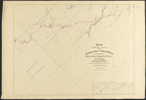
Map showing route from Edmonton to Yukon River as followed by a party of North-West Mounted Police under command of Insp. J.D....
11.
Complete map of the rail roads and water courses in the United States & Canada
12.
Dinsmore's complete map of the railroads & canals in the United States & Canada
13.
Map of part of the Dominion of Canada, shewing location of some of the principal products, also railway & water routes
14.
Sherman & Smith's rail road, steam boat & stage route map of New England, New-York, and Canada
15.
Aboriginal map of North America, denoting the boundaries and the locations of various Indian tribes
16.
British America, comprehending Canada, Labrador, New-Foundland, Nova Scotia &c
17.
British possessions in North America
18.
The British possessions in North America from the best authorities
19.
The British possessions in North America from the best authorities
20.
Canada and Nova Scotia
‹ Prev
Next ›
1
2
3
4
5
…
435
436