Toggle navigation
LMEC Home
Exhibitions
Georeferencing
Tools for Teachers
Collections
My Favorites
Sign Up / Log In
Search
Search the map portal
Map Collection
Map Collection
Map Sets
Search
Search
Search for
Search In
All Fields
Creator
Title
Subject
Place
Search All Digital Collections
Advanced Search
113 Results
My Search
Start Over
More Like
commonwealth:j3860855n
Remove constraint More Like: commonwealth:j3860855n
Filter your Search
Place
North and Central America
70
Massachusetts
34
New England
26
United States
24
Rhode Island
15
Connecticut
10
New York
7
Middle Atlantic
6
more
Place
»
Topic
Massachusetts--Maps--Early works to 1800
30
New England--Maps--Early works to 1800
20
World maps--Early works to 1800
13
Rhode Island--Maps--Early works to 1800
11
America--Maps--Early works to 1800
9
Connecticut--Maps--Early works to 1800
9
Massachusetts--Maps
8
North America--Maps--Early works to 1800
8
more
Topic
»
Date
Date range begin
–
Date range end
Current results range from
1482
to
1990
View distribution
Creator
Ortelius, Abraham, 1527-1598
5
Des Barres, Joseph F. W. (Joseph Frederick Wallet), 1722-1824
4
Bew, John, -1793
3
Bordon, Benedetto, 1450-1530
3
Gastaldi, Giacomo, approximately 1500-approximately 1565
3
Hondius, Jodocus, 1594 or 1595-1629
3
Lodge, John, -1796
3
Mercator, Gerhard, 1512-1594
3
more
Creator
»
Format
Maps/Atlases
113
Books
1
Manuscripts
1
Georeferenced
Yes
12
No
101
Collection
Sidney R. Knafel Map Collection at Phillips Academy
87
American Revolutionary War-Era Maps
45
Boston and New England Maps
21
Norman B. Leventhal Map Center Collection
20
Maritime Charts and Atlases
4
British Library Collection
3
Mapping Boston Collection
2
Richard H. Brown Revolutionary War Map Collection at Mount Vernon
2
more
Collection
»
Available to use
No known restrictions
18
Creative Commons license
8
Search Constraints
Sort by relevance
relevance
title
date (asc)
date (desc)
Number of results to display per page
100 per page
10
per page
20
per page
50
per page
100
per page
View results as:
grid view
map view
Search Results
1.
An accurate map of Rhode Island, part of Connecticut and Massachusets, shewing Admiral Arbuthnot's station in blocking up...
2.
A map of the province of Massachusets Bay and colony of Rhode Island, with part of Connecticut, New Hampshire, and Vermont
3.
A new and accurate map of the colony of Massachusets Bay, in North America, from a late survey
4.
The state of Massachusetts from the best information
5.
An accurate map of Rhode Island, part of Connecticut and Massachusets, shewing Admiral Arbuthnot's station in blocking up...
6.
An accurate map of the Commonwealth of Massachusetts exclusive of the district of Maine : compiled pursuant to an Act of the...
7.
An accurate map of the country round Boston in New England from the best authorities
8.
An accurate map of the country round Boston in New England from the best authorities
9.
Carta rappresentante il porto di Boston
10.
Carte des environs de Boston, capitale de la Nlle. Angleterre en Amerique
11.
Coast of Massachusetts from Cape Ann to Manomet Point, including northern tip of Cape Cod
12.
Coast of Massachusetts from Cape Ann to Manomet Point, including northern tip of Cape Cod
13.
[Coast of New England from Chatham Harbor to Naragansett Bay]
14.
[Coast of New England from Chatham Harbor to Naragansett Bay]
15.
A Copy of the Plan returned by his Maj:tys Com:rs for setling the Boundarys between the Provinces of New Hampshire and the...
16.
Die gegend um Boston
17.
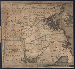
[Map of eastern Massachusetts and vicinity]
18.
A map of the colony of Rhode Island : with the adjacent parts of Connecticut, Massachusetts Bay, &c
19.
A map of the country adjacent to the north boundary line of the colony of Rhode Island as the same was run by commissioners...
20.
A map of the province of Massachusets Bay and colony of Rhode Island, with part of Connecticut, New Hampshire, and Vermont
21.
A Map Of the River MERRIMACK from the Atlantick Ocean to Pantuckett Falls describing bounds between His Maj:tys Province of New...
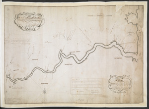
22.
Massachusetts
23.
A new and accurate map of the colony of Massachusets Bay, in North America, from a late survey
24.
A PLAN of the Rivers and Boundary Lines referr'd to in ye Proceedings & Judgment of ye Commissioners for adjusting the Bounds...
25.
The south part of New England as it planted this yeare, 1634
26.
The south part of New England, as it planted this yeare, 1639
27.
The state of Massachusetts
28.
The state of Massachusetts from the best information
29.
To the Hone. Jno. Hancock, Esqre. president of ye Continental Congress, this map of the seat of civil war in America, is...
30.
To the Hone. Jno. Hancock, Esqre. president of ye Continental Congress, this map of the seat of civil war in America, is...
31.
An accurate map of the English colonies in North America, bordering on the river Ohio
32.
America
33.
America sive India Nova : ad magnae Gerardi Mercatoris aui universalis imitationem in compendium redacta
34.
America sive novvs orbis respectv Evropaeorvm inferior globi terrestris pars
35.
Americae pars Borealis, Florida, Baccalaos, Canada, Corterealis
36.
Americae siue noui orbis, noua descriptio
37.
Americae siue noui orbis, noua descriptio
38.
The American Atlas or, A Geographical Description of the whole continent of America : wherein are delineated at large, its...
39.
The American pilot : containing the navigation of the sea coat of North America . . .
40.
Atlantic Ocean
41.
L'Atlas de mer ou monde aquatique, remontrant toutes les côtes de la mer, a scavoir de la partie connuë de I'Univers, avec une...
42.
Barnstable County, Dukes County and Nantucket Island, Massachusetts
43.
Baye et port d'Yorc, capitale de la Nouvelle Yorc
44.
Bowles's new pocket map of the most inhabited part of New England : comprehending the provinces of Massachusets Bay and New...
45.
Carta marina nova tabula
46.
Carte de la Nouvelle Angleterre, New York, Pensilvanie et Nouveau Jersay suivant les cartes angloises
47.
Carte de la Nouvelle Angleterre, Nouvelle York, Nouvelle Jersey et Pensilvanie
48.
Chart and plan of the harbour of New York & the couny. adjacent, from Sandy Hook to Kingsbridge, comprehending the whole of New...
49.
Chart for the journal of Mr. le Mquis. de Chastellux
50.
A chart of the gulf stream
51.
Costes et rivieres de Virginie, de Mariland, et de Nouvelle Angletere
52.
The English pilot. The fourth book. Describing the West-India navigation, from Hudson's-Bay to the River Amazones. Particulary...
53.
Garden of Eden
54.
Generale Ptholemei
55.
Geological map of Massachusetts
56.
The harbor of Holmes' Hole
57.
Herbipolis occidens Wurtzpurg
58.
La heroike enterprinse faict par le Signeur Draeck d'avoir cirquit toute la terre
59.
Map of Massachusetts, from the best authorities
60.
A map of New England, New York, New Jersey and Pensilvania
61.
A map of New-England, being the first that ever was here cut, and done by the best pattern that could be had, which being in...
62.
A map of the British and French dominions in North America with the roads, distances, limits, and extent of the settlements,...
63.
Map of the Caribbean Area
64.
Map of the northern, or, New England states of America, comprehending Vermont, New Hampshire, District of Main, Massachusetts,...
65.
Map of the northern part of New England : compiled for Pres't. Dwight's travels
66.
Map of the southern part of New England : compiled for Pres't. Dwights travels
67.
Maris Pacifici (quod vulgo Mar del Zur) cum regionibus circumiacentibus, insulisque in eodem passim sparsis, novissima descriptio
68.
Massachusetts
69.
Massachusetts
70.
Massachusetts
71.
Massachusetts and Rhode Island
72.
A new and accurate map of the present seat of war in North America : from a late survey
73.
New England and New York
74.
New England and New York
75.
New Englands prospect : A true, lively, and experimentall description of that part of America, commonly called New England:...
76.
A new map of the most considerable plantations of the English in America
77.
The north part of America : conteyning Newfoundland, new England, Virginia, Florida, new Spaine, and Noua Francia wth ye rich...
78.
Nouvelle Angleterre et Nouvel York
79.
Nova, et integra universi orbis descriptio
80.
Novae insulae XVII, nova tabula
81.
Oceani occidetalis seu terre nove tabula
82.
Old Colony & Newport railway and its connections
83.
Old Colony Railroad and connections
84.
Orbis terrae compendiosa descriptio : quam ex magna universali Gerardi Mercatoris Domino Richardo Gartho, geographie ac...
85.
Orbis typus uniuersalis iuxta hydrographorum traditionem
86.
Oval map of the world
87.
Pars Prima. Speculum Nauticum super navigatione maris Occidentalis confectum, continens omnes oras maritimas Gallia, Hispaniae...
88.
Part of east New Jarsey, New York, and Connecticut
89.
Partie de la carte du Capitaine Cluny, auteur d'un ouvrage anglois intitulé American Traveller publié à Londres en 1769
90.
Pascaert van Nieu Nederland van Hendrick Christiaens Eijland tot staten hoeck of Cabo Cod
91.
Pas-caert van Nieu Nederland, Virginia, Nieu Engeland als mede Penn-silvania, met de stad Philadelfia van Baston tot Carrik = a...
92.
Porti della Nuova York e Perthamboy
93.
Praeclara Ferna[n]di Cortesii de Noua maris Oceani Hyspania Narratio . . .
94.
Preliminary sketch showing the positions of Davis' Shoal and other dangers recently discovered by the Coast Survey and the...
95.
Quarte partie du monde
96.
Recens edita totius Novi Belgii in America Septentrionali siti
97.
Scandinavia
98.
Secunda etas mundi = Secunda etas mũdi
99.
Septentrionalium terrarum descriptio
100.
Sketch A No. 5 showing proposed site for a light house on Sow and Pigs Reef
‹ Prev
Next ›
1
2


![[Coast of New England from Chatham Harbor to Naragansett Bay]](https://bpldcassets.blob.core.windows.net/derivatives/images/commonwealth:7h149x27g/image_thumbnail_300.jpg)
![[Coast of New England from Chatham Harbor to Naragansett Bay]](https://bpldcassets.blob.core.windows.net/derivatives/images/commonwealth:7h149z37x/image_thumbnail_300.jpg)


![[Map of eastern Massachusetts and vicinity]](https://bpldcassets.blob.core.windows.net/derivatives/images/commonwealth:9s161d29f/image_thumbnail_300.jpg)


![Praeclara Ferna[n]di Cortesii de Noua maris Oceani Hyspania Narratio . . .](https://bpldcassets.blob.core.windows.net/derivatives/images/commonwealth:zk51wc44m/image_thumbnail_300.jpg)


