Toggle navigation
LMEC Home
Exhibitions
Georeferencing
Tools for Teachers
Collections
My Favorites
Sign Up / Log In
Search
Search the map portal
Map Collection
Map Collection
Map Sets
Search
Search
Search for
Search In
All Fields
Creator
Title
Subject
Place
Search All Digital Collections
Advanced Search
151 Results
My Search
Start Over
More Like
commonwealth:j3860851j
Remove constraint More Like: commonwealth:j3860851j
Filter your Search
Place
World
64
North and Central America
46
New England
20
United States
17
Massachusetts
16
Rhode Island
8
New York
7
Connecticut
6
more
Place
»
Topic
World maps--Early works to 1800
76
New England--Maps--Early works to 1800
15
America--Maps--Early works to 1800
11
Massachusetts--Maps
8
North America--Maps--Early works to 1800
8
Western Hemisphere--Maps--Early works to 1800
8
Connecticut--Maps--Early works to 1800
5
Cook, James, 1728-1779
5
more
Topic
»
Date
Date range begin
–
Date range end
Current results range from
1482
to
1990
View distribution
Creator
Ortelius, Abraham, 1527-1598
6
Mercator, Gerhard, 1512-1594
5
Bordon, Benedetto, 1450-1530
4
Münster, Sebastian, 1489-1552
4
Bew, John, -1793
3
Carey, Mathew, 1760-1839
3
Hondius, Hendrik, 1597-1651
3
Hondius, Jodocus, 1594 or 1595-1629
3
more
Creator
»
Format
Maps/Atlases
151
Manuscripts
2
Books
1
Georeferenced
Yes
10
No
141
Collection
Sidney R. Knafel Map Collection at Phillips Academy
87
Norman B. Leventhal Map Center Collection
64
American Revolutionary War-Era Maps
29
Mapping Boston Collection
19
Available to use
No known restrictions
45
Creative Commons license
19
Search Constraints
Sort by date (desc)
relevance
title
date (asc)
date (desc)
Number of results to display per page
100 per page
10
per page
20
per page
50
per page
100
per page
View results as:
grid view
map view
Search Results
1.
Carta universal en que se contiene todo lo que del mundo se ha descubierto fasta agora
2.
Sketch A showing the progress of the survey in section no. 1 from 1844 to 1881
3.
Old Colony Railroad and connections
4.
Barnstable County, Dukes County and Nantucket Island, Massachusetts
5.
Old Colony & Newport railway and its connections
6.
Massachusetts and Rhode Island
7.
Preliminary sketch showing the positions of Davis' Shoal and other dangers recently discovered by the Coast Survey and the...
8.
Sketch A No. 5 showing proposed site for a light house on Sow and Pigs Reef
9.
The harbor of Holmes' Hole
10.
Massachusetts
11.
Massachusetts
12.
Geological map of Massachusetts
13.
Map of the northern part of New England : compiled for Pres't. Dwight's travels
14.
Map of the southern part of New England : compiled for Pres't. Dwights travels
15.
The state of Massachusetts
16.
Map of Massachusetts, from the best authorities
17.
The American pilot : containing the navigation of the sea coat of North America . . .
18.
Massachusetts
19.
A variation chart
20.
Chart of the world according to Mercators projection, shewing the tracks & discoveries of Captn. Cook
21.
The state of Massachusetts from the best information
22.
A map of Massachusetts, from the best authorities
23.
Map of the northern, or, New England states of America, comprehending Vermont, New Hampshire, District of Main, Massachusetts,...
24.
A map of the world from the best authorities
25.
A map of the world on a globular projection : exhibiting particularly the nautical researches of Captain James Cook, F.R.S. :...
26.
A Mercators chart
27.
Chart for the journal of Mr. le Mquis. de Chastellux
28.
Carte de la Nouvelle Angleterre, Nouvelle York, Nouvelle Jersey et Pensilvanie
29.
Mappe Monde ou carte générale du globe terrestre dessinée suivant les regles de la projection des cartes réduites
30.
A map of the province of Massachusets Bay and colony of Rhode Island, with part of Connecticut, New Hampshire, and Vermont
31.
Chart and plan of the harbour of New York & the couny. adjacent, from Sandy Hook to Kingsbridge, comprehending the whole of New...
32.
An accurate map of Rhode Island, part of Connecticut and Massachusets, shewing Admiral Arbuthnot's station in blocking up...
33.
A new and accurate map of the colony of Massachusets Bay, in North America, from a late survey
34.
The world with all modern discoveries
35.
The American Atlas or, A Geographical Description of the whole continent of America : wherein are delineated at large, its...
36.
Bowles's new pocket map of the most inhabited part of New England : comprehending the provinces of Massachusets Bay and New...
37.
Chart of the track of the Dolphin, Tamar, Swallow & Endeavour through the South Seas ; & of the track of M. Bougainville round...
38.
A chart of the world upon Mercator's projection : describing the tracks of Capt. Cook in the year 1768, 69, 70, 71, and in...
39.
Mappa totius mundi : adornata juxta observationes dnn. academiae regalis scientiarum et nonnullorum aliorum secundum...
40.
A new and accurate map of the present seat of war in North America : from a late survey
41.
Partie de la carte du Capitaine Cluny, auteur d'un ouvrage anglois intitulé American Traveller publié à Londres en 1769
42.
A chart of the gulf stream
43.
Part of east New Jarsey, New York, and Connecticut
44.
Baye et port d'Yorc, capitale de la Nouvelle Yorc
45.
Carte de la Nouvelle Angleterre, New York, Pensilvanie et Nouveau Jersay suivant les cartes angloises
46.
Porti della Nuova York e Perthamboy
47.
The world, according to the latest discoveries
48.
A map of the British and French dominions in North America with the roads, distances, limits, and extent of the settlements,...
49.
The English pilot. The fourth book. Describing the West-India navigation, from Hudson's-Bay to the River Amazones. Particulary...
50.
An accurate map of the English colonies in North America, bordering on the river Ohio
51.
Mappemonde ou Description du globe terrestre
52.
Orbis vetus in utrâque continente juxtà mentem Sansonianam distinctus, nec non observationibus astronomicis
53.
Planiglobii terrestris mappa universalis utrumq hemisphærium orient. et occidentale repræsentans ex IV mappis generalibus =...
54.
A new map of the most considerable plantations of the English in America
55.
Mappe-monde
56.
A new map of the whole world with the trade winds according to ye latest and most exact observations
57.
Diversi globi terr-aquei statione variante et visu intercedente, per coluros tropicorum, per ambos polos et particul : sphaerae...
58.
A map of New England, New York, New Jersey and Pensilvania
59.
Recens edita totius Novi Belgii in America Septentrionali siti
60.
A new and correct map of the world, laid down according to the newest discoveries, and from the most exact observations
61.
A map of the world : corrected from the observations communicated to the Royal Societys of London and Paris
62.
A new map of the world from the latest observations
63.
A new & correct map of the whole world : shewing ye situation of its principal parts. viz. the oceans, kingdoms, rivers, capes,...
64.
Mappmonde ou description generale du globe terrestre
65.
New England and New York
66.
A new map of the terraqueous globe according to the ancient discoveries and most general divisions of it into continents and...
67.
A new map of the terraqueous globe according to the latest discoveries and most general divisions of it into continents and oceans
68.
[Hamadaradz Asharhatsuyts] = [Extensive world map]
69.
Nouus planiglobii terrestris per utrumque polum conspectus
70.
Orbis terrarum nova et accuratissima tabula
71.
Nouvelle Angleterre et Nouvel York
72.
Pas-caert van Nieu Nederland, Virginia, Nieu Engeland als mede Penn-silvania, met de stad Philadelfia van Baston tot Carrik = a...
73.
A new mapp of the world
74.
New England and New York
75.
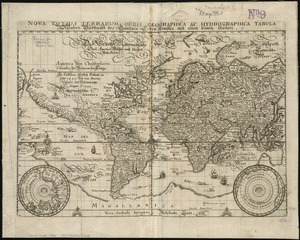
Nova totius terrarum orbis geographica ac hydrographica tabula
76.
A map of New-England, being the first that ever was here cut, and done by the best pattern that could be had, which being in...
77.
Pascaert van Nieu Nederland van Hendrick Christiaens Eijland tot staten hoeck of Cabo Cod
78.
Costes et rivieres de Virginie, de Mariland, et de Nouvelle Angletere
79.
Novissima totius terrarum orbis tabula
80.
Orbis terrarum nova et accuratissima tabula
81.
L'Atlas de mer ou monde aquatique, remontrant toutes les côtes de la mer, a scavoir de la partie connuë de I'Univers, avec une...
82.
Systema ideale quo exprimitur, aquarum per canales hydragogos subterraneos ex mari et in montium hydrophylacia protrusio,...
83.
A new and accurat map of the world : drawne according to ye truest descriptions latest discoveries & best observations yt have...
84.
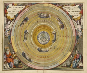
Planisphaerium Ptolemaicum siue machina orbium mundi ex hypothesi Ptolemaica in plano disposita
85.
Nova totius terrarum orbis tabula
86.
Noua orbis terrarum delineatio singulari ratione accommodata meridiano tabb. Rudolphi astronomicarum
87.
A plat of all the world : projected according to the truest rules being far more exact than either the plain-card or the maps...
88.
A new and accurat map of the world drawne according to ye truest descriptions latest discoveries & best observations yt have...
89.
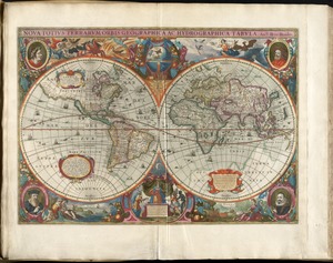
Noua totius terrarum orbis geographica ac hydrographica tabula
90.
New Englands prospect : A true, lively, and experimentall description of that part of America, commonly called New England:...
91.
Noua totius terrarum orbis geographica ac hydrographica tabula
92.
Nova totius terrarum orbis geographica ac hydrographica tabula = Wahre Biltnüss des Gantzen Erden Kraÿses mit allen seinen...
93.
Nova totivs terrarvm orbis geographica ac hydrographica tabvla
94.
Septentrionalium terrarum descriptio
95.
America
96.
A new and accurat map of the world
97.
The north part of America : conteyning Newfoundland, new England, Virginia, Florida, new Spaine, and Noua Francia wth ye rich...
98.
Geographica restituta per globi trientes
99.
Virginia et Nova Francia
100.
Maris Pacifici (quod vulgo Mar del Zur) cum regionibus circumiacentibus, insulisque in eodem passim sparsis, novissima descriptio
‹ Prev
Next ›
1
2


![[Hamadaradz Asharhatsuyts]](https://bpldcassets.blob.core.windows.net/derivatives/images/commonwealth:x633f982n/image_thumbnail_300.jpg)


![Systema ideale quo exprimitur, aquarum per canales hydragogos subterraneos ex mari et in montium hydrophylacia protrusio, aquarumq[ue] subterrestrium per pyragogos canales concoctus](https://bpldcassets.blob.core.windows.net/derivatives/images/commonwealth:n8710p89m/image_thumbnail_300.jpg)