Toggle navigation
LMEC Home
Exhibitions
Georeferencing
Tools for Teachers
Collections
My Favorites
Sign Up / Log In
Search
Search the map portal
Map Collection
Map Collection
Map Sets
Search
Search
Search for
Search In
All Fields
Creator
Title
Subject
Place
Search All Digital Collections
Advanced Search
151 Results
My Search
Start Over
More Like
commonwealth:j38608070
Remove constraint More Like: commonwealth:j38608070
Filter your Search
Place
World
64
North and Central America
46
New England
20
United States
17
Massachusetts
16
Rhode Island
8
New York
7
Connecticut
6
more
Place
»
Topic
World maps--Early works to 1800
76
New England--Maps--Early works to 1800
15
America--Maps--Early works to 1800
11
Massachusetts--Maps
8
North America--Maps--Early works to 1800
8
Western Hemisphere--Maps--Early works to 1800
8
Connecticut--Maps--Early works to 1800
5
Cook, James, 1728-1779
5
more
Topic
»
Date
Date range begin
–
Date range end
Current results range from
1482
to
1990
View distribution
Creator
Ortelius, Abraham, 1527-1598
6
Mercator, Gerhard, 1512-1594
5
Bordon, Benedetto, 1450-1530
4
Bew, John, -1793
3
Carey, Mathew, 1760-1839
3
Gastaldi, Giacomo, approximately 1500-approximately 1565
3
Hondius, Hendrik, 1597-1651
3
Hondius, Jodocus, 1594 or 1595-1629
3
more
Creator
»
Format
Maps/Atlases
151
Manuscripts
2
Books
1
Georeferenced
Yes
10
No
141
Collection
Sidney R. Knafel Map Collection at Phillips Academy
87
Norman B. Leventhal Map Center Collection
64
American Revolutionary War-Era Maps
29
Mapping Boston Collection
19
Available to use
No known restrictions
45
Creative Commons license
19
Search Constraints
Sort by date (asc)
relevance
title
date (asc)
date (desc)
Number of results to display per page
20 per page
10
per page
20
per page
50
per page
100
per page
View results as:
grid view
map view
Search Results
121.
Chart and plan of the harbour of New York & the couny. adjacent, from Sandy Hook to Kingsbridge, comprehending the whole of New...
122.
A map of the province of Massachusets Bay and colony of Rhode Island, with part of Connecticut, New Hampshire, and Vermont
123.
Carte de la Nouvelle Angleterre, Nouvelle York, Nouvelle Jersey et Pensilvanie
124.
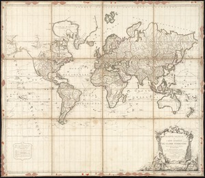
Mappe Monde ou carte générale du globe terrestre dessinée suivant les regles de la projection des cartes réduites
125.
Chart for the journal of Mr. le Mquis. de Chastellux
126.
A Mercators chart
127.
A map of the world on a globular projection : exhibiting particularly the nautical researches of Captain James Cook, F.R.S. :...
128.
Map of the northern, or, New England states of America, comprehending Vermont, New Hampshire, District of Main, Massachusetts,...
129.
A map of the world from the best authorities
130.
A map of Massachusetts, from the best authorities
131.
Chart of the world according to Mercators projection, shewing the tracks & discoveries of Captn. Cook
132.
The state of Massachusetts from the best information
133.
Massachusetts
134.
A variation chart
135.
The American pilot : containing the navigation of the sea coat of North America . . .
136.
Map of Massachusetts, from the best authorities
137.
The state of Massachusetts
138.
Map of the northern part of New England : compiled for Pres't. Dwight's travels
139.
Map of the southern part of New England : compiled for Pres't. Dwights travels
140.
Geological map of Massachusetts
‹ Prev
Next ›
1
2
3
4
5
6
7
8