Toggle navigation
LMEC Home
Exhibitions
Georeferencing
Tools for Teachers
Collections
My Favorites
Sign Up / Log In
Search
Search the map portal
Map Collection
Map Collection
Map Sets
Search
Search
Search for
Search In
All Fields
Creator
Title
Subject
Place
Search All Digital Collections
Advanced Search
382 Results
My Search
Start Over
More Like
commonwealth:hx11z547c
Remove constraint More Like: commonwealth:hx11z547c
Filter your Search
Place
North and Central America
341
United States
215
Canada
104
Essex (county)
24
Louisbourg
22
Saint Lawrence River
19
Suffolk (county)
17
Fort Edward
16
more
Place
»
Topic
United States--History--French and Indian War, 1754-1763--Maps, Manuscript--Early works to 1800
58
Louisbourg (N.S.)--Maps, Manuscript--Early works to 1800
18
Fort Edward (N.Y.)--Maps, Manuscript--Early works to 1800
16
Fort Ticonderoga (N.Y.)--Maps, Manuscript--Early works to 1800
15
Saint Lawrence River--Maps, Manuscript--Early works to 1800
15
Louisbourg (N.S.)--History--Siege, 1745--Maps, Manuscript--Early works to 1800
14
Fortification--New York (State)--Fort Edward--Maps, Manuscript--Early works to 1800
13
Fortification--New York (State)--Maps, Manuscript--Early works to 1800
13
more
Topic
»
Date
Date range begin
–
Date range end
Current results range from
1664
to
1816
View distribution
Creator
Royal United Services Institute for Defence and Security Studies
160
George, III, King of Great Britain, 1738-1820
151
George, IV, King of Great Britain, 1762-1830
150
Amherst, Jeffery Amherst, Baron, 1717-1797
128
Skinner, Monier
28
Skinner, William, 1700-1780
28
Brasier, William
16
Bastide, John Henry, approximately 1700-1770
15
more
Creator
»
Format
Maps/Atlases
365
Manuscripts
150
Drawings/Illustrations
15
Georeferenced
Yes
7
No
375
Collection
British Library Collection
376
American Revolutionary War-Era Maps
358
Boston and New England Maps
21
Urban Maps
5
Maritime Charts and Atlases
3
Norman B. Leventhal Map Center Collection
3
Richard H. Brown Revolutionary War Map Collection at Mount Vernon
3
Available to use
Creative Commons license
379
No known restrictions
3
Search Constraints
Sort by relevance
relevance
title
date (asc)
date (desc)
Number of results to display per page
20 per page
10
per page
20
per page
50
per page
100
per page
View results as:
grid view
map view
Search Results
1.
A general map of the southern British colonies in America comprehending North and South Carolina, Georgia, East and West...
2.
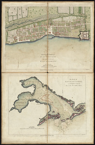
[Map of Florida, Carolina, and the Gulf Coast]
3.
A new and general map of the Southern dominions belonging to the United States of America, viz North Carolina, South Carolina,...
4.
Particular draughts and plans of some of the principal towns and harbours belonging to the English, French, and Spaniards, in...
5.
Plan of the town of St. Augustine, the capital of East Florida ; The bay of Espiritu Santo, on the western coast of East Florida
6.
Port de St. Augustin -- Port de la Providence -- La Havane dans l'isle de Cuba -- Baye de Sn. Iago dans l'isle de Cuba -- Port...
7.
1.r Plan du fort proposé dans l'Ille de S.t Simon pour la deffence de l'Entree du Havre de Jenkins Sownd
8.
1.r Plan du fort proposé dans l'Ille de S.t Simon pour la deffence de l'Entree du Havre de Jenkins Sownd
9.
1:st Position
10.
2:d Position
11.
2.e Plan d'une Batterie & d'une Redoute avec un Corps de Garde construit en forme de Redoute a Machecoulis pour y Servir de...
12.
3:d Position
13.
4:th Position
14.
[A colored map of the route between Albany and Oswego; drawn about 1756, on a scale of 2 miles to an inch]
15.
[A coloured chart of the upper part of Lake Erie at Fort Erie and a detailed plan of Fort Erie, together with three cross...
16.
A= draught of Boston Harbor
17.
[A manuscript map of Isle Royalle]
18.
[A map of Fort Carillon and environs]
19.
[A map of Fort Carillon and environs]
20.
[A map of Lake Champlain and Lake George, showing the route from Fort Edward to Montreal]
‹ Prev
Next ›
1
2
3
4
5
…
19
20

![[Map of Florida, Carolina, and the Gulf Coast]](https://bpldcassets.blob.core.windows.net/derivatives/images/commonwealth:z603vr379/image_thumbnail_300.jpg)


![[A colored map of the route between Albany and Oswego; drawn about 1756, on a scale of 2 miles to an inch]](https://bpldcassets.blob.core.windows.net/derivatives/images/commonwealth:hx11z3223/image_thumbnail_300.jpg)
![[A coloured chart of the upper part of Lake Erie at Fort Erie and a detailed plan of Fort Erie, together with three cross sectional drawings]](https://bpldcassets.blob.core.windows.net/derivatives/images/commonwealth:hx11z482r/image_thumbnail_300.jpg)

![[A manuscript map of Isle Royalle]](https://bpldcassets.blob.core.windows.net/derivatives/images/commonwealth:hx11z507d/image_thumbnail_300.jpg)
![[A map of Fort Carillon and environs]](https://bpldcassets.blob.core.windows.net/derivatives/images/commonwealth:hx11z538d/image_thumbnail_300.jpg)
![[A map of Fort Carillon and environs]](https://bpldcassets.blob.core.windows.net/derivatives/images/commonwealth:hx11z342k/image_thumbnail_300.jpg)
![[A map of Lake Champlain and Lake George, showing the route from Fort Edward to Montreal]](https://bpldcassets.blob.core.windows.net/derivatives/images/commonwealth:hx11z3312/image_thumbnail_300.jpg)