Toggle navigation
LMEC Home
Exhibitions
Georeferencing
Tools for Teachers
Collections
My Favorites
Sign Up / Log In
Search
Search the map portal
Map Collection
Map Collection
Map Sets
Search
Search
Search for
Search In
All Fields
Creator
Title
Subject
Place
Search All Digital Collections
Advanced Search
127 Results
My Search
Start Over
More Like
commonwealth:hq37vv983
Remove constraint More Like: commonwealth:hq37vv983
Filter your Search
Place
North and Central America
84
New Jersey
30
United States
27
New England
23
Massachusetts
20
Connecticut
16
New York
14
Rhode Island
14
more
Place
»
Topic
New Jersey--Maps--Early works to 1800
30
New England--Maps--Early works to 1800
18
Connecticut--Maps--Early works to 1800
15
World maps--Early works to 1800
13
Middle Atlantic States--Maps--Early works to 1800
10
New York (State)--Maps--Early works to 1800
10
Rhode Island--Maps--Early works to 1800
10
America--Maps--Early works to 1800
9
more
Topic
»
Date
Date range begin
–
Date range end
Current results range from
1482
to
1990
View distribution
Creator
Faden, William, 1749-1836
6
Kitchin, Thomas, 1718-1784
5
Ortelius, Abraham, 1527-1598
5
Bancker, Gerard, 1740-1799
4
Lodge, John, -1796
4
Bew, John, -1793
3
Bordon, Benedetto, 1450-1530
3
Gastaldi, Giacomo, approximately 1500-approximately 1565
3
more
Creator
»
Format
Maps/Atlases
127
Books
1
Manuscripts
1
Georeferenced
Yes
15
No
112
Collection
Sidney R. Knafel Map Collection at Phillips Academy
87
American Revolutionary War-Era Maps
59
Norman B. Leventhal Map Center Collection
18
New York Public Library Collection
14
Boston and New England Maps
8
Richard H. Brown Revolutionary War Map Collection at Mount Vernon
7
Library of Congress Collection
1
Maritime Charts and Atlases
1
Available to use
Creative Commons license
22
No known restrictions
18
Search Constraints
Sort by relevance
relevance
title
date (asc)
date (desc)
Number of results to display per page
20 per page
10
per page
20
per page
50
per page
100
per page
View results as:
grid view
map view
Search Results
21.
A map of the eastern part of the province of New York with part of New Jersey, & c
22.
A map of the eastern part of the province of New York with part of New Jersey, & c
23.
A map of the provinces of New-York and New Jersey, with a part of Pennsylvania and the Province of Quebec
24.
A mapp of New Jersey in America
25.
Mappa geographica Provinciæ Nova Eboraci ab Anglis New-York : dictæ ex ampliori delineatione ad exactas dimensiones concinnata...
26.
A New and accurate map of New Jersey : from the best authorities
27.
A New and accurate map of the present seat of war in North America : comprehending New Jersey, Philadelphia, Pensylvania,...
28.
A New and accurate map of the present seat of war in North America : comprehending New Jersey, Philadelphia, Pensylvania,...
29.
New Engelland, New York, New Yersey und Pensilvania
30.
A new map of Virginia, Mary-land and the improved parts of Penn-sylvania & New Jersey
31.
Paskaerte van de Zuÿdt en Noordt Revier in Nieu Nederlant streckende van Cabo Hinloopen tot Rechkewach
32.
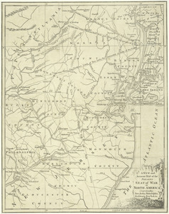
La Pensilvania, la Nuova York, il Jersey Settentrio[na]le : con la parte occidentale del Connecticut, Massachusset-s-bay e...
33.
Pensylvania Nova Jersey et Nova York cum Regionibus ad Fluvium Delaware in America sitis
34.
Position der Koenigl;Grosbrittanischen und derer vereinigten provinzial armée in New York und dem Jerseys in Nord America im...
35.
Position du camp de l'armée combinée a Philipsburg du 6 juillet au 19 aoust
36.
Province de New-Jersey divisée en est et ouest nomée vulgairement les Jerseys
37.
The Province of New Jersey : divided into East and West, commonly called the Jerseys
38.
The Province of New Jersey : divided into East and West, commonly called the Jerseys
39.
The province of New Jersey, divided into east and west, commonly called the Jerseys
40.
The province of New Jersey, divided into east and west, commonly called the Jerseys
‹ Prev
Next ›
1
2
3
4
5
6
7


![La Pensilvania, la Nuova York, il Jersey Settentrio[na]le](https://bpldcassets.blob.core.windows.net/derivatives/images/commonwealth:z603vq53g/image_thumbnail_300.jpg)