Toggle navigation
LMEC Home
Exhibitions
Georeferencing
Tools for Teachers
Collections
My Favorites
Sign Up / Log In
Search
Search the map portal
Map Collection
Map Collection
Map Sets
Search
Search
Search for
Search In
All Fields
Creator
Title
Subject
Place
Search All Digital Collections
Advanced Search
519 Results
My Search
Start Over
More Like
commonwealth:g445fx66s
Remove constraint More Like: commonwealth:g445fx66s
Filter your Search
Place
North and Central America
516
United States
510
Suffolk (county)
505
Boston
504
Roxbury
88
Massachusetts
78
South End
52
Fens
47
more
Place
»
Topic
City planning--Massachusetts--Boston--Maps
417
Urban renewal--Massachusetts--Boston--Maps
253
Boston (Mass.)--Maps
141
Land use--Massachusetts--Boston--Maps
100
Roxbury (Boston, Mass.)--Maps
87
Buildings--Massachusetts--Boston--Maps
85
Real property--Massachusetts--Boston--Maps
78
Fenway (Boston, Mass.)--Maps
48
more
Topic
»
Date
Date range begin
–
Date range end
Current results range from
1832
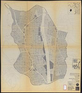
to
2014
View distribution
Creator
Boston Redevelopment Authority
370
Bromley, George Washington
17
Bromley, Walter Scott
17
G.W. Bromley & Co.
12
Downtown Waterfront Corporation
10
Victor Gruen Associates
10
Boston (Mass.). Parks and Recreation Department
8
Sasaki Associates
6
more
Creator
»
Format
Maps/Atlases
518
Drawings/Illustrations
3
Manuscripts
1
Prints
1
Georeferenced
Yes
7
No
512
Collection
Boston and New England Maps
505
Urban Maps
492
Boston Redevelopment Authority Collection
441
Norman B. Leventhal Map Center Collection
128
Massachusetts Real Estate Atlases
5
Mapping Boston Collection
1
Available to use
No known restrictions
512
Creative Commons license
1
Search Constraints
Sort by relevance
relevance
title
date (asc)
date (desc)
Number of results to display per page
20 per page
10
per page
20
per page
50
per page
100
per page
View results as:
grid view
map view
Search Results
61.
Cooperative housing : Whitney Street
62.
Downtown project no. Mass. r-46 : existing land use
63.
Downtown Waterfront-Faneuil Hall renewal area : existing land use
64.
East Boston urban renewal area r-44 : proposed land use
65.
East Boston urban renewal area r-44 : existing land use
66.
Fenway urban renewal area : blighted areas
67.
Fenway urban renewal area : locality map
68.
Fenway urban renewal area : existing land use
69.
Government Center project no. Mass. r-35 : existing land use map
70.
Government Center project no. Mass. r-35 : proposed land use
71.
Government Center project no. Mass. r-35 : proposed land use map
72.
Government Center redevelopment project : land use map
73.
Illustrative re-use site plan for the regional core
74.
Illustrative site plan : a proposal for community review South End/Lower Roxbury development policy
75.
Illustrative site plan : South End urban renewal area, Massachusetts r-56
76.
Illustrative site plan : a proposal for community review South End/Lower Roxbury development policy
77.
Jamaica Plain urban renewal area r-49 : proposed land use
78.
Jamaica Plain urban renewal area r-49 : existing land use
79.
Mattapan project : land use and disposition plan
80.
Mattapan project : existing land use
‹ Prev
Next ›
1
2
3
4
5
6
7
8
…
25
26