Toggle navigation
LMEC Home
Exhibitions
Georeferencing
Tools for Teachers
Collections
My Favorites
Sign Up / Log In
Search
Search the map portal
Map Collection
Map Collection
Map Sets
Search
Search
Search for
Search In
All Fields
Creator
Title
Subject
Place
Search All Digital Collections
Advanced Search
8769 Results
My Search
Start Over
More Like
commonwealth:cj82m2577
Remove constraint More Like: commonwealth:cj82m2577
Filter your Search
Place
North and Central America
5,997
United States
4,917
Massachusetts
2,083
Europe
1,396
Suffolk (county)
1,048
Boston
1,021
Canada
470
Asia
438
more
Place
»
Topic
Boston (Mass.)--Maps
588
United States--Maps
330
Real property--Massachusetts--Boston--Maps
175
Massachusetts--Maps
164
Landowners--Massachusetts--Boston--Maps
133
New England--Maps
127
North America--Maps--Early works to 1800
103
Europe--Maps
79
more
Topic
»
Date
Date range begin
–
Date range end
Current results range from
1482
to
2023
View distribution
Creator
United States. Hydrographic Office
595
O.H. Bailey & Co
148
Des Barres, Joseph F. W. (Joseph Frederick Wallet), 1722-1824
123
United States. Post Office Dept
120
Ptolemy, 2nd cent
100
Walling, Henry Francis, 1825-1888
94
Geological Survey (U.S.)
87
Jefferys, Thomas, -1771
86
more
Creator
»
Format
Maps/Atlases
8,709
Manuscripts
215
Prints
56
Books
36
Objects/Artifacts
10
Drawings/Illustrations
8
Posters
5
Georeferenced
Yes
873
No
7,896
Collection
Norman B. Leventhal Map & Education Center Collection
8,704
Boston and New England Maps
2,239
Urban Maps
2,023
Maritime Charts and Atlases
1,083
American Revolutionary War-Era Maps
674
Boston Redevelopment Authority Collection
87
Maps from AAS
29
William L. Clements Library Collection
16
more
Collection
»
Available to use
No known restrictions
8,560
Creative Commons license
53
Search Constraints
Sort by relevance
relevance
title
date (asc)
date (desc)
Number of results to display per page
20 per page
10
per page
20
per page
50
per page
100
per page
View results as:
grid view
map view
Search Results
4001.
Map of Manitoba shewing provincial government lands for sale
4002.
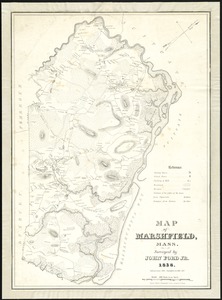
Map of Marshfield, Mass
4003.
A map of Massachusetts
4004.
Map of Massachusetts
4005.
Map of Massachusetts : to accompany the Massachusetts register & business directory
4006.
Map of Massachusetts
4007.
Map of Massachusetts
4008.
Map of Massachusetts
4009.
Map of Massachusetts
4010.
Map of Massachusetts and Rhode Island
4011.
Map of Massachusetts, Connecticut and Rhode Island constructed from the latest authorities
4012.
Map of Massachusetts, Connecticut and Rhode Island constructed from the latest authorities
4013.
A map of Massachusetts, exhibiting the boundary lines of each town and county : compiled from the latest authorities, embracing...
4014.
Map of Massachusetts proper
4015.
Map of Massachusetts, Rhode-Island & Connecticut : compiled from the latest authorities
4016.
Map of Massachusetts showing population according to census of 1910
4017.
Map of Massachusetts showing population according to United States Census of 1900 and congressional districts
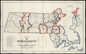
4018.
Map of Massachusetts showing state highways laid out & petitioned for
4019.
Map of Massachusetts showing state highways laid out & petitioned for
4020.
Map of Massachusetts showing state highways laid out and petitioned for
‹ Prev
Next ›
1
2
…
197
198
199
200
201
202
203
204
205
…
438
439