Toggle navigation
LMEC Home
Exhibitions
Georeferencing
Tools for Teachers
Collections
My Favorites
Sign Up / Log In
Search
Search the map portal
Map Collection
Map Collection
Map Sets
Search
Search
Search for
Search In
All Fields
Creator
Title
Subject
Place
Search All Digital Collections
Advanced Search
8173 Results
My Search
Start Over
More Like
commonwealth:cj82kn038
Remove constraint More Like: commonwealth:cj82kn038
Filter your Search
Place
North and Central America
4,922
United States
3,606
Suffolk (county)
1,026
Boston
999
Europe
963
Canada
427
France
269
Massachusetts
249
more
Place
»
Topic
Boston (Mass.)--Maps
574
United States--Maps
270
Real property--Massachusetts--Boston--Maps
174
Massachusetts--Maps
160
Landowners--Massachusetts--Boston--Maps
132
North America--Maps--Early works to 1800
103
New England--Maps
99
Europe--Maps
78
more
Topic
»
Date
Date range begin
–
Date range end
Current results range from
1482
to
2023
View distribution
Creator
United States. Hydrographic Office
357
O.H. Bailey & Co
148
Des Barres, Joseph F. W. (Joseph Frederick Wallet), 1722-1824
123
United States. Post Office Dept
119
Ptolemy, 2nd cent
100
Walling, Henry Francis, 1825-1888
94
Jefferys, Thomas, -1771
84
Geological Survey (U.S.)
82
more
Creator
»
Format
Maps/Atlases
8,114
Manuscripts
215
Prints
51
Books
36
Objects/Artifacts
10
Drawings/Illustrations
8
Posters
4
Georeferenced
Yes
869
No
7,304
Collection
Norman B. Leventhal Map Center Collection
8,162
Boston and New England Maps
2,184
Urban Maps
1,925
Maritime Charts and Atlases
750
American Revolutionary War-Era Maps
627
Boston Redevelopment Authority Collection
86
American Antiquarian Society Collection
7
William L. Clements Library Collection
4
Available to use
No known restrictions
8,021
Creative Commons license
46
Search Constraints
Sort by relevance
relevance
title
date (asc)
date (desc)
Number of results to display per page
20 per page
10
per page
20
per page
50
per page
100
per page
View results as:
grid view
map view
Search Results
1.
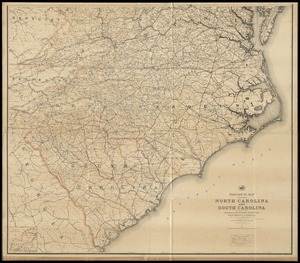
Post route map of the states of North Carolina and South Carolina showing post offices with the intermediate distances and mail...
2.
Post route map of the states of North Carolina and South Carolina with adjacent parts of Georgia, Tennessee, Kentucky, West...
3.
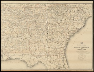
Post route map of the States of South Carolina and Georgia with adjacent parts of North Carolina, Tennessee, Alabama and...
4.
The Rand McNally new commercial atlas map of South Carolina
5.
Colton's North Carolina
6.
J.H. Colton's topographical map of North and South Carolina : a large portion of Georgia & part of adjoining states
7.
North Carolina & South Carolina
8.
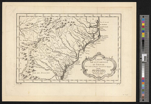
Carte de la Caroline at Georgie pour servir à l'histoire générale des voyages : tirée des auteurs Anglois
9.
Carte de la Caroline et Georgie. : Pour servir à l'Histoire générale des voyages
10.
Carte de la Caroline et Georgie. : Pour servir à l'Histoire générale des voyages
11.
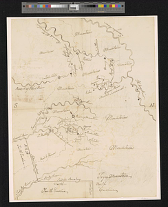
Mr. Wilkinsons plat of ye Cherekee country
12.
A new & accurate map of the provinces of North & South Carolina Georgia &c
13.
South & North Carolina : an exact map of the boundary line between the provinces of South & North Carolina agreeable to the...
14.
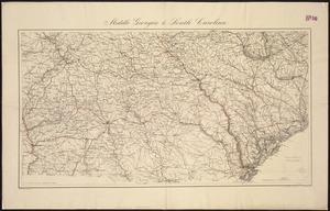
Middle Georgia & South Carolina
15.
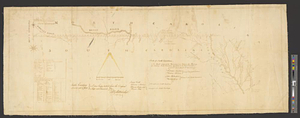
[Middle Georgia and South Carolina]
16.
South Carolina
17.
The state of South Carolina : from the best authorities
18.
Coast of North Carolina & Virginia
19.
Colton's new topographical map of the eastern portion of the State of North Carolina with part of Virginia & South Carolina...
20.
Colton's new topographical map of the eastern portion of the State of North Carolina with part of Virginia & South Carolina...
‹ Prev
Next ›
1
2
3
4
5
…
408
409


![[Middle Georgia and South Carolina]](https://bpldcassets.blob.core.windows.net/derivatives/images/commonwealth:7h14b2665/image_thumbnail_300.jpg)


