Toggle navigation
LMEC Home
Exhibitions
Georeferencing
Tools for Teachers
Collections
My Favorites
Sign Up / Log In
Search
Search the map portal
Map Collection
Map Collection
Map Sets
Search
Search
Search for
Search In
All Fields
Creator
Title
Subject
Place
Search All Digital Collections
Advanced Search
106 Results
My Search
Start Over
More Like
commonwealth:c821k731n
Remove constraint More Like: commonwealth:c821k731n
Filter your Search
Place
North and Central America
65
Maine
50
United States
25
Asia
11
Canada
8
New Hampshire
7
China
6
Europe
6
more
Place
»
Topic
Maine--Maps
50
New Hampshire--Maps
7
China--Maps
5
Korea--Maps
5
Railroads--Maine--Maps
5
Vermont--Maps
5
Counties--Maine--Maps
4
Japan--Maps
4
more
Topic
»
Date
Date range begin
–
Date range end
Current results range from
1623
to
1963
View distribution
Creator
Carleton, Osgood, 1742-1816
14
Norman, John, 1748?-1817
6
United States. Post Office Dept
4
Greenleaf, Moses, 1777-1834
3
Hayashi, Yoshinaga
3
Holland, Samuel, 1728-1801
3
Zhuang, Tingfu, active 18th century
3
Anville, Jean Baptiste Bourguignon d', 1697-1782
2
more
Creator
»
Format
Maps/Atlases
104
Manuscripts
6
Objects/Artifacts
2
Ephemera
1
Prints
1
Georeferenced
Yes
3
No
103
Collection
MacLean Collection Map Library
57
Norman B. Leventhal Map Center Collection
33
Boston and New England Maps
27
American Revolutionary War-Era Maps
23
American Antiquarian Society Collection
8
William L. Clements Library Collection
6
David Judkins Weaver Papers
1
Massachusetts Historical Society Map Collection
1
more
Collection
»
Available to use
No known restrictions
33
Creative Commons license
1
Search Constraints
Sort by date (desc)
relevance
title
date (asc)
date (desc)
Number of results to display per page
20 per page
10
per page
20
per page
50
per page
100
per page
View results as:
grid view
map view
Search Results
1.
A map of the state of Maine
2.
State of Maine
3.
Route and pictorial map of Maine
4.
A map of the Maine coast from York Harbor to Saco Bay : reminiscent & actual
5.
Rand McNally official 1924 auto trails map Maine ; Rand McNally official 1924 auto trails map New Hampshire, Vermont
6.
State of Maine
7.
Bangor & Aroostook Railroad and connections : including northern Maine hunting and fishing region
8.
New commercial, sportsmen's and route survey of Maine : showing all postoffices, railroads, electric roads, principal highways,...
9.
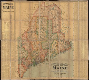
Map of Maine for the Maine register
10.
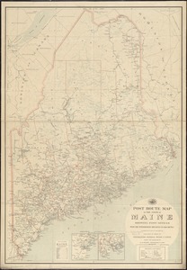
Post route map of the state of Maine showing post offices with the intermediate distances on mail routes in operation on the...
11.
The National Publishing Company's 1900 census map of Maine : showing all counties, towns, railroads, cities, villages, post...
12.
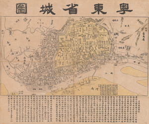
Yuedong sheng chengtu
13.
Fishing & hunting resorts of Maine, northern New Hampshire, and part of Canada and the provinces, Rangeley & Moosehead Lakes as...
14.
Lumberman's map of northern Maine
15.
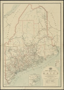
Post route map of the state of Maine showing post offices with the intermediate distances on mail routes in operation on the...
16.
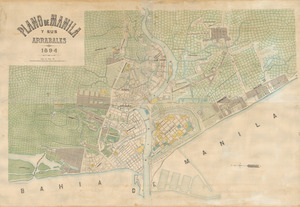
Plano de Manila y sus arrabales 1894
17.
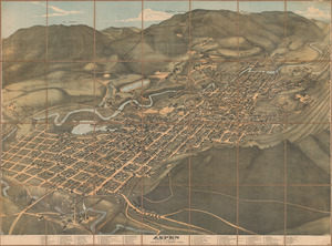
Bird’s eye view of Aspen, Pitkin Co. Colo. 1893
18.
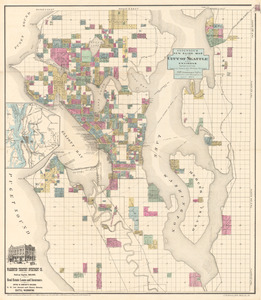
Anderson’s new guide map of the city of Seattle and environs
19.
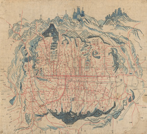
Map of Seoul
20.
State of Maine
‹ Prev
Next ›
1
2
3
4
5
6