Toggle navigation
LMEC Home
Exhibitions
Georeferencing
Tools for Teachers
Collections
My Favorites
Sign Up / Log In
Search
Search the map portal
Map Collection
Map Collection
Map Sets
Search
Search
Search for
Search In
All Fields
Creator
Title
Subject
Place
Search All Digital Collections
Advanced Search
76 Results
My Search
Start Over
More Like
commonwealth:bz60gd390
Remove constraint More Like: commonwealth:bz60gd390
Filter your Search
Place
South America
19
North and Central America
17
United States
13
Asia
11
China
6
Europe
6
Japan
5
North America
5
more
Place
»
Topic
South America--Maps
19
China--Maps
5
Korea--Maps
5
North America--Maps
5
Japan--Maps
4
Kyoto (Japan)--Maps
3
Massachusetts--Maps
3
United States--Maps
3
more
Topic
»
Date
Date range begin
–
Date range end
Current results range from
1623
to
2005
View distribution
Creator
Carleton, Osgood, 1742-1816
10
Norman, John, 1748?-1817
5
Anville, Jean Baptiste Bourguignon d', 1697-1782
4
Hayashi, Yoshinaga
3
Zhuang, Tingfu, active 18th century
3
Glot, C. B., active 18th century
2
Kitchin, Thomas, 1718-1784
2
Aspen Times
1
more
Creator
»
Format
Maps/Atlases
74
Manuscripts
4
Ephemera
1
Objects/Artifacts
1
Prints
1
Georeferenced
Yes
4
No
72
Collection
MacLean Collection Map Library
57
Norman B. Leventhal Map Center Collection
15
American Revolutionary War-Era Maps
12
American Antiquarian Society Collection
4
Available to use
No known restrictions
15
Search Constraints
Sort by relevance
relevance
title
date (asc)
date (desc)
Number of results to display per page
20 per page
10
per page
20
per page
50
per page
100
per page
View results as:
grid view
map view
Search Results
1.
Amérique méridionale : publiée sous les auspices de Monseigneur le Duc d'Orleans prémier prince du Sang
2.
Carte générale de L'Amérique Méridionale et des îles qui en dépendent
3.
Colombie et Guyanes
4.
The good neighbor pictorial map of South America
5.
A map of South America according to the best authorities
6.
Map of the European settlements in South America and on the western coast of Africa
7.
Mapa de America sujecto à las observaciones astronomicas
8.
A New map of the whole continent of America, divided into North and South and West Indies. : With a descriptive account of the...
9.
A New map of the whole continent of America, divided into North and South and West Indies. : Wherein are exactly described the...
10.
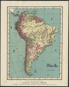
No. 4 : [South America]
11.
Peru, Chili and La Plata
12.
Rand, McNally & Co.'s indexed atlas of the world map of South America
13.
South America
14.
South America
15.
South America
16.
South America
17.
South America
18.
South America : reduced from the sheet map
19.
Südamerika
20.
An accurate map of the commonwealth of Massachusetts exclusive of the district of Maine compiled pursuant to an act of the...
‹ Prev
Next ›
1
2
3
4